Related Research Articles

Clapham Park is an area in the Borough of Lambeth in London, to the south of central Clapham and west of Brixton.

West Bridgford is a town and the administrative centre of the Borough of Rushcliffe, in the county of Nottinghamshire, England. It lies south of Nottingham city centre, east of Wilford, north of Ruddington and west of Radcliffe-on-Trent. It is also southwest of Colwick and southeast of Beeston which are on the opposite bank of the River Trent. The town is part of the Nottingham Urban Area and had a population of 36,487 in a 2021-census.

Little Aston is a village in the Lichfield District of Staffordshire, England. It is 5 miles (8 km) south of the city of Lichfield. It is contiguous with Sutton Coldfield and Streetly. At the 2011 United Kingdom census the population of Little Aston ward was 2,920 people living in 1,104 households. Little Aston is also in the parish of Shenstone.

West Park is a suburb of north-west Leeds, West Yorkshire, England, north of Headingley. It is a mixed area of private suburban housing and suburban council estates. The name derives from its main park containing playing fields together with a conservation area of grassy meadow ending in woodland. The largest housing estate in West Park is Moor Grange.

The New Hall Estate is the older of the two major private housing estates named after New Hall Manor in the Royal Town of Sutton Coldfield in the West Midlands in England. The newer being New Hall Manor Estate.

Abbeydale and Abbeymead are modern suburbs of the city of Gloucester in the county of Gloucestershire, England. They lie approximately 3 miles south-east of the city centre, and are bounded by the suburbs of Coney Hill to the north west, Barnwood and Hucclecote to the north and north east, Matson to the south west and the M5 motorway to the south and east. Mostly connected with segregated bicycle paths into Gloucester city along Metz Way. The village of Upton St Leonards is directly across the M5 motorway.

Birley ward — which includes the area of Frecheville, and parts of Gleadless and Hackenthorpe — is one of the 28 electoral wards in City of Sheffield, England. It is located in the southeastern part of the city and covers an area of 5.1 square kilometres (2 sq mi). The population of this ward in 2011 was 16,943 people in 7,393 households. It is one of the five wards that make up the Sheffield South East constituency.

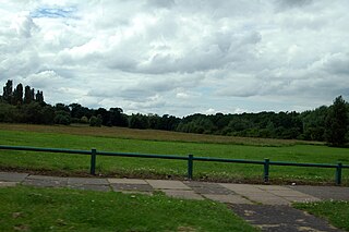
Wilford Hill is the highest point in West Bridgford, giving views of the Trent Valley as far as Newark-on-Trent. It is listed as having an elevation of 87m and a prominence of 49m.

Edwalton is an area of West Bridgford and former civil parish in the Rushcliffe district, in Nottinghamshire, England, covering Gamston and the older Edwalton village. The population of the Rushcliffe Ward was 3,908 at the 2011 Census. Results from the 2021 census now indicates that the population has risen to 5,774.

Llanmartin is a village and parish in the city of Newport, Wales.

Moulsecoomb is a suburb of Brighton, Sussex, England, on the northeast side around the A270 Lewes Road, between Coldean and Bevendean, 2+1⁄4 miles (3.6 km) north of the seafront. The eastern edge adjoins Falmer Hill on the South Downs. It is often divided into smaller sections on maps: North Moulsecoomb, East Moulsecoomb and South Moulsecoomb.
Tibbington is a residential area of Tipton, a town in the West Midlands of England. It takes its name from the original 11th-century name of Tipton – Tibbingtone.
Pype Hayes is a modern housing estate area and council ward in the east of the Erdington district of Birmingham. It was within the Tyburn ward until 2018. Covering the postcodes of B24 and B76.
Tantany is a residential area of West Bromwich. It is situated to the north of the town centre and consists predominantly of council housing constructed during the 1920s.
Westcotes is an area to the west of the city of Leicester. It is also a ward of the City of Leicester whose population at the 2011 census was 11,644. It is also known as the West End of Leicester. The area is quite small in comparison with other areas of the city, but it is well known as it has many shops, bars and restaurants and is a popular choice for students and young professionals.
Redditch is a town and local government district in Worcestershire, England. The town is divided into separate districts. All street-name signs in Redditch have the street name in white lettering on a blue background and the district name in black lettering on a white background at the bottom of the sign. In the New Town areas the roads are usually named in alphabetical order and house numbering in the cul-de-sac closes is consecutive, starting with number 1 as the first house on the left as you enter, and the highest house number will be on the opposite side of the road as you leave.

Austin Village is a First World War housing estate of prefabs between Longbridge and Northfield, Birmingham.

The Meadows or Meadows is an area of Nottingham, England, south of the city centre, close to the River Trent and connected to West Bridgford in the Borough of Rushcliffe by Trent Bridge and the Wilford Suspension Bridge. Victoria Embankment runs alongside the River Trent to the south of the Meadows and is home to the Nottingham War Memorial Gardens.
The 1950s and 1960s saw the construction of numerous brutalist apartment blocks in Sheffield, England. The Sheffield City Council had been clearing inner-city residential slums since the early 1900s. Prior to the 1950s these slums were replaced with low-rise council housing, mostly constructed in new estates on the edge of the city. By the mid-1950s the establishment of a green belt had led to a shortage of available land on the edges of the city, whilst the government increased subsidies for the construction of high-rise apartment towers on former slum land, so the council began to construct high-rise inner city estates, adopting modernist designs and industrialised construction techniques, culminating in the construction of the award-winning Gleadless Valley and Park Hill estates.

Braunstone Park & Rowley Fields is an electoral ward and administrative division of the city of Leicester, England. It comprises the western Leicester suburbs of Braunstone Frith, Braunstone Park and Rowley Fields.
References
- 1 2 "Abbey Park". Metropolitan Thames Valley. Retrieved 18 January 2024.
- ↑ "Abbey Park". HousingCare. Retrieved 18 January 2024.