Related Research Articles

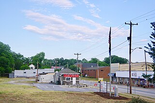
Duncan is a town in Spartanburg County, South Carolina, United States. Its population was 3,181 at the 2010 census.
Wauzeka is a town in Crawford County, Wisconsin, United States. The population was 711 at the 2010 census. The village of Wauzeka is located within the town. The unincorporated community of Boydtown is located partially in the town.
Burray is one of the Orkney Islands in Scotland. It lies to the east of Scapa Flow and is one of a chain of islands linked by the Churchill Barriers.
Hukuntsi is a village in Kgalagadi District (Kalahari) in Botswana.

Deoria district, one of the districts of eastern Uttar Pradesh, India has its headquarters located at Deoria and is a part of Gorakhpur division. It came into existence on 16 March 1946 from Gorakhpur district.

Sant Kabir Nagar district is one of the 75 districts of Uttar Pradesh state in northern India. Khalilabad is the district headquarters. Sant Kabir Nagar district is a part of Basti division. The total area of Sant Kabir Nagar district is 1,646 km2 (636 sq mi).

Division No. 17 is a census division in Alberta, Canada. It spans the central and northwest portions of northern Alberta and its largest urban community is the Town of Slave Lake. Division No. 17 is the largest census division in Alberta according to area and also has the lowest population density.
California's 27th congressional district is a congressional district in the U.S. state of California. The district is currently represented by Republican Mike Garcia. It was one of 18 districts that would have voted for Joe Biden in the 2020 presidential election had they existed in their current configuration while being won or held by a Republican in 2022, and the only Republican-held congressional district to include portions of the city of Los Angeles.
Serafina Corrêa is a municipality in the state of Rio Grande do Sul, Brazil.
São José das Missões is a municipality in the state of Rio Grande do Sul, Brazil. As of 2020, the estimated population was 2,514.
Nathalie is an unincorporated community and census-designated place (CDP) in Halifax County, Virginia, United States, in the south-central region of the state. The population as of the 2010 census was 183.

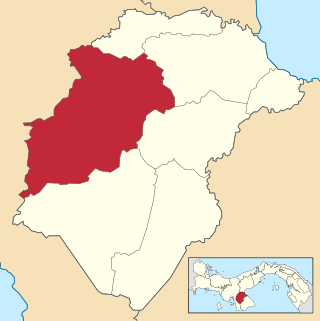
Ocú District is a district (distrito) of Herrera Province in Panama. The population according to the 2000 census was 15,936. The district covers a total area of 625 km². The capital lies at the city of Ocú.

Kumi Town, commonly called Kumi, is a town in the Eastern Region of Uganda. It is the main municipal, administrative, and commercial center in Kumi District and the site of the district headquarters.
Pinehurst is a hamlet in the town of Hamburg in Erie County, New York, United States.

Verhulitsa is a village in Setomaa Parish, Võru County in southeastern Estonia.
Mandra is a village in the municipality of Sokolac, Bosnia and Herzegovina.
Pullens is an unincorporated community in Pittsylvania County, in the U.S. state of Virginia.

Caln is a census-designated place (CDP) in Caln Township, Chester County, Pennsylvania, United States. The population was 1,519 at the 2010 census. It is located east of the city of Coatesville and lies west of Philadelphia.
Bartkuškis Manor is a former residential manor in Bartkuškis village, Širvintos District Municipality.

Gadhawa Rural Municipality is located in Deukhuri valley of Dang district of Lumbini Province, Nepal. This rural municipality was declared on Falgun 12, 2073 Vikram Samvat. It lies from 195 meter to 885 meter above sea level. The former Gadhawa VDC office was the administrative center of Gadhawa Rural Municipality for 4 years of its inception and then the office of the executive was moved to a new building. According to the preliminary report of population census 2078, Gadhawa Rural Municipality has 46275 population where male and female comprises 22650 (48.95%) and 23625 (51.05%) population respectively. During local level restructuring, this rural municipality was formed by annexing former four VDCs named Gobardiya, Gangapraspur, Gadhawa and Koilabas. This rural municipality has a 358.57 square km area and is divided into 8 wards. It is surrounded by Arghakhanchi and Kapilvastu districts from the east, Rajapur Rural Municipality from the west, Lamahi Municipality and Rapti Rural Municipality in the north, and India in the south direction.
References
- ↑ "Parish population 2011" . Retrieved 2 November 2015.
- The geographic coordinates are from the Ordnance Survey.