Clytha

Last updated

Clytha
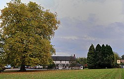
The Clytha Arms - geograph.org.uk - 1544942.jpg
The Clytha Arms
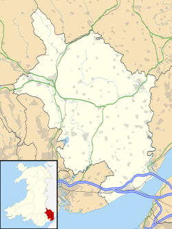
Monmouthshire UK location map.svg
Red pog.svg
Clytha
Location within Monmouthshire
Principal area
Preserved county
Country Wales
Sovereign state United Kingdom
Police Gwent
Fire South Wales
Ambulance Welsh
UK Parliament
List of places
UK
Wales
Monmouthshire
51°47′06″N2°54′46″W / 51.785°N 2.912778°W / 51.785; -2.912778

Clytha (Welsh : Cleidda) is a hamlet and historical area in Monmouthshire, Wales.

Overview

It lies just off the A40 road, to the south of Llanarth and west of Raglan. It contains Clytha Park and Clytha Castle and Llanarth Estate Office, Ty Gwynt and Pit House. The castle, the park and The Clytha Arms public house, [1] however, lie on the southern side of the A40. The hamlet lies within the parish of Llanarth and covered 1841 acres with a population of 361 people in 1861. [2]

Clytha is home to the first polo club in Wales, the Monmouthshire Polo Club, founded in 1872 by Reginald and Francis Herbert. [3]

Great House, Clytha is a Grade II listed building. [4]

The Clytha Arms, a converted Dower house, holds an annual Cider Festival on May Bank Holidays. [1]

Related Research Articles

<span class="mw-page-title-main">Abergavenny</span> Market town in Monmouthshire, Wales

Abergavenny is a market town and community in Monmouthshire, Wales. Abergavenny is promoted as a "Gateway to Wales"; it is approximately 6 miles (10 km) from the border with England and is located where the A40 trunk road and the recently upgraded A465 Heads of the Valleys road meet.

<span class="mw-page-title-main">Monmouth</span> Town in Monmouthshire, Wales

Monmouth is a market town and community in Monmouthshire, Wales, situated on where the River Monnow joins the River Wye, two miles from the Wales–England border. The population in the 2011 census was 10,508, rising from 8,877 in 2001. Monmouth was the county town of historic Monmouthshire, although Abergavenny is the largest settlement and Monmouthshire County Council has its main offices at Rhadyr, just outside Usk. Monmouth is in the UK Parliament constituency of Monmouthshire and the Senedd constituency of Monmouth.

<span class="mw-page-title-main">Brecknockshire</span> Historic county of Wales

Until 1974, Brecknockshire, also formerly known as the County of Brecknock, Breconshire, or the County of Brecon, was an administrative county in the south of Wales, later classed as one of the thirteen historic counties of Wales. Named after its county town of Brecon, the county was mountainous and primarily rural.

<span class="mw-page-title-main">Llangynidr</span> Village and community in Powys, Wales

Llangynidr is a village, community and electoral ward in Powys, Wales, about 4 miles (6.4 km) west of Crickhowell and 9 miles (14.5 km) south-east of Brecon. The River Usk flows through the village as does the Monmouthshire and Brecon Canal. It is in the historic county of Brecknockshire.

Southern Monmouthshire was a parliamentary constituency in Monmouthshire, Wales. It returned one Member of Parliament (MP) to the House of Commons of the Parliament of the United Kingdom.

<span class="mw-page-title-main">Bettws Newydd</span> Village in Monmouthshire, Wales

Bettws Newydd is a small village in Monmouthshire, in southeast Wales located about 3+12 miles (5.6 km) north of Usk, a few miles south of Clytha near Raglan, Monmouthshire.

<span class="mw-page-title-main">Clytha Castle</span> Folly in Clytha, Monmouthshire

Clytha Castle is a folly near Clytha between Llanarth and Raglan in Monmouthshire, south east Wales. Dating from 1790, the castle was built by William Jones, owner of the Clytha Park estate as a memorial to his wife, Elizabeth, who died in 1787. The castle is an example of the Gothic Revival and comprises three towers, of which two are habitable, and linking, castellated curtain walls. Long attributed to John Nash, recent research has confirmed that the architect was John Davenport of Shrewsbury. The folly has views towards the Sugar Loaf and Skirrid mountains on the easternmost edge of the Brecon Beacons National Park. Described by the architectural historian John Newman as one of the two "outstanding examples of late eighteenth century fanciful Gothic in the county", Clytha Castle is a Grade I listed building.

<span class="mw-page-title-main">Llanover</span> Village in Monmouthshire, Wales

Llanover is a village in the community of Goetre Fawr in Monmouthshire, Wales.

<span class="mw-page-title-main">Mansion House, Newport</span> Mansion in Newport, Wales

The Mansion House is a property in Stow Park Circle in Newport, Wales. It was the official residence of the Mayor of Newport, South Wales until 2009 and has since become the local register office.

<span class="mw-page-title-main">Llanarth Court</span> House in Llanarth, Monmouthshire

Llanarth Court is a late-18th-century country house with substantial 19th-century alterations in Llanarth, Monmouthshire, Wales. The court was built for the Jones family of Treowen and was subsequently the home of Ivor Herbert, 1st Baron Treowen, whose family still owns much of the Llanarth estate, although not the court itself. The court is a Grade II* listed building and is now a private hospital. The gardens are included on the Cadw/ICOMOS Register of Parks and Gardens of Special Historic Interest in Wales.

<span class="mw-page-title-main">Clytha Park</span> House in Clytha, Monmouthshire

Clytha Park, Clytha, Monmouthshire, is a 19th-century Neoclassical country house, "the finest early nineteenth century Greek Revival house in the county." The wider estate encompasses Monmouthshire's "two outstanding examples of late eighteenth century Gothic", the gates to the park and Clytha Castle. The owners were the Jones family, later Herbert, of Treowen and Llanarth Court. It is a Grade I listed building.

<span class="mw-page-title-main">Grade I listed buildings in Monmouthshire</span>

Monmouthshire is a county and principal area of Wales. It borders Torfaen and Newport to the west; Herefordshire and Gloucestershire to the east; and Powys to the north. The largest town is Abergavenny, with the other major towns being Chepstow, Monmouth, and Usk. The county is 850 km2 in extent, with a population of 95,200 as of 2020. The present county was formed under the Local Government (Wales) Act 1994, which came into effect in 1996, and comprises some sixty percent of the historic county. Between 1974 and 1996, the county was known by the ancient title of Gwent, recalling the medieval Welsh kingdom. In his essay on local government in the fifth and final volume of the Gwent County History, Robert McCloy suggests that the governance of "no county in the United Kingdom in the twentieth century was so transformed as that of Monmouthshire".

<span class="mw-page-title-main">Grade II* listed buildings in Monmouthshire</span> List of buildings in principal area of Wales

Monmouthshire is a county of Wales. It borders Torfaen and Newport to the west; Herefordshire and Gloucestershire to the east; and Powys to the north. The largest town is Abergavenny, with the other major towns being Chepstow, Monmouth, and Usk. The county is 850 km2 in extent, with a population of 95,200 as of 2020. The present county was formed under the Local Government (Wales) Act 1994, which came into effect in 1996, and comprises some sixty percent of the historic county. Between 1974 and 1996, the county was known by the ancient title of Gwent, recalling the medieval Welsh kingdom. In his essay on local government in the fifth and final volume of the Gwent County History, Robert McCloy suggests that the governance of "no county in the United Kingdom in the twentieth century was so transformed as that of Monmouthshire".

<span class="mw-page-title-main">St Teilo's Church, Llanarth</span> Church in Monmouthshire, Wales

The Church of St Teilo, Llanarth, Monmouthshire, Wales is a former parish church with its origins in the 15th century. Renovations took place in the 18th, 19th and 20th centuries. It is a Grade II* listed building and is now a redundant church, having closed in 2013.

<span class="mw-page-title-main">St Peter's Church, Bryngwyn</span> Church in Monmouthshire, Wales

The Church of St Peter, Bryngwyn, Monmouthshire, Wales is a parish church with its origins in the 13th century. It is a Grade II* listed building.

<span class="mw-page-title-main">Great House, Llanarth</span> Farmhouse in Llanarth, Monmouthshire

Great House, Llanarth, Monmouthshire is a farmhouse dating from the late-16th century. Extended in the mid-17th century and little altered thereafter, it is a Grade II* listed building. The detached barn range has its own Grade II listing.

<span class="mw-page-title-main">Welsh Perry and Cider Festival</span>

Welsh Cider and Perry Festival is an annual festival for cider and perry held at Caldicot Castle in Monmouthshire.

<span class="mw-page-title-main">Chapel Farmhouse, Llanarth</span> House in Llanarth, Monmouthshire

Chapel Farmhouse and its attached outbuilding, Llanarth, Monmouthshire is a house dating from the 16th century. Greatly enlarged in the 17th century, it remains a private house. It is a Grade II* listed building.

<span class="mw-page-title-main">Perth-hir House</span> House in Rockfield, Monmouthshire

Perth-hir House, Rockfield, Monmouthshire, Wales, was a major residence of the Herbert family. It stood at a bend of the River Monnow, to the north-west of the village. At its height in the 16th century, the mansion, entered by two drawbridges over a moat, comprised a great hall and a number of secondary structures. Subsequently in the ownership of the Powells, and then the Lorimers, the house became a centre of Catholic recusancy following the English Reformation. By the 19th century, the house had declined to the status of a farmhouse and it was largely demolished in around 1830. Its ruins, and the site which contains considerable remnants of a Tudor garden, are a scheduled monument.

<span class="mw-page-title-main">Registered historic parks and gardens in Monmouthshire</span> List of buildings in the county of Wales

Monmouthshire is a county of Wales. It borders Torfaen and Newport to the west; Herefordshire and Gloucestershire to the east; and Powys to the north. The largest town is Abergavenny, with other large settlements being Chepstow, Monmouth, and Usk. The present county was formed under the Local Government (Wales) Act 1994, which came into effect in 1996. It has an area of 850 km2 (330 sq mi), with a population of 93,200 as of 2021. Monmouthshire comprises some sixty per cent of the historic county, and was known as Gwent between 1974 and 1996.

References

  1. 1 2 The Clytha Arms
  2. Great Britain. Parliament. House of Commons (1862). Parliamentary papers. HMSO. p. 1.
  3. Horace A. Laffaye, Polo in Britain: A History, Jefferson, North Carolina: McFarland & Company, 2012, pp. 11-12
  4. "Barn range at Great House, Clytha, Llanarth" at britishlistedbuildings.co.uk