
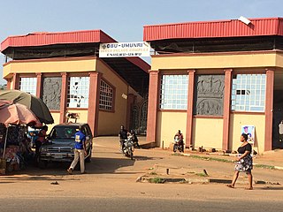
Nsukka is an Igbo town and a Local Government Area in Enugu State, Nigeria. Towns that share a common border with Nsukka are Edem, Opi, Ede-Oballa, and Obimo. Nsukka people are also found in Kogi state. As of 2006, Nsukka had a population of 309,633. Nsukka Town is known as the site of the University of Nigeria, the first indigenous Nigerian university, founded by the late Dr. Nnamdi Azikiwe, first President of Nigeria. Currently the town has a number of Federal Parastatals in the university such as NABDA, CBSS, and the Energy Research Centre.

Enugu is the capital of Enugu State in Nigeria. It is located in southeastern Nigeria. The city had a population of 722,664 according to the 2006 Nigerian census. The name Enugu is derived from the two Igbo words Énú Ụ́gwụ́ meaning "hill top" denoting the city's hilly geography. The city was named after Enugwu Ngwuo, under which coal was found. Enugwu Ngwuo is one of the ten villages that made up the Ngwuo clan, often referred to as the children of Ngwuako, the ancestral founder of the clan. Ngwuako positioned Udeneogu, his warrior son of on top of the hill (Enu-Ugwu) to protect the clan from invaders. Enugwu Ama Udeneogu, The people lived on the hilltop and farmed the sprawling surrounding valleys. Ngwuo has borders with Oshie clan in the south, Ojebeogene clan in the north and Nkanu clan in the east. The discovery of coal deposits on Enugwu Ngwuo farm lands down the valley, attracted people from all and sundry to the newly discovered wealth, in search for means of living, and as depicted in the map of the original plan for a government station, titled Enugwu Ngwo government station, this marked the core of the first urban settlement of what is today known as Enugu, started on Ngwuo land and it was called Enugwu Ngwuo until when it attained township status, the word Ngwo was removed for the convenience of pronunciation, thus a village of Ngwuo clan gave birth to a city which today has grown into a mega city, and still growing, engulfing the surrounding Nkanu towns of Nike and Akunino and stretching towards Neke and Emene.

Owerri is the capital of Imo State in Nigeria, set in the heart of Igboland. It is also the state's largest city, followed by Orlu and Okigwe as second and third respectively. Owerri consists of three Local Government Areas including Owerri Municipal, Owerri North and Owerri West, it has an estimated population of about 1,401,873 as of 2016 and is approximately 100 square kilometres (40 sq mi) in area. Owerri is bordered by the Otamiri River to the east and the Nworie River to the south.

Umuahia is the capital city of Abia State in southeastern Nigeria. Umuahia is located along the rail road that lies between Port Harcourt to its south and Enugu city to its north. Umuahia has a population of 359,230 according to the 2006 Nigerian census. Umuahia is indigenously Igbo.

Enugu, usually referred to as Enugu State to distinguish it from the city of Enugu, is a state in southeastern Nigeria, created in 1991 from part of the old Anambra State. Its capital and largest city is Enugu, from which the state derives its name. The principal cities in the state are Enugu, Ohum, Ezeagu, Ngwo, Nsukka, Agbani, Awgu, Aninri and Udi.
The Eastern Region was an administrative region in Nigeria, dating back originally from the division of the colony Southern Nigeria in 1954. Its first capital was Calabar. The capital was later moved to Enugu and the second capital was Umuahia. The region was officially divided in 1967 into three new states, the East-Central State,South-Eastern State. East-Central State had its capital at Enugu, which is now part of Enugu State.
Ogidi is an Igbo village, the headquarters of Idemili North Local Government area, Anambra State, Nigeria. It has an estimated population of 70,000 and has as its neighbours Abatete, Ṅkpọr, Ụmụnnachị, Ụmụoji, Ogbụnike and Ụmụdiọka. Ogidi is best known for its mid-July annual Nwafor Festival, an 11-day festival in July that takes place after cultivation of yams and included prayers for a good season. It usually starts on the first Friday of the month.

The Aro people or Aros are an Igbo subgroup that originated from the Arochukwu kingdom in present-day Abia state, Nigeria. The Aros can also be found in about 250 other settlements mostly in the Southeastern Nigeria and adjacent areas. The Aros today are classified as Eastern or Cross River Igbos because of their location, mixed origins, culture, and dialect. Their god, Chukwu Abiama, was a key factor in establishing the Aro Confederacy as a regional power in the Niger Delta and Southeastern Nigeria during the 18th and 19th centuries.
Ngwo is a town located in the south-eastern state of Enugu, Nigeria, with a population of about 50,000 people. The towns native population are of Igbo ethnicity.
Ozalla is a prominent town in Nkanu West Local Government Area of Enugu State, Nigeria.
Egede is one of the communities that makes the Udi Local Government Area in Enugu State of Nigeria. It is situated between Ebe town at the south; Umuoka town at the north; Affa town at the west; and Okpatu town and Awhum town at the east.
Udi is a Local Government Area of Enugu State, Nigeria. Its headquarters is in the town of Udi on the A232 highway. The current Local government chairman is Hon Ifeanyi Agu.
Enugwu Ukwu is a large town in Anambra State, Nigeria. Enugwu-Ukwu town is geographically situated on hilly terrain; thus it is named after its geographical topography. It is predominantly occupied by the Igbo people ethnic group of Anambra State. Most of its inhabitants are Christians. It is located in Njikoka Local Government Area of Anambra State. Major villages that make up the town include Uruokwe, Enu-Avomimi, Adagbe-Avomini, Umu-Atulu, Urualor, Akiyi, Avomimi, Awovu, Enuagu, Ire, Orji, Orofia, Osili, Umuakwu, Umuatulu, Umuatuora, Umuokpaleri, Uruekwo, Urukpaleke, Urunnebo, and Uruogbo.

Umueri, also known and pronounced as Umuleri, is an ancient town in the Anambra State of Southeastern Nigeria. The people of Umuleri belong to the Igbo ethnic group, and the town has an estimated population of 1,500,000. It is located within the Anambra Valley, bordered by the Anambra River and Anam communities in the north, Nteje to the south, Aguleri and Nando in the east and Nsugbe in the western flank. The forebears are widely acknowledged as the settlers in Omambala valley.
Inyi is a town in Enugu State, Nigeria.
Ase is a coastal community on the shores of the Ase River, off River Niger in Ndokwa East Local Government Area of Delta State, Nigeria. Ase River derives its name from Ase town. Ase is an idyllic countryside with a spectacular and breathtaking natural beach, evergreen rain-forest vegetation rich in flora and fauna which overhangs the Ase Creek. Ase is a serene natural tourist resort still waiting to be explored. Ase shares common boundaries with Ibedeni, Onyah, Aviara, Uzere, Patani and Trofani. During the colonial era, Ase served as the commercial and administrative Headquarters for the colonial administrators. Relics of colonial presence still dot the landscape. John Holt and UAC are some of the companies that had trade offices and warehouses in Ase. The town is made up of descendants from Ndokwa speakers who have intermarried with the Isokos and Ijaws over the years. The Ase dialect of the Ukwuani language and also the Isoko language is spoken by the Ase people. The Ase people are of the same ancestral origin with Ase-Azaga, Ase-Imoniteh, and Ase-Omuku. Among the other Ases, Ase town is generally referred to as Ase Ebeneze or Ase Ukwu.
Anaku is one of the administrative divisions of Anambra State, South-Eastern Nigeria. The town lies 6°15' North of the Equator and 6°44' East of the Greenwich Meridian. It is bordered by "Omabala," the native name of the Anambra River, which is a tributary of the River Niger (North), Aguleri, Ezu River (South), Omor and Umuerum communities (East).
The Waawa clan of Northern Igboland, also referred to as Ndi Waawa, Wawa People, are a unique sub-group of the Igbo people in Enugu and Ebonyi State, Nigeria, consisting of several communities, who all speak a unique dialect of Igbo called Waawa. The most notable among these are the Agbaja and Ngwo which consist of peoples between the wooded lands of Awka to the rocky valleys of Enugu. The Agbaja are made up of communities in present-day Ngwo clan, Udi, Ezeagu, Umulokpa, Igbo-Etiti, Oji River, greater Awgu, and Enugu East Local Government Areas. Other notable parts of the Waawa clan include Nkanu, Nsukka, Abia, Nike, and other communities in Enugu State. The Waawa are most notably associated with Chief Onyeama's people from Eke, who was the paramount ruler of Agbaja in the early 20th century.
Nru Nsukka is a suburb located in Nsukka town. Nru Nsukka is one of the former old three autonomous communities: Mkpunanor, Nru and Ihe n'Owerre that made up the Nsukka urban area. Nru Nsukka having been upgraded to a suburban area was split into three newer autonomous communities with newly installed traditional rulers. Since 2018, the suburb is now made up of Iheagu Nru autonomous community with its traditional ruler as Sylvanus Arumah, Ezema ne Edem Nru autonomous community with its traditional ruler as Linus.O. Atugwu and the youngest being Umuoyo Nru autonomous community yet to be installed.

Neke is a town located in Isi-Uzo Local Government Area of Enugu State in South Eastern Nigeria. Bordered by towns such as Nike, Ikem, Mbu, Eha Amufu, Obollo and Umu-Ero, Neke is a small town with a strong backbone. In the pre-colonial era, the people of Neke were known as fearsome warriors who had an economic stronghold on neighboring areas. In the present day, there are 5 main districts located in Neke namely; Ishienu, Akpani, ObeguAba, Umugwu and Umuegwu. These districts represent villages made up of clans and kindred prominent to the town's social structure.