Google Maps is a web mapping platform and consumer application offered by Google. It offers satellite imagery, aerial photography, street maps, 360° interactive panoramic views of streets, real-time traffic conditions, and route planning for traveling by foot, car, bike, air and public transportation. As of 2020, Google Maps was being used by over one billion people every month around the world.

Google Earth is a web and computer program that renders a 3D representation of Earth based primarily on satellite imagery. The program maps the Earth by superimposing satellite images, aerial photography, and GIS data onto a 3D globe, allowing users to see cities and landscapes from various angles. Users can explore the globe by entering addresses and coordinates, or by using a keyboard or mouse. The program can also be downloaded on a smartphone or tablet, using a touch screen or stylus to navigate. Users may use the program to add their own data using Keyhole Markup Language and upload them through various sources, such as forums or blogs. Google Earth is able to show various kinds of images overlaid on the surface of the Earth and is also a Web Map Service client. In 2019, Google revealed that Google Earth covers more than 97 percent of the world.
Burraq is a village in southern Syria, located in the Daraa Governorate and in the Al-Sanamayn District. Its other names are Bouraq, Bourâq, Burāq, Bouraa, Al Burak, Burak, Buraq, Burrāq, Bourak. It is located at an altitude of 650 meters.

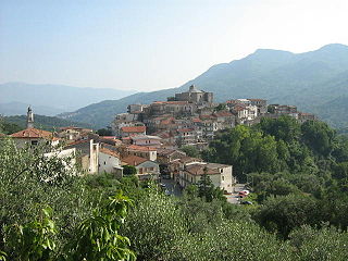
Rofrano is a town and comune of the province of Salerno in the Campania region of south-west Italy. It is located in the southern Cilento. In 2015 its population was 1,539.

Karnana, also known as Akhtar Karnana, is a town and the 73rd Union Council Gujrat District in the Punjab Province of Pakistan. The town has a population of over 20,000 people. It is located at 32°39'35"N, 73°52'0"E and has an elevation of 233 metres (767 feet) above sea level.

Jaʽar is a small town and the capital of Khanfir District in southwestern Yemen. One of the largest settlements in Abyan Governorate, it is located to the north of Al Kawd and the regional capital of Zinjibar. The town is located about 2 kilometres east of the right bank of the Wadi Bana.
Bulindo is a neighborhood in Kira Municipality, Kyaddondo County, Wakiso District, in the Central Region of Uganda.
The following is a timeline for Google Street View, a technology implemented in Google Maps and Google Earth that provides ground-level interactive panoramas of cities. The service was first introduced in the United States on May 25, 2007, and initially covered only five cities: San Francisco, Las Vegas, Denver, Miami, and New York City. By the end of 2008, Street View had full coverage available for all of the major and minor cities in the continental United States and had started expanding its scope to include some of the country's national parks, as well as cities elsewhere in the world. For the first year and a half of its existence, Street View featured camera icon markers, each representing at least one major city or area. By its 10th anniversary, the Street View service had provided imagery for more than 10 million miles' worth of roads across 83 countries worldwide.

Deir al-Adas is a village in southern Syria, administratively part of the Daraa Governorate. It is situated about 40 kilometers northwest of Daraa. According to the Central Bureau of Statistics (CBS), it had a population of 3,723.
Al-Mushannaf is a village in southern Syria, administratively part of the al-Suwayda Governorate, located northeast of al-Suwayda. Nearby localities include Tarba to the north, Shahba and Salkhad to the northwest, Qanawat to the west and al-Kafr to the southwest. According to the Syria Central Bureau of Statistics (CBS), al-Mushannaf had a population of 2,581 in the 2004 census. The town is also the administrative center of the al-Mushannaf nahiyah of the al-Suwayda District consisting of 14 villages with a combined population of 17,134.
Al-Qurayya is a town in southern Syria, administratively part of the al-Suwayda Governorate, located south of al-Suwayda. Nearby localities include Bosra to the southwest, Hout to the south, Salkhad to the southeast, al-Kafr, Hibran and Sahwat al-Khudr to the northeast, Sahwat Bilata and Rasas to the north and 'Ara and al-Mujaymer to the northwest. According to the Syria Central Bureau of Statistics (CBS), al-Qurayya had a population of 6,789 in the 2004 census. The town is also the administrative center of the al-Qurayya nahiyah which consists of four towns with a combined population of 9,892.

Mdoukha is a village and municipality 72 kilometres (45 mi) east of Beirut in the Rashaya District, Beqaa Governorate, Lebanon. A significant majority of the population is considered to be Lebanese Canadian, with 60% living in London, Ontario. Most of the population identifies as Sunni Muslim.
Muthabin is a village in southern Syria, administratively part of the Daraa Governorate, located northeast of Daraa in the al-Sanamayn District. Nearby localities include Ghabaghib to the north, al-Masmiyah to the east, Jabab to the southeast, Bassir to the south, al-Sanamayn to the southwest and Deir al-Bukht to the west. According to the Syria Central Bureau of Statistics (CBS), Muthabin had a population of 2,351 in the 2004 census.
Maliha al-Atash is a village in southern Syria, part of the Daraa Governorate situated in the Hauran plain. It is located 20 kilometers (12 mi) northeast of Daraa and 22 kilometers (14 mi) northwest of Suwayda. Nearby localities include Izra to the northwest, Busra al-Harir to the northeast, Nahitah and al-Maliha al-Gharbiya to the southeast, al-Hirak to the south, al-Surah to the southwest, Namer and Qarfa to the west. In the 2004 census by the Central Bureau of Statistics (CBS) Maliha al-Atash had a population of 3,150.
Al-Sahwah ; also known as Sahwat al-Qamh or Sehwet el-Kamh is a village in southern Syria, administratively part of the Daraa Governorate, located east of Daraa. Nearby localities include al-Jiza to the southwest, Ghasm to the south, Maaraba, Daraa to the southeast, Umm Walad to the northeast, al-Musayfirah to the north and Kahil to the west. According to the Syria Central Bureau of Statistics, al-Sahwah had a population of 3,950 in the 2004 census, making it the least populous locality in the al-Musayfirah nahiyah ("subdistrict").
Tangowali is a village in Sargodha District of Punjab, Pakistan. Its full name is Chak No. 17-S.B. It is situated in Sargodha, about 18 kilometers east of Sargodha District near by Kot Moman Road Sargodha. It is about 102 miles to Islamabad in south, the country's capital town. This village recently become the most active and social media village of Sargodha region by getting 25,000+ SUBSCRIBERS on YouTube by getting the help from most leading service group in the village.
Al Bowereh or Al-Bweireh, also known as Aqabat Injeleh, is a Palestinian village located just east of Hebron. It is situated adjacent to and north of the Israeli settlement of Givat Harsina. The village is occupied by Israel since 1967, together with the rest of the West Bank.
Al-Yadudah is a village in southern Syria, administratively part of the Daraa Governorate, located north-west of Daraa. Nearby localities include Tell Shihab to the west, Muzayrib to the northwest, Tafas to the west and Ataman to the east.
Al-Shajara is a town in southern Syria, administratively part of the Daraa Governorate, located west of Daraa, in between the Israeli-occupied Golan Heights and Jordan. Nearby localities include Saham al-Jawlan to the east, Nafia to the north, Jamla to the northwest and Beit Ara to the southwest. The village center has an elevation of 410 meters (1,350 ft) above sea level.
Banī Wahbān is a sub-district of the Shar'ab as-Salam District, in Taiz Governorate, Yemen. Banī Wahbān had a population of 7,133 at the 2004 census. It lies in close proximity to the border with Ibb Governorate and contains the Mosque of Muhammad ibn Ziyad and a school.


