
South Dakota is a U.S. state in the Midwestern region of the United States. It is named after the Lakota and Dakota Sioux Native American tribes, who comprise a large portion of the population and historically dominated the territory. South Dakota is the seventeenth largest by area, but the 5th least populous, and the 5th least densely populated of the 50 United States. As the southern part of the former Dakota Territory, South Dakota became a state on November 2, 1889, simultaneously with North Dakota. It is either the 39th or 40th state admitted to the union. President Benjamin Harrison shuffled the statehood papers before signing them so that no one could tell which became a state first. Pierre is the state capital and Sioux Falls, with a population of about 187,200, is South Dakota's largest city.

Oglala Lakota County is a county in southwestern South Dakota, United States. The population was 13,586 at the 2010 census. Oglala Lakota County does not have a functioning county seat; Hot Springs in neighboring Fall River County serves as its administrative center. The county was created as a part of the Dakota Territory in 1875, although it remains unorganized. Its largest community is Pine Ridge.

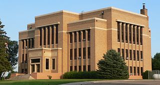
Minnehaha County is a county on the eastern border of the state of South Dakota. As of the 2010 United States Census, the population was 169,468, making it the state's most populous county. Its county seat is Sioux Falls, South Dakota's largest city. The county was created in 1862 and organized in 1868. Its name was derived from the Sioux word Mnihaha, meaning "rapid water," or "waterfall".

Miner County is a county in the U.S. state of South Dakota. As of the 2010 United States Census, the population was 2,389. Its county seat is Howard. The county was created in 1873 and organized in 1880.
Charles Mix County is a county in the U.S. state of South Dakota. As of the 2010 United States Census, the population was 9,129. Its county seat is Lake Andes. The county was created in 1862 and organized in 1879. It was named for Charles Eli Mix, an official of the Bureau of Indian Affairs influential in signing a peace treaty with the local Lakota Indian tribes. The easternmost approximately 60% of the county comprises the Yankton Indian Reservation.

Dakota County is the third-most populous county in the U.S. state of Minnesota, located in the east central portion of the state. As of the 2010 United States Census, the population was 398,552. The county seat is Hastings. Dakota County is named for the Dakota Sioux tribal bands who inhabited the area. The name is recorded as "Dahkotah" in the United States Census records until 1851. Dakota County is included in the Minneapolis–St. Paul–Bloomington, MN–WI Metropolitan Statistical Area, the sixteenth largest metropolitan area in the United States with about 3.64 million residents. The largest city in Dakota County is the city of Lakeville, the eleventh-largest city in Minnesota and sixth-largest Twin Cities suburb. The county is bordered by the Minnesota and Mississippi Rivers on the north, and the state of Wisconsin on the east.

Scouting in South Dakota has a long history, from the 1910s to the present, and serves thousands of youth in programs that suit the environment in which they live.

Devils Lake is a city in Ramsey County, North Dakota, United States. It is the county seat of Ramsey County. The population was 7,141 at the 2010 census. It is named after the nearby body of water called Devils Lake. The first house in Devils Lake was built in 1882. It was surveyed in 1883 and named Creelsburg and later Creel City, after the surveyor, Heber M. Creel. In 1884 it was renamed Devils Lake.
Watertown is a city in and the county seat of Codington County, South Dakota, United States. Watertown is home to the Redlin Art Center which houses many of the original art works produced by Terry Redlin, one of America's most popular wildlife artists. Watertown is located between Pelican Lake and Lake Kampeska, from which Redlin derived inspiration for his artwork.

Canton is a city in and the county seat of Lincoln County, South Dakota, United States. Canton is located 20 minutes south of Sioux Falls in southeastern South Dakota. Canton is nestled in the rolling hills of the Sioux Valley, providing an abundance of recreational activities with the Big Sioux River bordering the eastern side, Newton Hills State Park to the south, and Lake Alvin to the north. The city was named by Norwegian settler and former legislator James M. Wahl. The population was 3,057 as of the 2010 census.

Minnehaha is a fictional Native American woman documented in Henry Wadsworth Longfellow's 1855 epic poem The Song of Hiawatha. She is the lover of the titular protagonist Hiawatha and comes to a tragic end. The name, often said to mean "laughing water", literally translates to "waterfall" or "rapid water" in Dakota.

Arthur Calvin Mellette was the last Governor of Dakota Territory, the first Governor of the State of South Dakota, and an American Civil War veteran.
Mdewakantonwan are one of the sub-tribes of the Isanti (Santee) Dakota (Sioux). Their historic home is Mille Lacs Lake in central Minnesota, which in the Dakota language was called Mde wakan. Together with the Wahpekute, they form the so-called Upper Council of the Dakota or Santee Sioux.

The Lake Traverse Indian Reservation is the homeland of the Sisseton Wahpeton Oyate, a branch of the Santee Dakota group of Native Americans. Most of the reservation covers parts of five counties in northeastern South Dakota, while smaller parts are in two counties in southeastern North Dakota, United States. Its resident population of 10,408 persons was counted during the 2000 census. About one-third of its inhabitants claim to be of solely Native American heritage. Its largest community is the city of Sisseton, South Dakota.

The Dakota are a Native American tribe and First Nations band government in North America. They compose two of the three main subcultures of the Sioux people, and are typically divided into the Eastern Dakota and the Western Dakota.

Lake Herman State Park is a South Dakota state park in Lake County, South Dakota in the United States. The park is open for year-round recreation including camping, swimming, fishing, hiking and boating on the 1,350-acre Lake Herman. There are 72 campsites which feature electric hook-ups and 2 cabins.

Roy Lake State Park is a South Dakota state park in Marshall County, South Dakota in the United States. The park is divided in two sections on Roy Lake, and is open for year-round recreation including camping, beaches, swimming, fishing, hiking and boating. The Roy Lake Resort & Lodge is located in the park. Boat ramps are available and visitors can rent boats from the resort.
