Ooty, officially known as Udhagamandalam ; abbreviated as Udhagai), is a town and a municipality in the Nilgiris district of the South Indian state of Tamil Nadu. It is located 86 km (53 mi) north west of Coimbatore, 100 km (65 mi) north west of Tirupur, 128 km (80 mi) south of Mysore and is the headquarters of the Nilgiris district. It is a popular hill station located in the Nilgiri Hills. It is popularly called the "Queen of Hill Stations". It was the summer capital of the Madras Presidency.

The Nilgiris district is one of the 38 districts in the southern Indian state of Tamil Nadu. Nilgiri is the name given to a range of mountains spread across the borders among the states of Tamil Nadu, Karnataka and Kerala. The Nilgiri Hills are part of a larger mountain chain known as the Western Ghats. Their highest point is the mountain of Doddabetta, height 2,637 m. The district is contained mainly within the Nilgiri Mountains range. The administrative headquarters is located at Ooty. The district is bounded by Coimbatore to the south, Erode to the east, and Chamarajnagar district of Karnataka and Wayanad district of Kerala to the north. As it is located at the junction of three states, namely, Tamil Nadu, Kerala, and Karnataka, significant Malayali and Kannadiga populations reside in the district. Nilgiris district is known for natural mines of Gold, which is also seen in the other parts of Nilgiri Biosphere Reserve extended in the neighbouring states of Karnataka and Kerala too.

The Government Botanical Garden is a botanical garden in Udhagamandalam, near Coimbatore (Ooty), Tamil Nadu state, India laid out in 1848. The gardens, divided into several sections, cover an area of around 55 acres, and lie on the lower slopes of Doddabetta peak. The garden has a terraced layout. It is maintained by the Tamil Nadu Horticulture Department.
Mettupalayam is a municipality town and taluk headquarters of Mettupalayam Taluk in the Coimbatore district of the Indian state of Tamil Nadu, a suburb of Coimbatore. It is the third largest town in the Coimbatore district after Coimbatore and Pollachi. It's located to the North of the Coimbatore city on the way to Ooty in the foothills of Nilgiri hills. As of 2011, the town had a population of 66,595. Mettupalayam railway station is the starting point of Nilgiri Mountain Railway and it operates the only rack railway in India connecting Ooty and Mettupalayam.

Pykara is a river 19 kilometres (12 mi) from Ooty in the Indian State of Tamil Nadu with a village by the same name nearby. The Pykara River is considered very sacred by the Todas. It rises at Mukurthi peak, flows northwards, and then turns to the west after reaching the edge of the plateau. The river flows through Mukurthi, Pykara and Glenmorgan dams, and forms part of an important hydro-electric power project.

Southwick is a suburb in Ooty town. It is located on the NH 67 road from Ooty to Coonoor at about 3 km from the bus stand in Ooty. The suburb falls within the Ooty municipality in Tamil Nadu, India. It has derived its name from the Southwick Bungalow in the suburb.

The Kamaraj Sagar Dam is in the Nilgiris district of Tamil Nadu state in India. It is located at a distance of 10 km from the Ooty bus stand. It is a picnic spot and a film shooting spot on the slopes of the Wenlock Downs. The dam's storage capacity is 26.6 million cubic meters(MCM) or 0.94 tmc ft.

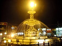
Charring cross is a junction in National Highway 67 (India) intersecting the commercial road and the Ooty-Coonoor road in Ooty, Tamil Nadu. It is considered to be one of the most important and beautiful places in Ooty. The important landmark in charring cross is the Gandhi Statue.
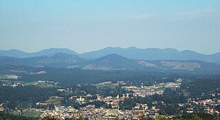
Valley View is a tourist spot in Ooty, India. It is located on the Ooty Coonoor road at a distance of 4 kilometres (2.5 mi) from Ooty bus stand and constitutes ward number 5 of the Nilgiris Lok Sabha constituency. It has views over the Ketti valley, and is an important tourist centre in Ooty. Ketti valley is sometimes referred to as the Switzerland of Southern India. The valley extends from the Mysore plateau to the Coimbatore plains and is one of the largest valleys in the world.

Kalhatti Falls also called as Bird Watcher's Falls is a tourist spot near Ooty, The Nilgiris, Tamil Nadu. These falls are about 13 km from Ooty, on the Ooty to Mysore Road or Sigur Ghat Road, It is situated at an average height of around 400 feet in the Sigur Plateau.This Place is rich in wild life like Bison, Bear, Deer, and also various type of birds. From the Kalhatti village one has to continue for 2 miles to reach the falls and the falls is connected in the same Kalhatti village road.
St. Joseph's Higher Secondary School is a boys' school located in the scenic hill station town Ooty, which is part of The Nilgiris district in Tamil Nadu, India. The school was started by Christian missionaries in 1820.

Ooty Bus Stand, also known as Udhagamandalam Central Bus Stand is a bus station located in the town of Ooty. It serves as main bus stand for The Nilgiris district, Tamil Nadu, apart from bus stands in Coonoor, Kotagiri and Gudalur.

Summer Festival is a festival celebrated in the Nilgiri mountains of India each May. The festival is organized by the Tamil Nadu Department of Tourism and the national Ministry of Tourism. Events during the festival include cultural programmes, a Flower Show, a Rose Show, a Dog Show, a Fruit Show, a Spice Show, a Vegetable Show, a Boat Race, and Boat pageantry.

Avalanche Lake is located 28 kilometers from Ooty in the Nilgiris district in Tamil Nadu.

Emerald Lake is located near Emerald village in the Nilgiris district in Tamil Nadu, India. It is located in a region called the silent valley, about 25 kilometers from the Ooty town.
Commercial road is an important roadway passing through foothills in the township of Ooty, Tamil Nadu. The road is characterized by busy pedestrian and road traffic. As the name suggests, the road is an important commercial hub of the town. The most important junction on the road is Charring cross, which is considered to be one of the most important and beautiful places in Ooty. The region adjoining the roadway houses various commercial establishments like Kairali, a Handicrafts Development Corporation of Kerala showroom.

The Ooty Municipal Market is located in the Nilgiris district in Tamil Nadu. It is one of the largest retail markets in India. This market is the most important shopping centre in Ooty and utilized by the people for shopping vegetables, fruits and groceries.
The Black Bridge is a historic bridge in Wellington, The Nilgiris District, India. At 43.5 metres long, the bridge spans across the Mynala stream, which joins the Coonoor River 2 kilometres downstream. The bridge connects Wellington Cantonment to the Ooty - Coonoor road (NH181). The bridge was constructed in 1858, but it collapsed before its completion. The bridge was constructed again in 1878 using wooden structures. It was christened the Waterloo Bridge, as the beginning of the Waterloo Road, which leads all the up to present-day Madras Regimental Centre. The bridge has locally been known as Black Bridge ever since, as the bridge was built of Burmese teak and was coated with black tar. In 2009, after the most recent reconstruction, the bridge is named "Manekshaw Bridge" in honour of the Late Field Marshal SHFJ Manekshaw, who had made Coonoor his final resting place. The bridge now sports a statue of the late Field Marshal at the confluence with NH 181.