
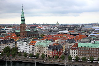
Fiolstræde is a pedestrianised shopping street in central Copenhagen, Denmark. It passes the square Frue Plads on its way from Nørreport station in the north to Skindergade in the south where Jorcks Passage connects it to the shopping street Strøget. Copenhagen Cathedral is located on the street which also passes the rear side of Copenhagen University Library.

St. Paul's Church is a Lutheran church in central Copenhagen, Denmark, also colloquially known as Nyboder's Church due to its location in the middle of the Nyboder area. It was designed by Johannes Emil Gnudtzmann and constructed from 1872 to 1877.

Vester Voldgade is a street in Copenhagen, Denmark which runs from Jarmers Plads to the waterfront between Frederiksholms Kanal and Langebro, passing the City Hall Square on the way.

Nørre Voldgade is a street in central Copenhagen, Denmark. It runs north-east from Jarmers Plads for approximately 600 metres to Gothersgade where it turns into Øster Voldgade. The succession of Nørre Voldgade, Øster Voldgade and Vester Voldgade together forms a traffic artery which arches around the Zealand side of the central and oldest part of Copenhagen. Nørreport Station, Denmark's busiest railway station, is located in the street.
Ved Stranden is a canal side public space and street which runs along a short section of the Zealand side of Slotsholmen Canal in central Copenhagen, Denmark. It begins at Holmens Kanal, opposite the Church of Holmen, and runs west along the canal for one and a half blocks before widening into a small, triangular space adjacent to Højbro Bridge and Højbro Plads. The name of the street refers to Gammel Strand, 'Old Beach', which it formed part of until 1961.

The Gustmeyer House is a historic property on Ved Stranden, opposite Christiansborg Palace on Slotsholmen, in central Copenhagen, Denmark. It was built in 1797 to a Neoclassical design by Johan Martin Quist. The Nobel Prize-winning physicist Niels Bohr was born in the building. McKinsey & Company is now based in the building.
Christianshavns Torv is the central public square of the Christianshavn neighborhood in Copenhagen, Denmark. It is situated at the intersection of Torvegade and Christianshavn Canal, roughly at the center of the area.

Nansensgade is a street in central Copenhagen, Denmark, linking Gyldenløvesgade in the southwest with Gothersgade in the northeast. The street is known for its abundance of cafés and trendy shops, and plays host to an annual street festival. Charlotte Ammundsens Plads, located in front of the local community centre, is an urban space which connects Nansensgade to Nørre Søgade
Enghave Plads is a central public square of the Vesterbro district in Copenhagen, Denmark. It is located where Istedgade reaches Enghavevej, which separates the square from Enghave Park.

Sankt Peder Stræde is a street in central Copenhagen, Denmark. It runs from Nørregade to Jarmers Plads, crossing Larsbjørnsstræde, Teglgårdsstræde and Larslejsstræde on the way. The eponymous St. Peter's Church is located at the beginning of the street, on the corner with Nørregade. Most of its other buildings date from the years after the Copenhagen Fire of 1795. Part of Copenhagen's Latin Quarter, the street is home to several well-known restaurants and shops.

Hauser Plads is a public square in the Old Town of Copenhagen, Denmark. It is separated from the larger, more well-known square Kultorvet by the former Copenhagen Central Library Building. A landscaped playground and Copenhagen Municipality's underground Cleaning Facilities Centre occupies most of the site since a renovation in 2011..
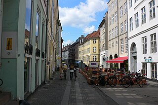
Strædet is the colloquial name of a popular shopping and café street in the Old Town of Copenhagen, Denmark, linking Højbro Plads on Strøget at its eastern end with Regnbuepladsen next to City Hall to the west. The official street names are Læderstræde, Kompagnistræde and Farvergade. The shops along the street are generally smaller and more eclectic than the flagship stores on neighbouring Strøget. It is dominated by art galleries and antique shops. It is known for its rich gay culture with LGBT citizens, shops, bars, restaurants and coffeehouses.

Nikolaj Plads is a public square located at the foot of the former St Nicolas' Church, just off Strøget, in the Old Town of Copenhagen, Denmark. Most of the buildings that line the square date from the rebuilding of the surrounding neighbourhood in the years after the Copenhagen Fire of 1795. The square is a quiet alternative to the much busier squares Amagertorv and Højbro Plads. The former church houses an exhibition space and a restaurant with outdoor service and a small playground is also located at the site.

Palægade is a street located close to Kongens Nytorv in central Copenhagen, Denmark. It runs from Bredgade in the east to Store Kongensgade in the west.

Åbenrå is a street in the Old Town of Copenhagen, Denmark. It runs from Landemærket in the southeast to Rosenborggade in the northwest, linking Vognmagergade with Tornebuskgade. The last part of the street passes the rear side of the grounds of the Reformed Church in Gothersgade. The former rectory associated with the church is located at No. 32-36. It is now houses the Danish Association of Architects.

Vingprdstræde is a street in the Old Town of Copenhagen, Denmark. The first part of the street passes the south side of the Magasin du Nord department store and the north side of Danske Bank's headquarters.

The Peschier House is a listed property at Holmens Kanal in the Old Town of Copenhagen, Denmark. The building is currently part of Danske Bank's headquarters but it has been sold to Standard Life and the bank has announced its plans to move to new premises close to Copenhagen Central Station.
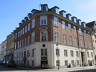
Nikolaj Plads 27 is a Neoclassical property situated at the corner of Nikolaj Plads and Admiralgade in central Copenhagen, Denmark. It was like most of the other buildings in the area constructed as part of the rebuilding of the city following the Copenhagen Fire of 1795. It was listed in the Danish registry of protected buildings and places es in 1945.
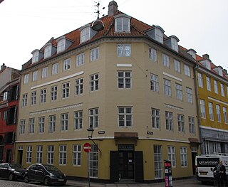
Nikolakplads 23 is a Neoclassical property situated at the corner of Nikolaj Plads and the street Nikolajgade in central Copenhagen, Denmark. It was listed in the Danish registry of protected buildings and places. The building was listed in the Danish registry of protected buildings and places in 1934. Former residents include scientific illustrator Johannes Eilert Steenfeldt, composer Rudolph Bay and playwright and theatre historian Thomas Overskou. The building is owned today by Karberghus.

Boldhusgade 2/Admiralgade 26 is a Neoclassical apartment building situated at the corner of Boldhusgade and Admiralgade in the Old Town of Copenhagen, Denmark. The building, like most of the other buildings in the area, was constructed as part of the rebuilding of the city following the Copenhagen Fire of 1795. Notable former residents include the army officer Bernhard Ditlef von Staffeldt. The building was later home to first the restaurant and bar venue Admiral-Krien and then the experimental theatre Boldhus Teatret. The building was listed in the Danish registry of protected buildings and places in 1939.


