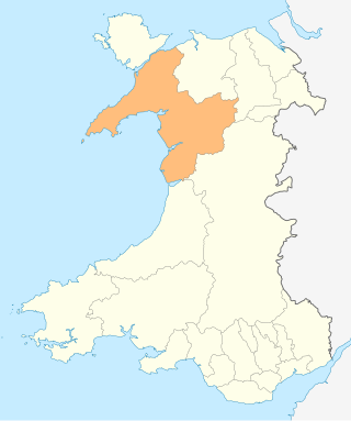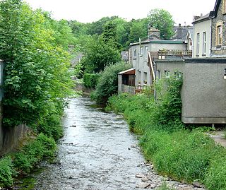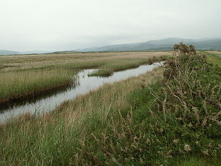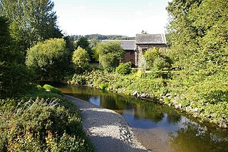
The River Conwy is a river in northern Wales. From its source to its discharge in Conwy Bay it is 55 kilometres (34 mi) long and drains an area of 678 square km. "Conwy" was formerly anglicised as "Conway."

The River Teifi in Wales forms the boundary for most of its length between the counties of Ceredigion and Carmarthenshire, and for the final 3 miles (4.8 km) of its total length of 76 miles (122 km), the boundary between Ceredigion and Pembrokeshire. Its estuary is northwest of Cardigan, known in Welsh as Aberteifi, meaning 'mouth of the Teifi'. Teifi has formerly been anglicised as "Tivy".

The River Dwyryd is a river in Gwynedd, Wales which flows principally westwards; draining to the sea into Tremadog Bay, south of Porthmadog.

The River Vyrnwy is a river which flows through northern Powys, Wales, and Shropshire, England. The name derives from Severn, the river of which it is a tributary.

Aberangell is a village in Gwynedd, Wales.

Afon Seiont is a river in Gwynedd, Wales which runs into the Menai Strait.

Esgairgeiliog is a village in Powys, Wales, UK. It is situated at the junction of the Afon Glesyrch's and Afon Dulas' valleys.

The River Dyfi, also known as the River Dovey, is an approximately 30-mile (48-kilometre) long river in Wales.

Dinas Mawddwy is a village in the community of Mawddwy in south-east Gwynedd, north Wales. It lies within the Snowdonia National Park, but just to the east of the main A470, and consequently many visitors pass the village by. Its population is roughly 600. The village marks the junction of the unclassified road to Llanuwchllyn which climbs up through the mountains to cross Bwlch y Groes at its highest point, the second highest road pass in Wales. This minor road also provides the closest access to the mountain Aran Fawddwy and is the nearest settlement to Craig Cywarch.

Afon Dulyn is the outflow from Llyn Dulyn, a lake in the Carneddau mountains in north-west Wales. It is a tributary of the river Conwy.

The River Cegidog is a river in north-east Wales. It flows mainly through Flintshire but towards the end of its course it forms the border between Flintshire and Wrexham County Borough.
The Mawddwy Railway was a rural line in the Dyfi Valley in mid-Wales that connected Dinas Mawddwy with a junction at Cemmaes Road railway station on the Newtown and Machynlleth Railway section of the Cambrian Railways.

The Afon Mynach is a small river in Ceredigion, Wales.
The River Cwmnantcol is a river in North Wales.

The River Rhythallt is a river in Gwynedd, North Wales whose source is Llyn Padarn. It flows in a northwesterly direction past the village of Brynrefail, Gwynedd and changes its name to Afon Seiont downstream of Pont Rhythallt in Llanrug. The Afon Seiont eventually reaches the sea at Caernarfon. The river has a broad flood plain which occasionally threatens homes in the village of Cwm-y-glo.

Afon Wyre, , is a small river in the county of Ceredigion, Wales; also called Afon Wyre Fawr and formerly Gwyrai.

The River Brenig is a tributary river of the River Teifi and runs through the market town of Tregaron in Ceredigion, Wales. It is formed from the confluence of the Afon Groes and Afon Berwyn in the foothills of the Cambrian Mountains.

The Afon Leri is a river in Ceredigion, Wales. It rises at Llyn Craig-y-Pistyll and is joined at Talybont by Afon Ceulan before passing behind Borth to its mouth in the Dyfi estuary at Ynyslas.

Afon Tanat is a river in northern Powys, Wales. Its source is close to the Cyrniau Nod mountain, to the north of Lake Vyrnwy. The river flows in a generally east-south-east direction until it joins the River Vyrnwy near Llansantffraid-ym-Mechain. For a short distance prior to its confluence it flows within western Shropshire, England.

The Afon Aber is a small river in Gwynedd that enters Liverpool Bay on the coast of North Wales at Abergwyngregyn, 53.242°N 4.027°W. It rises in the Carneddau mountains on the northern watersheds of Drum, Foel Fras and Garnedd Uchaf and the eastern watersheds of Drosgl and Moel Wnion. It is principally noted for the spectacular waterfall of one its principal tributaries, the Aber Falls, where it leaves the hills and descends in a single drop to the valley floor. The river, joined by the other main tributary, the Afon Anafon, then flows through a densely wooded valley which is now a nature reserve before entering the sea just north of Abergwyngregyn.


