
Merionethshire or Merioneth is one of thirteen historic counties of Wales, a vice county and a former administrative county.
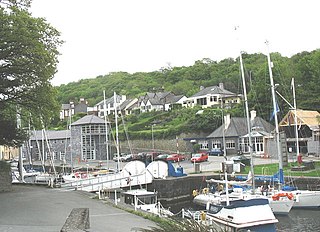
Y Felinheli, formerly known in English as Port Dinorwic, is a village and community beside the Menai Strait between Bangor and Caernarfon in Gwynedd, northwest Wales.

Corris is a village in the county of Gwynedd, Wales, about 4.5 miles (7 km) north of the town of Machynlleth. The village lies on the west bank of the Afon Dulas, around that river's confluence with the Afon Deri. Its railway station is the headquarters and museum of the Corris Railway, a preserved narrow gauge railway.

Esgairgeiliog is a village in Powys, Wales, UK. It is situated at the junction of the Afon Glesyrch's and Afon Dulas' valleys.

The River Dyfi, also known as the River Dovey, is an approximately 30-mile (48-kilometre) long river in Wales.

Mallwyd is a small village at the most southern end of Gwynedd, Wales in the Dinas Mawddwy community, in the valley of the River Dyfi. It lies on the A470 approximately halfway between Dolgellau and Machynlleth, and forms the junction of the A458 towards Welshpool. The nearest villages are Dinas Mawddwy, two miles to the north, and Aberangell a similar distance to the south. The River Dugoed flows into the River Dyfi near the village.

Dinas Mawddwy is a village in the community of Mawddwy in south-east Gwynedd, north Wales. It lies within the Snowdonia National Park, but just to the east of the main A470, and consequently many visitors pass the village by. Its population is roughly 600. The village marks the junction of the unclassified road to Llanuwchllyn which climbs up through the mountains to cross Bwlch y Groes at its highest point, the second highest road pass in Wales. This minor road also provides the closest access to the mountain Aran Fawddwy and is the nearest settlement to Craig Cywarch.

The Hendre-Ddu Tramway was a 1 ft 11 in narrow gauge industrial railway built in 1874 in Mid-Wales to connect the Hendre-Ddu slate quarry to Aberangell station on the Mawddwy Railway. It consisted of a main line 3+1⁄2 miles (5.6 km) long and several branch lines and spurs serving other quarries, local farms and the timber industry.
The Mawddwy Railway was a rural line in the Dyfi Valley in mid-Wales that connected Dinas Mawddwy with a junction at Cemmaes Road railway station on the Newtown and Machynlleth Railway section of the Cambrian Railways.

Llanymawddwy is a village in Gwynedd, Wales, which is to the north of the larger village of Dinas Mawddwy, on the minor road which connects Dinas Mawddwy to Llanuwchllyn over Bwlch y Groes. The most notable building is the parish church dedicated to Saint Tydecho, where the tradition of singing Matins endures.
Aberangell railway station was an intermediate railway station on the Mawddwy Railway which ran from Cemmaes Road to Dinas Mawddy in the Welsh county of Merionethshire. The station was opened by the Mawddwy Railway in 1867 and closed to all goods traffic in 1908. The railway re-opened in 1911 with all services run by the Cambrian Railways. It was amalgamated into the Great Western Railway in 1923 as part of the grouping of British railways, and remained open to passenger and freight traffic until 1931 and 1952, respectively. The station was the transshipment point between the branch and the Hendre Ddu Tramway.

Garneddwen is a hamlet in the south of the county of Gwynedd, Wales. It lies in the historic county of Merionethshire/Sir Feirionnydd, in the valley of the Afon Dulas.
Sir Edmund Buckley, 1st Baronet was a British landowner and Conservative politician who sat in the House of Commons from 1865 to 1878.

Dwygyfylchi is a village in Conwy County Borough, Wales. It is part of the community of Penmaenmawr which has a population of 4,353. The electoral ward of Capelulo which includes Dwygyfylchi had a population of 1,485 in 2011. It forms part of the historic county of Caernarfonshire.

The Dyfi hills are a range situated in the southernmost area of Snowdonia, bounded by the River Dyfi on the east and south sides, by the Afon Dulas on the west and the Afon Cerist to the north. They lie to the west of the Aran Fawddwy range, north-east of the Tarren y Gesail range and are a subgroup of the Cadair Idris group.
Mawddwy is a community in the county of Gwynedd, Wales, and is 88.3 miles (142.2 km) from Cardiff and 172.8 miles (278.0 km) from London. In 2011 the population of Mawddwy was 622 with 59.5% of them able to speak Welsh. It is one of the largest and most sparsely populated communities in Wales.

The Afon Angell is a river in Gwynedd, Mid Wales.

Mynydd Dolgoed or Craig Portas is a mountain in southern Snowdonia, Wales. It is a long ridge running from a low summit between the valleys of the Afon Angell and the Nant Ceiswyn, north east to the cliff of Craig Portas above Dinas Mawddwy. The next mountain in the ridge to south-east is Mynydd Hendre-ddu, while to the south lie Mynydd Llwydiarth and Mynydd Cymerau.
Minllyn quarry was a slate quarry near Dinas Mawddwy in Wales that opened before 1793 and continued working intermittently until 1925. The quarry is located on the western flank of Foel Dinas.


