Afon Llyfni

Last updated

Afon Llyfni at the outflow of Llyn Nantlle Uchaf. AfonLlyfni-LlynNantlleUchaf-01s.jpg
Afon Llyfni at the outflow of Llyn Nantlle Uchaf.

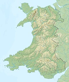
The Afon Llyfni is a small river in North Wales which arises as Nant Drws y Coed between Mynydd Mawr and Mynydd Drws-y-Coed just to the west of Snowdon.

The main river forms at the outlet of the Llyn Nantlle Uchaf and flows past the great slate workings of Nantlle picking up drainage from the very deep flooded quarries.

It then passes to the south of Talysarn and Penygroes before eventually discharging to the sea at Pontllyfni.

For a number of years there were concerns that the quality of the river might be polluted because of illegal and historical dumping of industrial waste in one of the deep, water-filled quarries. [1] However, it appears that there has been little or no detectable quality shift.
Related Research Articles

<span class="mw-page-title-main">River Conwy</span> River in north Wales

The River Conwy is a river in northern Wales. From its source to its discharge in Conwy Bay it is 55 kilometres (34 mi) long and drains an area of 678 square km. "Conwy" was formerly anglicised as "Conway."

<span class="mw-page-title-main">Moel Hebog</span> Mountain, part of the Snowdonia range

Moel Hebog is a mountain in Snowdonia, north Wales which dominates the view west from the village of Beddgelert. It gives name to a whole range of peaks in the north-western corner of Snowdonia, which include the Nantlle Ridge and Mynydd Mawr.

<span class="mw-page-title-main">Afon Ogwen</span> River in Wales

ˈ The Afon Ogwen is a river in north-west Wales draining from some of the greatest peaks in Snowdonia before discharging to the sea on the eastern side of Bangor, Gwynedd.

<span class="mw-page-title-main">Nantlle Valley</span> Area of Gwynedd, Wales

The Nantlle Valley is an area in Gwynedd, North Wales, characterised by its numerous small settlements.

<span class="mw-page-title-main">Nantlle Ridge</span>

The Nantlle Ridge is the name given to a small range of mountains in Snowdonia, north Wales which runs south-west from the village of Rhyd Ddu for a distance of about 9 km (6 mi), ending above Nebo in the Nantlle Valley.

<span class="mw-page-title-main">Craig Cwm Silyn</span>

Craig Cwm Silyn is a mountain in Snowdonia, North Wales which forms the highest point on the celebrated Nantlle Ridge.

<span class="mw-page-title-main">Afon Lledr</span> River in north-west Wales and the second major tributary of the River Conwy

The Afon Lledr is a river in north-west Wales and the second major tributary of the River Conwy. It is about 10 miles or 16 km long, and flows in a generally easterly direction.

<span class="mw-page-title-main">Nantlle Railway</span>

The Nantlle Railway was a Welsh narrow gauge railway. It was built to carry slate from several slate quarries across the Nantlle Valley to the harbour at Caernarfon for export by sea. The line provided a passenger service between Caernarfon and Talysarn from 1856 to 1865. It was the first public railway to be operated in North Wales.

<span class="mw-page-title-main">Llanllyfni</span> Human settlement in Wales

Llanllyfni is a village and a community in Gwynedd, Wales. It is in the historic county of Caernarfonshire. The community consists of the villages of Drws-y-coed, Nantlle, Nasareth, Nebo, Penygroes, Talysarn and the village of Llanllyfni itself. Penygroes, Llanllyfni and Talysarn are almost conjoined. As an electoral ward the 2011 census recorded a population of 1256. It is a largely Welsh-speaking village as 85% of the villagers speak Welsh as their first language. The community covers 43 square kilometres.

<span class="mw-page-title-main">Trum y Ddysgl</span>

Trum y Ddysgl is a mountain in Snowdonia, north Wales and is the second highest summit on the celebrated Nantlle Ridge. It is also one half of the two Marilyns that make up the ridge, the other being Craig Cwm Silyn.

<span class="mw-page-title-main">Y Garn (Nantlle Ridge)</span> Hill in Wales

Y Garn is a top of Mynydd Drws-y-Coed in Snowdonia, north Wales and is the easterly end of the Nantlle Ridge.

<span class="mw-page-title-main">Mynydd Drws-y-Coed</span> Mountain in the United Kingdom

Mynydd Drws-y-Coed is a peak on the Nantlle Ridge in Snowdonia, north Wales. It is located at the easterly end of the ridge, and is a subsidiary summit of Trum y Ddysgl. It has steep west-facing cliffs, the summit area being the highest point on a thin ridge.

<span class="mw-page-title-main">Carnarvon Castle railway station</span> Disused railway station in Wales

Carnarvon Castle railway station was opened in 1856 by the narrow gauge Nantlle Railway near the foot of what is today the Allt Y Castell which slopes down to Caernarfon's harbour area. It was the line's northern terminus and was the closest of Caernarfon's ultimately five stations to the historic town centre.

References

Coordinates: 53°02′58″N4°20′19″W / 53.04952°N 4.33874°W / 53.04952; -4.33874