Llandudwen

Last updated

Llandudwen
Looking SW to Carn Fadryn from Bronheulog - geograph.org.uk - 269567.jpg
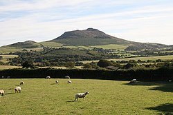
Carn Fadryn seen from Bronheulog
Gwynedd UK location map.svg
Red pog.svg
Llandudwen
Location within Gwynedd
OS grid reference SH2837
Community
Principal area
Ceremonial county
Country Wales
Sovereign state United Kingdom
Post town PWLLHELI
Postcode district LL53
Dialling code 01758
Police North Wales
Fire North Wales
Ambulance Welsh
UK Parliament
Senedd Cymru – Welsh Parliament
List of places
UK
Wales
Gwynedd
52°54′36″N4°32′49″W / 52.91°N 4.547°W / 52.91; -4.547 Coordinates: 52°54′36″N4°32′49″W / 52.91°N 4.547°W / 52.91; -4.547

Llandudwen is a former civil parish in the Welsh county of Gwynedd. It was abolished in 1934, and divided between Buan and Tudweiliog. [1]

Related Research Articles

A parish is a territorial entity in many Christian denominations, constituting a division within a diocese. A parish is under the pastoral care and clerical jurisdiction of a priest, often termed a parish priest, who might be assisted by one or more curates, and who operates from a parish church. Historically, a parish often covered the same geographical area as a manor. Its association with the parish church remains paramount.

Parish church Church which acts as the religious centre of a parish

A parish church in Christianity is the church which acts as the religious centre of a parish. In many parts of the world, especially in rural areas, the parish church may play a significant role in community activities, often allowing its premises to be used for non-religious community events. The church building reflects this status, and there is considerable variety in the size and style of parish churches. Many villages in Europe have churches that date back to the Middle Ages, but all periods of architecture are represented.

A parish council is a civil local authority found in England and is the lowest tier of local government. They are elected corporate bodies, have variable tax raising powers, and are responsible for areas known as civil parishes, serving in total 16 million people. A parish council may decide to call itself a Town Council, Village Council, Community Council, Neighbourhood Council, or if the parish has city status, the parish council may call itself a City Council. However the powers and duties of the parish council are the same whatever name it carries.

Stirlingshire Historic county in Scotland

Stirlingshire or the County of Stirling, Scottish Gaelic: Siorrachd Sruighlea) is a historic county and registration county of Scotland. Its county town is Stirling.

In England, a township is a local division or district of a large parish containing a village or small town usually having its own church. A township may or may not be coterminous with a chapelry, manor, or any other minor area of local administration.

Freguesia Administrative subdivision of Portugal

Freguesia, usually translated as "parish" or "civil parish", is the third-level administrative subdivision of Portugal, as defined by the 1976 Constitution. It is also the designation for local government jurisdictions in the former Portuguese overseas territories of Cape Verde and Macau. In the past, was also an administrative division of the other Portuguese overseas territories. The parroquia in the Spanish autonomous communities of Galicia and Asturias is similar to a freguesia.

Civil parish Territorial designation and lowest tier of local government in England

In England, a civil parish is a type of administrative parish used for local government. It is a territorial designation which is the lowest tier of local government below districts and counties, or their combined form, the unitary authority. Civil parishes can trace their origin to the ancient system of ecclesiastical parishes which historically played a role in both civil and ecclesiastical administration; civil and religious parishes were formally split into two types in the 19th century and are now entirely separate. The unit was devised and rolled out across England in the 1860s.

A parish register in an ecclesiastical parish is a handwritten volume, normally kept in the parish church in which certain details of religious ceremonies marking major events such as baptisms, marriages, children, and burials are recorded. Along with these vital details, church goods, the parish’s response to briefs, and notes on various happenings in the parish were also recorded. These elaborate records existed for the purpose of preventing bigamy and consanguineous marriage.

A parish is an administrative division used by several countries. To distinguish it from an ecclesiastical parish, the term civil parish is used in some jurisdictions, as noted below.

A vestry was a committee for the local secular and ecclesiastical government for a parish in England and Wales, which originally met in the vestry or sacristy of the parish church, and consequently became known colloquially as the "vestry".

Llŷn Peninsula

The Llŷn Peninsula extends 30 miles (50 km) into the Irish Sea from North West Wales, south west of the Isle of Anglesey. It is part of the historic county of Caernarfonshire, and historic region and local authority area of Gwynedd. Much of the eastern part of the peninsula, around Criccieth, may be regarded as part of Eifionydd rather than Llŷn, although the boundary is somewhat vague. The area of Llŷn is about 400 km2 (150 sq mi), and its population is at least 20,000.

The wards and electoral divisions in the United Kingdom are electoral districts at sub-national level represented by one or more councillors. The ward is the primary unit of English electoral geography for civil parishes and borough and district councils, electoral ward is the unit used by Welsh principal councils, while the electoral division is the unit used by English county councils and some unitary authorities. Each ward/division has an average electorate of about 5,500 people, but ward-population counts can vary substantially. As at the end of 2014 there were 9,456 electoral wards/divisions in the UK.

Buan, Gwynedd Human settlement in Wales

Buan is a community in the Welsh county of Gwynedd, located on the Llŷn Peninsula. It includes the villages of Boduan and Rhydyclafdy, and has a population of 469, increasing to 484 at the 2011 Census. Other settlements include Ceidio, Llandudwen and Llanfihangel Bachellaeth.

Civil parishes in Cornwall

A civil parish is a country subdivision, forming the lowest unit of local government in England. There are 218 civil parishes in the ceremonial county of Cornwall, which includes the Isles of Scilly. The county is effectively parished in its entirety; only the unpopulated Wolf Rock is unparished. At the 2001 census, there were 501,267 people living in the current parishes, accounting for the whole of the county's population. The final unparished areas of mainland Cornwall, around St Austell, were parished on 1 April 2009 to coincide with the structural changes to local government in England.

Civil parishes are small divisions used for statistical purposes and formerly for local government in Scotland.

Civil parishes in Ireland Administrative division of Ireland

Civil parishes are units of territory in the island of Ireland that have their origins in old Gaelic territorial divisions. They were adopted by the Anglo-Norman Lordship of Ireland and then by the Elizabethan Kingdom of Ireland, and were formalised as land divisions at the time of the Plantations of Ireland. They no longer correspond to the boundaries of Roman Catholic or Church of Ireland parishes, which are generally larger. Their use as administrative units was gradually replaced by Poor Law Divisions in the 19th century, although they were not formally abolished. Today they are still sometimes used for legal purposes, such as to locate property in deeds of property registered between 1833 and 1946.

References