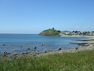
Criccieth Castle is a fortification in the town of Criccieth, Gwynedd, North Wales. The castle is situated on a rocky headland overlooking Tremadog Bay and consists of an inner ward almost surrounded by an outer ward. The most prominent feature is the twin-towered gatehouse, which survives in part to its full height.
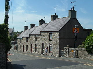
Criccieth is a town and community in Gwynedd, Wales, on the boundary between the Llŷn Peninsula and Eifionydd. The town is 5 miles (8 km) west of Porthmadog, 9 miles (14 km) east of Pwllheli and 17 miles (27 km) south of Caernarfon. It had a population of 1,826 in 2001, reducing to 1,753 at the 2011 census.
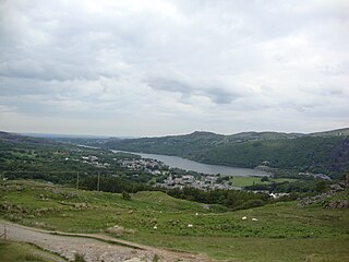
Llanberis is a village, community and electoral ward in Gwynedd, northwest Wales, on the southern bank of the lake Llyn Padarn and at the foot of Snowdon, the highest mountain in Wales. It is a centre for outdoor activities in Snowdonia, including walking, mountaineering, climbing, mountain biking and pony trekking, as well as water sports such as scuba diving. The community includes Nant Peris.
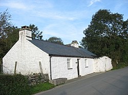
Llanrhaeadr-ym-Mochnant is a village, community and an ecclesiastical parish in the extreme north of Powys, Wales; about 9 miles west of Oswestry and 12 miles south of Llangollen, on the B4580. It lies near the foothills of the Berwyn mountains on the river Rhaeadr. At the top end of the valley is the Pistyll Rhaeadr waterfall, one of the Seven Wonders of Wales in the old rhyme. One mile north of the town is the hill Moel Hen-fache. The community includes the hamlet of Llanarmon Mynydd Mawr.

Cilgerran is both a village, a parish, and also a community, situated on the south bank of the River Teifi in Pembrokeshire, Wales. It was formerly an incorporated market town.

Meifod, formerly also written Meivod, is a small village, community and electoral ward 7 miles north-west of Welshpool in Montgomeryshire, Powys, Wales, on the A495 road and located in the valley of the River Vyrnwy. The River Banwy has a confluence with the Vyrnwy approximately two miles to the west of the village. The village itself had a population of 317. The community includes the village of Bwlch-y-cibau and the hamlet of Allt-y-Main.
Pentraeth is a village and community on the island of Anglesey, North Wales, at grid reference SH523786. The Royal Mail postcode begins LL75. The community population taken at the 2011 census was 1,178. The village itself having a population of 557.
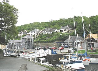
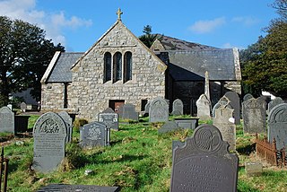
Y Felinheli, formerly known in English as Port Dinorwic, is a village and community beside the Menai Strait between Bangor and Caernarfon in Gwynedd, northwest Wales.

Llanbedrog is a village and community on the Llŷn peninsula of Gwynedd in Wales. It is situated on the south side of the peninsula on the A499 between Pwllheli and Abersoch. Formerly in the county of Caernarfonshire, it had a population of 1,020 in 2001, reducing slightly to 1,002 at the 2011 Census.
The Llŷn Peninsula extends 30 miles (50 km) into the Irish Sea from North West Wales, south west of the Isle of Anglesey. It is part of the historic county of Caernarfonshire, and historic region and local authority area of Gwynedd. Much of the eastern part of the peninsula, around Criccieth, may be regarded as part of Eifionydd rather than Llŷn, although the boundary is somewhat vague. The area of Llŷn is about 400 km2 (150 sq mi), and its population is at least 20,000.

Eifionydd is an area in north-west Wales covering the south-eastern part of the Llŷn Peninsula from Porthmadog to just east of Pwllheli. The Afon Erch forms its western border. It now lies in Gwynedd.
Llanengan is a small village and community 1.2 mi (1.9 km) around Abersoch in Gwynedd in north-west Wales. It had a population of 2,024 at the 2001 census, which had been reduced to 1,989 at the 2011 Census. The popular seaside resort village of Abersoch falls within the community, as do the villages of Llangian, Mynytho, Machroes and Llanengan. The local public house is called the Sun.

Llansanffraid Glan Conwy, usually shortened to Glan Conwy, is a village, community and electoral ward in Conwy County Borough, Wales. The name translates from the Welsh as Church of St Ffraid on the bank of the River Conwy. The village was founded in the 5th century and in the past had a marine-based economy, but it is now largely residential. The population was 2,290 in 2001, reducing to 2,196 at the 2011 census. It includes the village of Pentrefelin.

Llangelynnin is a small village and community near Tywyn, Gwynedd, Wales. Although the village is usually known as Llangelynnin in English, the community name used was Llangelynin though now its also "Llangelynnin".
Llanaelhaearn is a village and community on the Llŷn Peninsula in the county of Gwynedd, Wales. The community includes the larger village of Trefor and has a population of 1,067, increasing to 1,117 at the 2011 Census.

Llannor is a village, parish and community located on the Llŷn Peninsula in the Welsh county of Gwynedd. Historically in Caernarfonshire, it lies 1.7 miles (2.8 km) north of Pwllheli and 18.0 miles (29.0 km) south west of Caernarfon. The community includes the villages of Y Ffor, Abererch, Efailnewydd, Llwyndyrys and Rhos-fawr, and had a population of 2,244 in 2010, reducing slightly to 2,145 at the 2011 Census.

Buan is a community in the Welsh county of Gwynedd, located on the Llŷn Peninsula. It includes the villages of Boduan and Rhydyclafdy, and has a population of 469, increasing to 484 at the 2011 Census. Other settlements include Ceidio, Llandudwen and Llanfihangel Bachellaeth.

Llaneilian is a village and community in Anglesey, Wales. It is located in the north east of the island, 2.2 miles (3.5 km) east of Amlwch, 16.5 miles (26.6 km) north west of Menai Bridge and 12.5 miles (20.1 km) north of Llangefni. The community includes the villages and hamlets of Dulas, Llaneilian, Pengorffwysfa, Cerrig Man and Penysarn, Gadfa and Nebo, and at the 2001 census had a population of 1,192, decreasing slightly to 1,186 at the 2011 Census. The parish is crowned by its hill, Mynydd Eilian, a HuMP, popular with walkers and ramblers, and its beach, Traeth Eilian, which is popular with holidaymakers and for watersport activities. At the north easternmost point is Point Lynas,, while Ynys Dulas lies off the North East coast of the island, east of Dulas Bay.

Castle Caereinion is a small village and community in Montgomeryshire, Powys, Wales upon the River Banwy, around 8 miles west of Welshpool, and 4 miles east of Llanfair Caereinion.

The Diocese of Bangor is a diocese of the Church in Wales in North West Wales. The diocese covers the counties of Anglesey, most of Caernarfonshire and Merionethshire and the western part of Montgomeryshire.