Related Research Articles
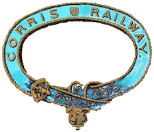
The Corris Railway is a narrow gauge preserved railway based in Corris on the border between Merionethshire and Montgomeryshire in Mid-Wales.

Aberangell is a village in Gwynedd, Wales.

Aberhafesp is a small village and community in Montgomeryshire, Powys, Wales. The hamlet of Bwlch-y-Ffridd is within the community.

The River Dyfi, sometimes anglicised to River Dovey, is an approximately 30 mi (48 km) long river in Wales.
Llwyngwern was a station on the Corris Railway in Wales, built to serve the hamlet of Pantperthog and the residents of Plas Llwyngwern, a house where a daughter of the 5th Marquess of Londonderry lived with her husband. Although the Plas was in Montgomeryshire, the station was across the Afon Dulas in Merionethshire. The station was built at Llwyngwern, rather than at Pantperthog, because there is a very tight bend and a steep gradient on the railway at Pantperthog.

Ffridd Gate was a station on the Corris Railway in Merioneth, Wales, UK. It was built at the level crossing over the B4404 road to Llanwrin, near the hamlet of Fridd. A small hamlet also grew up around the station and a nearby (pre-existent) toll-house. The hamlet and former station are near to the confluence of the Afon Dulas and the River Dyfi, around 2+1⁄4 miles (3.6 km) west of the village of Llanwrin and 1 mile (1.6 km) north of the town of Machynlleth.

Sarn Helen refers to several stretches of Roman road in Wales. The 160-mile (260 km) route, which follows a meandering course through central Wales, connects Aberconwy in the north with Carmarthen in the west. Despite its length, academic debate continues as to the precise course of the Roman road. Many sections are now used by the modern road network while other parts are still traceable. However, there are sizeable stretches that have been lost and are unidentifiable.

Gwalchmai is a village on Anglesey in north Wales, within the Trewalchmai community.

The Blaen y Cwm quarry was a slate quarry located east of Blaenau Ffestiniog in Wales. It was first worked in some time between 1813 and 1818 and sporadically after that until 1914. The quarry was connected to the Ffestiniog Railway at Duffws Station via the Rhiwbach Tramway.

The Afon Dulas, or North Dulas, is a river forming the border between Merionethshire/Gwynedd and Montgomeryshire/Powys in Wales. Another river called Afon Dulas joins the Dyfi from the south, upstream of its confluence with the North Dulas: locally this is referred to as the South Dulas.

Ffridd Faldwyn is an Iron Age hillfort in northern Powys, in the former county of Montgomeryshire, It is sited on a prominent hill west of Montgomery, close to but higher than Montgomery Castle, overlooking the River Severn. It is one of the largest hill-forts in Wales.

Clwt-y-bont is a village in Gwynedd, Wales, lying just to the south of Deiniolen. The two villages form one urban unit. Both were built in the early 19th century to house workers in the Dinorwig slate quarry, and both suffered when the quarry was closed in 1969.
John Davies, also known by his bardic name of Siôn Dafydd Las, was a Welsh bard active in the late 17th century. He is thought to have been from the Llanuwchllyn area of North Wales, and he may have lived in the Tyn-y-ffridd area for a while.

The River Rhiw is a short river in the north of Powys in Wales. Two headwater tributaries both named Afon Rhiw flow east to join at Dwyrhiew and then continue in a generally easterly direction to join the River Severn east of Berriew. The northern Rhiw emerges from Llyn y Bugail on Mynydd Waun Fawr whilst the southern Rhiw rises near Mynydd Dwyriw. The combined river flows past the hamlets of New Mills, Manafon and Pant-y-ffridd, accompanied by the B4390 road all the way to Berriew. Other tributaries include the Nant Wtre-wen, Crygnant, Nant y Llyn Mawr and Dolgar Brook. It is bridged and forded at numerous points, one of which is an aqueduct carrying the Montgomery Canal over it at Berriew. At the eastern end of the river is Glansevern Hall and gardens.
References
- ↑ Montgomeryshire XIA.SE (Map). Ordnance Survey. 1887.
- ↑ The Cambrian Journal. 1862. pp. 305–.
| | This Gwynedd location article is a stub. You can help Wikipedia by expanding it. |