
Afon Rheidol is a river in Ceredigion, Wales, 19 miles (31 km) in length. The source is Plynlimon. Receiving an average annual rainfall of 40 inches (1.02 m), Plynlimon is also the source of both the Wye and the Severn.

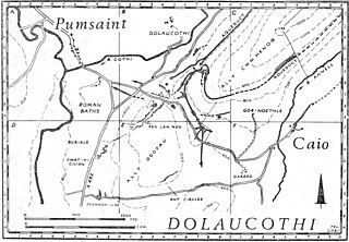
Pumsaint is a village in Carmarthenshire, Wales, halfway between Llanwrda and Lampeter on the A482 in the valley of the Afon Cothi. It forms part of the extensive estate of Dolaucothi, which is owned by the National Trust.
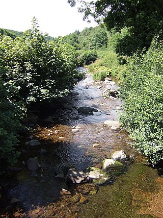
The Afon Cothi in Carmarthenshire is the largest tributary of the River Tywi in south Wales. From its source at Blaen Cothi in the north of the county, north of Pumsaint, it flows south-east and then turns south-west to flow past Cwrt-y-cadno, Pumsaint, Abergorlech and Pont-ar-Gothi before joining the River Tywi west of the village of Llanarthney.
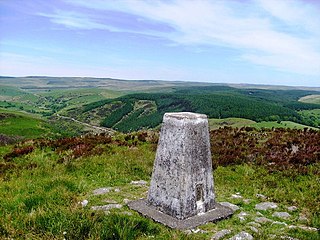
The Brechfa Forest is a forest in Carmarthenshire, south Wales. Brechfa Forest is the 'modern' name for part of the ancient Glyn Cothi Forest. From before records began in the 6th century the communities in the 15 villages which encircle Glyn Cothi Forest were managing it to provide employment, building materials, products, and grazing. At various times the forest has been the refuge of Welsh Princes fighting the Norman Invasion, a Royal Hunting Forest, and for two centuries was the 'Texas' of Wales, producing large quantities of oil for lamps. and was a major supplier of timber for the trenches and explosives during World War One.
The River Cleddau consists of the Eastern and Western Cleddau rivers in Pembrokeshire, west Wales. They unite to form the Daugleddau estuary and the important harbour of Milford Haven.

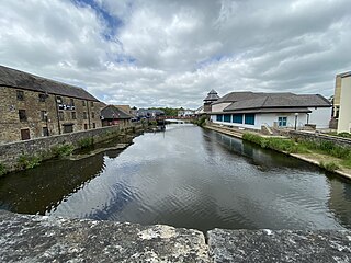
The River Lliedi has its source near Mynydd Sylen Llanelli and Llannon in Carmarthenshire, Wales. The river fills the Cwm-Lliedi Reservoirs and meets the sea at the Loughor Estuary at the former Carmarthenshire Dock ,Llanelli.
Brechfa, situated between Llandeilo and Carmarthen in the county of Carmarthenshire, Wales, is a village that has existed since the 6th century at the top of the Cothi Valley. Brechfa village is set in countryside, as well as being located by the Brechfa Forest

Cynwyl Elfed is a village and community in the county of Carmarthenshire, Wales. The community includes the villages of Cynwyl Elfed, Blaenycoed and Cwmduad. It is situated about 5 miles (8.0 km) north of Carmarthen and had a population of 953 in 2001, increasing to 1,044 at the 2011 Census.
The Afon Gwydderig is a tributary of the Afon Brân. It rises as the Nant Gwydderig on the southern slopes of Mynydd Bwlch-y-groes, about 3 miles (4.8 km) North of the small village of Llywel, Powys. The A40 runs next to the river from Llywel as far as Llandovery, Carmarthenshire.

River Dulais is a river of Wales which has its source at Mynydd y Drum. It joins the River Neath after flowing over Aberdulais Falls.

The River Gwili in Carmarthenshire, is a tributary of the River Towy, the longest river entirely in Wales. Its headwater is found east of Llanllawddog, in the Brechfa Forest. It runs west, through Llanpumsaint, to its confluence with the River Duad, just south of Cynwyl Elfed village. Here its course turns to the southeast, running through Bronwydd before joining the River Towy at Abergwili.

The Afon Cennen is a river in the county of Carmarthenshire, south Wales. It rises on the northern slopes of the Black Mountain to the east of the summit of Tair Carn Uchaf and flows north to Blaencennen Farm, then westwards past Carreg Cennen Castle, continuing through the village of Trap where it exits the Brecon Beacons National Park. Near the hamlet of Derwydd it turns northwest for a mile then northeast to run through the village of Ffairfach to its confluence with the River Towy opposite Llandeilo.
Trap is a hamlet in the county of Carmarthenshire in southwest Wales, located on the western border of the Brecon Beacons National Park, around four miles southeast of the town of Llandeilo. It is unclear whether the name – which often appears as Trapp on maps, although the spelling with a single p is generally preferred locally – refers to a fish-trap, a water-trap (mill-leat), or, given that the village is in Cwm Lladron, an ambush point.

Afon Annell is a small river in Carmarthenshire, Wales.
Brechfa Forest West Wind Farm is a wind farm in Brechfa Forest in Carmarthenshire in south west Wales. Construction of the wind farm began in November 2016 and power generation commenced in January 2018.

Mynydd Merthyr is a broad ridge of high ground between Taff Vale and the Cwm Cynon in the Valleys region of South Wales. It forms the boundary between the unitary authorities of Rhondda Cynon Taff to the west and Merthyr Tydfil to the east.

The Afon Twrch is a short river in Carmarthenshire, West Wales. It joins the River Cothi at the village of Pumsaint, near to which are the Roman gold mines of Dolaucothi.
Mynydd Mallaen is an expansive plateau to the northwest of Cilycwm in northeast Carmarthenshire, Wales. It forms part of the Cambrian Mountains massif, and is north-west of the Black Mountain (range) in the Brecon Beacons. It takes the form of an undulating plateau with steep slopes dropping away to the Towy valley to the east and those of the Gwenffrwd, Nant Melyn and Afon Cothi to the north and west. Its highest point of 1516 feet or 462m at OS grid reference SN 723455 is surmounted by two Bronze Age cairns known as Crugiau Merched. Caeo Forest covers much of the southern flanks of the hill and smaller forests also cover its eastern slopes. Much of the native woodland consists of sessile oak groves, especially on the valley sides. The human population is very low, being restricted to hill farms engaged in sheep farming, and some holiday cottages.
The Afon Cilieni is a short river which rises on the southern slopes of Mynydd Epynt in Powys, Wales. The name may mean ' the river rising in a small nook'.
