Related Research Articles

Papua New Guinea, officially the Independent State of Papua New Guinea, is a country in Oceania that comprises the eastern half of the island of New Guinea and its offshore islands in Melanesia. Its capital, located along its southeastern coast, is Port Moresby. The country is the world's third largest island country, with an area of 462,840 km2 (178,700 sq mi).

The geography of Papua New Guinea describes the eastern half of the island of New Guinea, the islands of New Ireland, New Britain and Bougainville, and smaller nearby islands. Together these make up the nation of Papua New Guinea in tropical Oceania, located in the western edge of the Pacific Ocean.

A swamp is a forested wetland. Swamps are considered to be transition zones because both land and water play a role in creating this environment. Swamps vary in size and are located all around the world. The water of a swamp may be fresh water, brackish water, or seawater. Freshwater swamps form along large rivers or lakes where they are critically dependent upon rainwater and seasonal flooding to maintain natural water level fluctuations. Saltwater swamps are found along tropical and subtropical coastlines. Some swamps have hammocks, or dry-land protrusions, covered by aquatic vegetation, or vegetation that tolerates periodic inundation or soil saturation. The two main types of swamp are "true" or swamp forests and "transitional" or shrub swamps. In the boreal regions of Canada, the word swamp is colloquially used for what is more formally termed a bog, fen, or muskeg. Some of the world's largest swamps are found along major rivers such as the Amazon, the Mississippi, and the Congo.

New Britain is the largest island in the Bismarck Archipelago, part of the Islands Region of Papua New Guinea. It is separated from New Guinea by a northwest corner of the Solomon Sea and from New Ireland by St. George's Channel. The main towns of New Britain are Rabaul/Kokopo and Kimbe. The island is roughly the size of Taiwan. While the island was part of German New Guinea, it was named Neupommern . In common with most of the Bismarcks it was largely formed by volcanic processes, and has active volcanoes including Ulawun, Langila, the Garbuna Group, the Sulu Range, and the volcanoes Tavurvur and Vulcan of the Rabaul caldera. A major eruption of Tavurvur in 1994 destroyed the East New Britain provincial capital of Rabaul. Most of the town still lies under metres of ash, and the capital has been moved to nearby Kokopo.
The East Papuan languages is a defunct proposal for a family of Papuan languages spoken on the islands to the east of New Guinea, including New Britain, New Ireland, Bougainville, Solomon Islands, and the Santa Cruz Islands. There is no evidence that these languages are related to each other, and the Santa Cruz languages are no longer recognized as Papuan.

The Battle of the Bismarck Sea took place in the South West Pacific Area (SWPA) during World War II when aircraft of the U.S. Fifth Air Force and the Royal Australian Air Force (RAAF) attacked a Japanese convoy carrying troops to Lae, New Guinea. Most of the Japanese task force was destroyed, and Japanese troop losses were heavy.
The Gulf of Papua is located in the southern coast region of New Guinea. It has a total surface area of 70,400 km2 (27,200 sq mi).

Melanesians are the predominant and indigenous inhabitants of Melanesia, in a wide area from New Guinea to the Fiji Islands. Most speak either one of the many languages of the Austronesian language family, especially ones in the Oceanic branch, or from one of the many unrelated families of Papuan languages. Other languages are the several creoles of the region, such as Tok Pisin, Hiri Motu, Solomon Islands Pijin, Bislama, and Papuan Malay.

Western New Guinea, also known as Papua, Indonesian New Guinea, or Indonesian Papua, is the western, Indonesian half of the island of New Guinea. Since the island is alternatively named as Papua, the region is also called West Papua.
The Territory of New Guinea was an Australian-administered United Nations trust territory on the island of New Guinea from 1914 until 1975. In 1949, the Territory and the Territory of Papua were established in an administrative union by the name of the Territory of Papua and New Guinea. That administrative union was renamed as Papua New Guinea in 1971. Notwithstanding that it was part of an administrative union, the Territory of New Guinea at all times retained a distinct legal status and identity until the advent of the Independent State of Papua New Guinea.
Sulka is a language isolate of New Britain, Papua New Guinea. In 1991, there were 2,500 speakers in eastern Pomio District, East New Britain Province. Villages include Guma in East Pomio Rural LLG. With such a low population of speakers, this language is considered to be endangered. Sulka speakers had originally migrated to East New Britain from New Ireland.
The Kol language is a language spoken in eastern New Britain island, Papua New Guinea. There are about 4000 speakers in Pomio District of East New Britain Province, mostly on the southern side of New Britain island.
Ghost Mountain is the name given by U.S. Army servicemen in 1942 to Mount Obree, a mountain in the Owen Stanley Range in the southeast of Papua New Guinea. Known locally as "Suwemalla," Ghost Mountain rises to a height of 3,080 metres (10,100 ft).
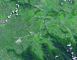
Kuk Swamp is an archaeological site in Papua New Guinea, that lies in the Wahgi Valley of the highlands. The swamp developed in a former lake basin, as it was filled by an alluvial fan or deposits of water-transported material. Archaeological evidence for early agricultural drainage systems was found here, beginning about 9,000 years ago. It includes draining ditches of three major classes, which were used to convert the area to an anthropogenic grassland. The native crop taro was grown here.

The Swamp Ghost is a Boeing B-17E Flying Fortress piloted by Captain Frederick 'Fred' C. Eaton, Jr, that ditched in a swamp on Papua New Guinea during the Second World War, after an attack on ships at Japanese-occupied New Britain on February 23, 1942. While flying over Rabaul, it was intercepted and eventually, having run out of fuel, had to force-land in a remote swamp near the north coast of New Guinea. All of the crew survived the crash landing and arduous trek out.

Xeromys myoides, also known as the water mouse, marine mouse, mangrove mouse, false water rat, manngay and yirrkoo, is a species of rodent native to waterways of Australia and Papua New Guinea.

New Guinea is the world's second-largest island, with an area of 785,753 km2 (303,381 sq mi). Located in Oceania in the southwestern Pacific Ocean, the island is separated from Australia by the 150-kilometre wide Torres Strait, though both landmasses lie on the same continental shelf. Numerous smaller islands are located to the west and east.

During World War II, the United States Army Air Forces established a series of airfields in Australia for the collective defense of the country, as well as for conducting offensive operations against the Imperial Japanese Army and Navy. From these airports and airfields in Australia, the Fifth Air Force was able to regroup, re-equip and begin offensive operations against the Empire of Japan after the disasters in the Philippines and Dutch East Indies during 1942.

Charles Raymond (Bob) Gurney, AFC was an Australian aviator who was involved in pioneering aviation in New Guinea in the 1930s. He flew with Qantas before and during the Second World War, and served with the Royal Australian Air Force from September 1939. He was killed on operations against the Japanese in the south west Pacific in 1942 flying with the United States Army Air Forces. In his aviation career "Bob" Gurney was chief pilot of Guinea Airways, a Qantas flying boat captain and a Squadron Leader in the RAAF, who even had to bomb his own home. In commemoration of his service an airport in Papua New Guinea and a street in Townsville, Queensland are named after him.
References
- ↑ "WHEREFORE 'SWAMP GHOST'?". Aerothentic.com. Archived from the original on 2005-04-18.
- ↑ "B-17E Flying Fortress Serial Number 41-2446 (aka "Swamp Ghost")". PacificWrecks.com.
- 1 2 One or more of the preceding sentences incorporates text from a publication now in the public domain : Chisholm, Hugh, ed. (1911). "Agaiambo". Encyclopædia Britannica . Vol. 1 (11th ed.). Cambridge University Press. p. 362.
Coordinates: 9°00′00″S148°05′00″E / 9.0000°S 148.0833°E
| | This Oro Province geography article is a stub. You can help Wikipedia by expanding it. |