
Ariyalur district is an administrative district, one of the 38 districts in the state of Tamil Nadu in India. The district headquarters is located at Ariyalur. The district encompasses an area of 1,949.31 km2.

Madurai district is one of the 38 districts of the state of Tamil Nadu in southeastern India. The city of Madurai serves as the district headquarters. It houses the famous Sri Meenakshi Sundareshwarar temple and is situated on the banks of the river Vaigai. Thiruparankundram is one of the major tourist place in the district. As of 2011, the district had a population of 3,038,252 with a sex-ratio of 990 females for every 1,000 males. Aside from the city of Madurai, the larger towns are Melur, Vadipatti, Thirumangalam, Thirupparankundram, Peraiyur, and Usilampatti. It is an important hub for various film shootings. Alanganallur is a popular spot in the district for Jallikattu, as are Palamedu and Avaniyapuram.

Kanyakumari district, officially Kanniyakumari district, is one of the 39 districts of Tamil Nadu state and the southern most district in mainland India. It stands second in terms of population density among the districts of Tamil Nadu. It is also the richest district in Tamil Nadu in terms of per capita income, and also tops the state in Human Development Index (HDI), literacy, and education. The district's headquarters is Nagercoil.
Thiruneermalai is a neighborhood in the city of Tambaram, situated within the Chennai Metropolitan Area, Tamil Nadu, India.

Tirunelveli district is one of the 38 districts of Tamil Nadu state in India. It is the largest district in terms of area with Tirunelveli as its headquarters. The district was formed on 1 September 1790 by the British East India Company and comprised the present Tirunelveli and Thoothukudi, Tenkasi and parts of Virudhunagar and Ramanathapuram district. As of 2011, the undivided district had a population of 30,77,233.
Pudukkottai District is one of the 38 districts of Tamil Nadu state in southern India. The city of Pudukkottai is the district headquarters. It is also known colloquially as Pudhugai.
Tiruchengode is a selection grade municipality located in western part of southern Indian state of Tamil Nadu. It is famous for the ancient hilltop Ardhanareeswarar Temple, dedicated to the unique combined male-female form of Lord Shiva and Goddess Parvathi. This important place of pilgrimage is mentioned in the Tamil work Silapathikaram as 'Nedulkundru' and is celebrated in the hymns of Saivite saints. The equally famous Chenkottu Velavar Temple, dedicated to Lord Murugan, is situated on the same hill. As of 2011, the town had a population of 95,335. As per 2011 population, Tiruchengode is the largest city in Namakkal district. It is also famous for rig business.
Agastheeswaram is a panchayat town in Kanniyakumari district in the Indian state of Tamil Nadu.
Edaganasalai is a Municipality in Salem district in the state of Tamil Nadu, India.
Kalambur is a selection grade town panchayat in Polur taluk, Tiruvanamalai district in the Indian state of Tamil Nadu, famous for its rice production. As of the 2011 census, the town had a population of 31,751. K.T.R.Palani is a Chairman of Kalambur selection grade Town panchyat.
Mandapam is a panchayat town in Ramanathapuram district in the Indian state of Tamil Nadu. The famed Pamban Railway bridge and Vehicular bridge lie to the East of this Panchayat Town. Mandapam is Tamil Nadu’s largest refugee camp for Sri Lankans in India.
Musiri is a municipality and Taluk in the Tiruchirappalli district in the Indian state of Tamil Nadu. It has an average elevation of 82 metres (269 feet).
Peravurani is a panchayat town in Thanjavur district in the Indian state of Tamil Nadu. It is the administrative headquarters of the Peravurani Taluk and Peravurani. It is declared as Selection Grade Town Panchayat.
Sundarapandiapuram is a panchayat town in Tenkasi district, in the Indian state of Tamil Nadu. It is known for its ancient temples and scenery. It is a setting for several Tamil films and regional sitcoms.
Thenkarai is a suburban area near Coimbatore City Municipal Corporation, in the Indian state of Tamil Nadu. It is in the western suburbs of Coimbatore. It recently merged with the Coimbatore Corporation limits. Thenkarai is one of the town panchayats in Coimbatore and consists of small villages such as Sennanur, Mathipalayam, Karadimadai, Thaneer Panthal, Appachimaar Kovil, Challikkuzhi and KrishnaPuram Pudur.
Thiruvidaimarudur is a panchayat town in Thanjavur district, in the Indian state of Tamil Nadu. The town is notable for its Mahalingeshwarar Temple, a Hindu shrine for Lord Shiva.
Thondamuthur is a suburb of Coimbatore city in the Indian state of Tamil Nadu. It comes under the Coimbatore Corporation. Thondamuthur is located 15 km west from the District headquarters Coimbatore, there are three routes available to reach Thondamuthur, through Vadavalli (15 km), through Perur (15 km), through Gandhi park, Vedapatti (14 km). Thondamuthur is the residential area. There is very high rise in population due to the development of many residential plots, apartments and many people reside here because the place is well connected with city centre through many routes and they can easily commute daily from Thondamuthur. The climate of Thondamuthur is very pleasant, low pollution, and many tourist spots like kovai Kutralam, Velliangiri hills, Isha Foundation, Siruvani hills, Vaidehi falls are situated near Thondamuthur. People can taste World's second tastiest water Siruvani here.

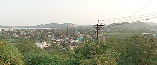
Ketti also called Ketti Valley is a small town nestled in a large valley of the same name. It is located in The Nilgiris District of Tamil Nadu State, South India and is a Revenue Village of Coonoor Taluk. Upper Ketti is another village called Yellanahalli, which is located on the main Coonoor to Ooty road.
Puthagaram is a village in Tamil Nadu, India. Here ancient Sri Maha kaliamman Temple is located.
Vadamadurai is a panchayat village in Thiruvallur district in the Indian state of Tamil Nadu.

