Related Research Articles

Assonet Bay is a lake in Assonet, a village within the town of Freetown, Massachusetts. The Assonet River connects the waters of the bay with the Taunton River.

Olav V Land is a peninsula in eastern Spitsbergen Island, Svalbard named after Olav V of Norway. It is covered by the Olav V Icefield, measuring about 4,150 square kilometres (1,600 sq mi).
Pluskota is a village in the administrative district of Gmina Wałcz, within Wałcz County, West Pomeranian Voivodeship, in north-western Poland. It lies approximately 5 kilometres (3 mi) north of Wałcz and 126 km (78 mi) east of the regional capital Szczecin.
Oscar II Land is the land area between Isfjorden and Kongsfjorden on Spitsbergen, Svalbard. The 30 km (19 mi) long glacier Sveabreen divides Oscar II Land from James I Land.
Bünsow Land is a land area at the inner end of Isfjorden at Spitsbergen, Svalbard. It forms a peninsula between Billefjorden and Sassenfjorden and Tempelfjorden. Bünsow Land is named after Friedrich Christian Ernestus Bünsow.
Dickson Land is a land area between Isfjorden and Wijdefjorden at Spitsbergen, Svalbard. It forms a peninsula between the Isfjorden branches Billefjorden and Dicksonfjorden. Dickson Land is named after Oscar Dickson.
Sabine Land is a land area on the east coast of Spitsbergen, Svalbard. It is named after explorer General Sir Edward Sabine. Among the glaciers in the area is the 250-square-kilometer (97 sq mi) Nordmannsfonna glacier.
James I Land is a land area on the northwestern part of Spitsbergen, Svalbard. It is named after King James I of England and Scotland. The 30 kilometer long glacier Sveabreen divides James I Land from Oscar II Land.
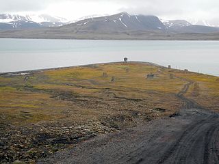
Finneset is a peninsula located on the east side of Grønfjorden on Spitsbergen in Svalbard, Norway. It is located 2 kilometers (1.2 mi) south of Barentsburg. A whaling station was located there until 1905. From 1911 it became the site of the first wireless station in the Arctic, named Svalbard Radio from 19 September 1925. It was also a meteorological station operated by the Norwegian Meteorological Institute. Both services moved to Longyearbyen on 1 September 1930. It is named for being a fine place to land a ship.
Sassendalen is a valley at Spitsbergen, Svalbard. The valley is among the largest valleys of Svalbard, and continues westwards into Sassenfjorden. Part of the valley divides Sabine Land and Nordenskiöld Land. The river Sassenelva runs through the valley.
Sassenelva is a river flowing through Sassendalen in Sabine Land at Spitsbergen, Svalbard. The river feeds from the glacier Rabotbreen and side glaciers of Nordmannsfonna and Hellefonna, and debouches into Sassenfjorden.
St. Jonsfjorden is a fjord in Oscar II Land at Spitsbergen, Svalbard. It has a length of 21 kilometer, and opens westwards into the strait of Forlandsundet. Several glaciers debouche into the fjord, including Gaffelbreen and Konowbreen from the north, a merge of Osbornebreen, Devikbreen, Vintervegen, Paulbreen and Bukkebreen at the bottom, and Vegardbreen, Charlesbreen and Bullbreen from the south.
Gipsdalen is a valley in Bünsow Land at Spitsbergen, Svalbard. It has a length of about 22 kilometers. The river Gipsdalselva flows through the valley and debouches into Gipsvika in Sassenfjorden. At the western side of the valley are Norströmfjellet, Meakinsfjellet, Grahamkammen, Usherfjellet and Gipshuken.
Agardhbukta is a bay between Sabine Land and Heer Land at Spitsbergen, Svalbard. It is located at the western side of Storfjorden. It has a length of about 5.5 kilometers and is a continuation of the valley Agardhdalen. The bay is named after botanist Jacob Georg Agardh. The river Agardhelva debouches into the bay. The coastal plain Belemnittsletta is to the east of the bay. Inside of the bay is the inlet Båtbogen.
Agardhdalen is a valley between Sabine Land and Heer Land at Spitsbergen, Svalbard. It forms a continuation of the bay Agardhbukta, at the western side of Storfjorden. The valley is named after botanist Jacob Georg Agardh. The river Agardhelva flows from Sveigbreen and Elfenbeinbreen, through Agardhdalen, with outlet into Agardhbukta.
Sveigbreen is a glacier stream in Sabine Land at Spitsbergen, Svalbard. It has a length of about eleven kilometers, and extends the southern part of the ice cap Hellefonna, south of Kropotkinfjellet. The glacier is one of the two main sources to the river Agardhelva, which flows through Agardhdalen towards Agardhbukta.
Elfenbeinbreen is a glacier stream in Sabine Land at Spitsbergen, Svalbard. It has a length of about twelve kilometers, and extends from the southern part of the ice cap Nordmannsfonna. The glacier is one of the two main sources to the river Agardhelva, which flows through Agardhdalen towards Agardhbukta.
Rabotbreen is a glacier in Sabine Land at Spitsbergen, Svalbard. The glacier is a tributary glacier to Fimbulisen, and is located in the upper part of Sassendalen. Nearby mountains are Bairdfjellet and Moskusryggen.
Dunérbukta is a bay at the western shore of Storfjorden in Sabine Land at Spitsbergen, Svalbard. It is named after Swedish astronomer Nils Christoffer Dunér. The glacier of Ulvebreen debouches into the bay. At the northern side of the bay is the mountain of Domen and the ridge Kapp Johannesen.

Hayesbreen is a glacier in Sabine Land at Spitsbergen, Svalbard. It is named after American politician and Arctic explorer Isaac Israel Hayes. The glacier has a length of about eighteen kilometers, and debouches into the bay of Mohnbukta. Surrounding mountains are Aagaardfjellet to the north, Jebensfjellet to the south, and Panofskyfjellet where Hayesbreen joins the glacier of Königsbergbreen.
References
- ↑ "Agardhelva (Svalbard)". Norwegian Polar Institute . Retrieved 8 July 2013.
78°05′28″N18°18′23″E / 78.09111°N 18.30639°E
| | This Spitsbergen location article is a stub. You can help Wikipedia by expanding it. |
| | This article related to a river in Norway is a stub. You can help Wikipedia by expanding it. |