
Guam is an organized, unincorporated territory of the United States in the Micronesia subregion of the western Pacific Ocean. It is the westernmost point and territory of the United States; in Oceania, it is the largest and southernmost of the Mariana Islands and the largest island in Micronesia. Guam's capital is Hagåtña, and the most populous city is Dededo.

Hagåtña is the capital village of the United States territory of Guam. From the 18th through mid-20th century, it was Guam's population center, but today it is the second smallest of the island's 19 villages in both area and population. However, it remains one of the island's major commercial districts in addition to being the seat of government.

Apra Harbor, also called Port Apra, is a deep-water port on the western side of the United States territory of Guam. It is considered one of the best natural ports in the Pacific Ocean. The harbor is bounded by Cabras Island and the Glass Breakwater to the north and the Orote Peninsula in the south. Naval Base Guam and the Port of Guam are the two major users of the harbor. It is also a popular recreation area for boaters, surfers, scuba divers, and other recreationalists.

The Seal of Guam appears in the middle of the United States territory of Guam. It depicts Agaña Bay near Hagåtña, a local proa and a palm tree. Charles Alan Pownall approved the seal in 1946. It depicts a coconut palm on the shore with a sailboat nearby on the water. The name "Guam" appears in red across the center of the seal.

Yona is a village in the United States territory of Guam.

Talofofo Bay is an inlet in the south-eastern coast of the island of Guam at the mouth of the Talofofo River in the village of Talofofo.

Cocos Lagoon appears as a small incomplete coral atoll attached to the south-western coast of Guam near the area of the village of Merizo. It stretches about 5.5 km (3.4 mi) east-west and 3.5 km (2.2 mi) north-south, covering an area of more than 10 km2 (3.9 sq mi).

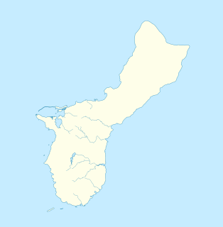
The following is an alphabetical list of articles related to the United States Territory of Guam.
The Ramu languages are a family of some thirty languages of Northern Papua New Guinea. They were identified as a family by John Z'graggen in 1971 and linked with the Sepik languages by Donald Laycock two years later. Malcolm Ross (2005) classifies them as one branch of a Ramu – Lower Sepik language family. Z'graggen had included the Yuat languages, but that now seems doubtful.

Talofofo is a village located in the southern part of the United States territory of Guam, on the east coast. The village center is located in the hills above the coast, while the smaller coastal community below the cliff is known as Ipan.
The Tamolan languages are a small family of clearly related languages spoken in the region of the Guam River in Madang Province, Papua New Guinea.

The Agat World War II Amtrac is an underwater relic of World War II, located off Ga'an Point in Agat Bay on the west side of the island of Guam. It is the remains of an LVT 4, an amphibious tracked landing vehicle. It is located about 500 yards (460 m) off Agat Invasion Beach in 45 feet (14 m) of water, and was described as being in good condition when it was discovered and surveyed in 1985. These vehicles were used during the 1944 Battle of Guam, in which American forces recaptured the island from occupying Japanese forces. This particular vehicle does not appear to exhibit significant war damage. This is the most intact of the three Amtracks remaining on Guam from the 850 that participated in the battle. It was re-surveyed by maritime archaeological field schools conducted from 2009 to 2012.
The Pago Bay Japanese pillboxes are a pair of World War II-era coastal defense pillboxes located on the shore of Pago Bay, located on the central east coast of Guam. Built out of steel-reinforced concrete mixed with coral stone, these two structures were built by Japanese defenders during their occupation of the island between 1941 and 1944. They were listed on the National Register of Historic Places in 1991 as Pagu' Pillbox I and Pagu' Pillbox II. Neither of these would have seen substantial action during the 1944 liberation of Guam, whose military activities were focused on the western, central, and northern parts of the island.

Typhoon Alice was a typhoon that brought severe flooding to Guam during the latter part of the 1953 Pacific typhoon season. The system was first tracked near the Marshall Islands on October 11 by the Joint Typhoon Warning Center (JTWC) as a tropical storm, and the Japan Meteorological Agency (JMA) as a tropical depression. The JMA upgraded Alice to a tropical storm east of Guam on October 14. One day later, and the JTWC reported that the storm had intensified to 65 knots, equivalent to a Category 1 typhoon on the Saffir–Simpson scale. Near Iwo Jima, the typhoon traveled northeastwards, reaching its peak of 100 kn late on October 18. Alice then steadily weakened down to a tropical storm on October 20. The storm became extratropical on October 23 near the International Date Line, and both agencies ceased tracking the cyclone.

The Guam River is a river in northern Papua New Guinea.

Guam confirmed its first case of the COVID-19 pandemic on March 15, 2020, and the first death on March 22. The Government of Guam ordered the general lockdown of the island in mid-March. Governor Lou Leon Guerrero announced the implementation of a four-step "Pandemic Condition of Readiness" (PCOR) on April 30, 2020. Travelers to Guam from designated high-risk areas must provide a recent negative COVID-19 test or undergo mandatory quarantine in a government-approved facility. Guam moved from PCOR 1 to PCOR 2 on May 10, allowing some business activity with restrictions, and then to PCOR 3 on July 20. An outbreak in mid-August was not controlled for several months, resulting in the 7-day rolling test positivity rate to spike above 15% in early October 2020, as well as infections in both the Governor and Lieutenant Governor. Guam announced a return to the lockdown conditions of PCOR 1 on August 14 to control the outbreak, which was not loosened to PCOR 2 until January 15, 2021. It was further relaxed to PCOR 3 on February 21, 2021.

Kizugawa Maru, or Kitsugawa Maru, is a World War II-era Japanese water tanker sunk in Apra Harbor, Guam. Damaged by a submarine torpedo attack off Guam on April 8, 1944, she was towed into port for repairs. In port, she was further damaged in three separate U.S. air attacks during the Mariana and Palau Islands campaign. Deemed irreparable, Kizugawa Maru was scuttled by shore guns on June 27, 1944. The shipwreck is now a deep recreational diving site.

