
This is a demography of Argentina including population density, ethnicity, economic status and other aspects of the population.

Salta is a province of Argentina, located in the northwest of the country. Neighboring provinces are from the east clockwise Formosa, Chaco, Santiago del Estero, Tucumán and Catamarca. It also surrounds Jujuy. To the north it borders Bolivia and Paraguay and to the west lies Chile.
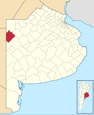
Rivadavia is a partido in the northwest of Buenos Aires Province, Argentina, on the border with La Pampa Province. It has an area of 3,940 square kilometres (1,520 sq mi), and a population of 15,452.
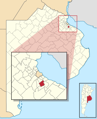
Almirante Brown is a partido of the Buenos Aires Province, Argentina, located at the south of the Gran Buenos Aires urban area, at coordinates 34°47′S58°24′W.
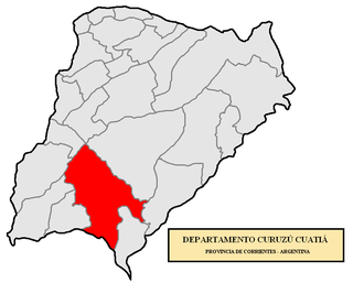
Curuzú Cuatiá is a city in the south of the province of Corrientes in the Argentine Mesopotamia. It had about 34,000 inhabitants at the 2010 census [INDEC], and is the head town of the Curuzú Cuatiá Department.

Alberti is a northern central partido of Buenos Aires Province, Argentina, at coordinates 35°02′S60°15′W

Abramo is a village and rural locality (municipality) in La Pampa Province in Argentina.
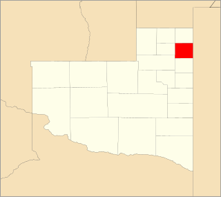
Adolfo Van Praet is a village and rural locality (municipality) in La Pampa Province in Argentina.
Alpachiri is a village and rural locality (municipality) in La Pampa Province in Argentina.

Abdón Castro Tolay is a rural municipality and village in the Cochinoca department in Jujuy Province in Argentina. It was founded in October 1919. Its main activity is the raising of llamas and sheep.

Frías is a city in Argentina, located southwest of the province of Santiago del Estero, near the border with the province of Catamarca, and is the head of the Choya Department. It is located on the banks of the river Albigasta at coordinates: 28 ° 38'60 "S 65 ° 09'05" W.
Lugones (Santiago del Estero) is a municipality and village in Santiago del Estero in Argentina.
Alba Posse is a village and municipality in Misiones Province in north-eastern Argentina.
Villa de Pomán is a town and municipality in Catamarca Province in northwestern Argentina.

Barrio San Pedro Pescador is a village and municipality in Chaco Province in northern Argentina, located on the thin coastal levee of the Paraná River. The town is located in the Primero de Mayo Department and reports administratively to the Colonia Benitez municipality. It occupies the left side of the Chaco end of the General Manuel Belgrano Bridge, which links the province of Chaco with the city of Corrientes. The low-lying and floodable characteristics of the right bank of the Parana River are not conducive for human settlement, San Pedro Pescador being Chaco's only urban settlement located on the main channel of this river. Paradoxically the Parana River is the main source of livelihood (fishing) and its main threat, because of the periodic floods that force temporary abandonment by its inhabitants.

Olacapato is a village and rural municipality in Salta Province in northwestern Argentina. Olacapato is one of the highest towns in Argentina. The previous census of 2001 indicated a population of 186 inhabitants, appearing as a rural dispersed population.
Máximo Fernández is a hamlet in Bragado county, Buenos Aires, Argentina.
José Marmol is a city in Greater Buenos Aires, Argentina, located 25 km south of Buenos Aires. It belongs to the Almirante Brown Partido (district). It has 5.14 km2, thus occupying 3.97% of the district. Its population was 40,612 inhabitants, grew 4.6% from the 38,842 inhabitants of the previous census, population density of 7,091 inhabitants / km ². In 1991 19.037 men and 19.805 women were counted, according to the 1991 national census. In that year there was also determined 11,290 homes.
Maracó Department is a department of Argentina in La Pampa Province. The capital city of the department is General Pico.