External links
Coordinates: 58°03′38″N6°40′21″W / 58.06068°N 6.67259°W
| | This article about a location in the Western Isles is a stub. You can help Wikipedia by expanding it. |
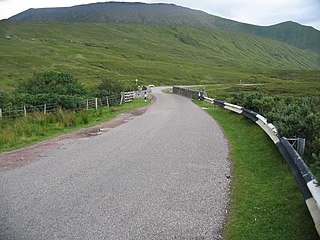
Airidh a' Bhruaich (Arivruaich - anglicised) is a scattered crofting township in the South Lochs district of the Isle of Lewis in the Outer Hebrides of Scotland. It lies at the head of the sea loch of Loch Seaforth.
Coordinates: 58°03′38″N6°40′21″W / 58.06068°N 6.67259°W
| | This article about a location in the Western Isles is a stub. You can help Wikipedia by expanding it. |
North Lochs,, an area in eastern Lewis, Outer Hebrides, Scotland, is named for the many lochans which dot the landscape. Because of its largely undulating and rocky terrain, it is sparsely populated apart from flat ground near the coast. Its communities support traditional crofting and fishing.

Park, also known as South Lochs, is a huge area of land connected to the rest of Lewis only by a narrow neck between Loch Seaforth and Loch Erisort. This had a wall called Gàrradh an Tighearna built across it by the Earl of Seaforth in the early 17th century, the outline of which can still be seen.

The River Thurso has Loch Rumsdale in Caithness as its source, about 26 kilometres south and 14 kilometres west of the burgh of Thurso, Caithness, and about 2 kilometres south of the railway line linking the burghs of Thurso and Wick with Inverness. At its source and until it reaches Loch More the river is known also as Strathmore Water. Caithness is in the Highland area of Scotland.
The A838 is a major road in Sutherland, in the Highland area of Scotland. It runs generally northwest from the A836 in the Lairg area to Laxford Bridge on the west coast of Scotland, then generally northeast to Durness on the north coast, and then generally east/southeast to Tongue, where it rejoins the A836. The A836 takes a more direct route from Lairg to Tongue.

Seaforth Island is an uninhabited island in the Outer Hebrides of Scotland. Unlike many other islands of the Outer Hebrides which are mainly surrounded by open sea, Seaforth Island lies in a narrow fjord-like sea loch named Loch Seaforth, 8 kilometres (5.0 mi) from the open waters of The Minch. There are two different Gaelic names for the island. Mulag is from the Old Norse name Múli, which describes its geographical location, and the other is after the family of Francis Mackenzie, 1st Baron Seaforth, who inherited the island in 1783.

The Callanish II stone circle is one of many megalithic structures around the better-known Calanais I on the west coast of the Isle of Lewis, in the Outer Hebrides, Scotland.
Broad Bay is a bay which is situated on the coast of Isle of Lewis, and separates Back and Point.

Eilean Chaluim Chille is an unpopulated island in the Outer Hebrides.
Eilean Kearstay is an uninhabited island in Loch Roag in the Outer Hebrides of Scotland.
Little Bernera is a small island situated off the west coast of the Isle of Lewis in the Outer Hebrides.
Soay Beag is a small, uninhabited tidal island in West Loch Tarbert, between the northern and southern parts of Harris. Soay Beag is separated from the southwest coast of North Harris by the Soay Sound. The island is located immediately to the northwest of the larger Soay Mòr, which is accessible on foot at low tide. Soay Beag's highest elevation is 37m.
Vacsay is one of the Outer Hebrides. It is off the west coast of Lewis in West Loch Roag. It is 41 hectares in size, and 34 metres at its highest point.
Pabay Mòr or Pabaigh Mòr is an uninhabited island in the Outer Hebrides of Scotland.
Eilean Liubhaird or Eilean Iubhard is an island in the Outer Hebrides, to the east of Lewis.
Fuaigh Beag or Vuia Be(a)g is an island in the Outer Hebrides. It is off the west coast of Lewis near Great Bernera in Loch Roag. Its name means "little Fuaigh", and is named in contrast to Fuaigh Mòr nearby.
Loch Ròg or Loch Roag is a large sea loch on the west coast of Lewis, Outer Hebrides. It is broadly divided into East Loch Roag and West Loch Roag with other branches which include Little Loch Roag. The loch is dominated by the only inhabited island Great Bernera and East Loch Roag is actually referred to as Loch Bernera on early maps, most notably Murdoch MacKenzie's original Admiralty Chart from 1776. The use of west and east to differentiate the sections of the loch appear from the original Ordnance Survey in the 19th century.
This is a list of the extreme points and extreme elevations in Scotland.
Ceabhaigh is a small island in an arm of Loch Ròg on the west coast of Lewis in the Outer Hebrides of Scotland. It is about 25 hectares in extent. It is not known if the island was ever permanently inhabited.

Dun Bharabhat is an Iron Age galleried dun or "semi-broch" situated on the island of Great Bernera near Lewis in Scotland.

Loch Na Berie is a broch in the Outer Hebrides of Scotland, located approximately 400 yards from the shore, and is thought to have been located on an island as the land to the east is a marsh. The site is designated a Scheduled Monument.