Los Gatos Creek formerly known as Arroyo Pasajero or Arroyo Poso de Chane, is a creek in Fresno County, California. Its source is in the north end of Garcia Canyon in the Diablo Range near Benito Pass. From there it runs through Los Gatos Canyon, in the eastern foothills of the Diablo Range, then passes across Pleasant Valley, north of Coalinga, where Warthan Creek joins it east of the town. Then it flows eastward to its confluence with Jacalitos Creek, before it passes to the north of the Guijarral Hills, into the San Joaquin Valley, where it is joined by Zapato Chino Creek.
Alamo Mucho Station, the misspelled name of Alamo Mocho Station was one of the original Butterfield Overland Mail stations located south of the Mexican border, in Baja California. Its location is 0.5 miles south-southeast of the Mexicali International Airport Terminal building.
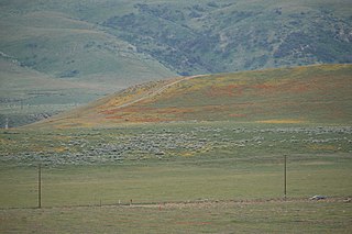
Poso de Chane or Poso Chane is a former settlement in Fresno County, California situated around the waterhole of that name, northwest just below the confluence of the Jacalitos Creek with Los Gatos Creek, 6 miles (9.7 km) east of Coalinga and northwest of the Guijarral Hills.
Orestimba Creek, originally Arroyo de Orestimba is a tributary of the San Joaquin River draining eastern slopes of part of the Diablo Range within the San Joaquin Valley of California.
Garza Creek, originally El Arroyo de las Garzas. Its source on the north slope of Zwang Peak of the Diablo Range, in Kings County.
Little Panoche Creek formerly known as Arroyita de Panoche or Arroyo de Pannochita and later anglicized to Panochita Creek is a creek in Fresno County, California. The source of this creek is on the east slope of Glaucophane Ridge, of the Diablo Range in San Benito County. It flows east-northeast through Little Panoche Reservoir to empty into the California Aqueduct. Before the advent of irrigation projects in the valley, its waters might have reached a slough of the San Joaquin River in years of heavy rains.
Cantua Creek, formerly in Spanish Arroyo de Cantúa, was named for José de Guadalupe Cantúa, a prominent Californio Ranchero in the 19th-century Mexican era of Alta California.

Canoas Creek formerly known as Arroyo de Las Canoas is a creek in Fresno County, California. Its source is on the north slope of Black Mountain, 1.25 miles west of Zwang Peak in the Diablo Range. Its course in its canyon, runs almost directly northeast through Reef Ridge and the Kreyenhagen Hills, from which it flows north northeast into the Kettleman Plain where it turns north northwest 4.6 miles northwest of Avenal near the Kettleman Hills to terminate in the Kettleman Plain, 7.1 miles northwest of Avenal and 3000 feet east of Zapato Chino Creek.
Salt Spring, originally, Aguaje de la Brea, a spring in the Antelope Plain on the southeast end of Pyramid Hills, 0.6 miles south of Emigrant Hill and 1.5 miles north of Wagon Wheel Mountain in the Pyramid Hills of Kern County, California. Its location appears on a 1914 USGS Topographic map of Lost Hills. Salt Spring is located just east of the Pyramid Hills and the Devils Den Oil Field, 3 miles southwest of Devils Den, close by the south side of Kecks Road, 0.23 miles east of the California Aqueduct, enclosed by a fence.
Las Tinajas de Los Indios, or "Indian Tanks", are tinajas located in the sandstone heights of the Point of Rocks on the north side of Antelope Valley in Kern County, California.

San Emigdio Creek, formerly Arroyo de San Emigdio, is a 33 kilometres (21 mi) northward-flowing stream in western Kern County, central California.
Bitterwater Creek, originally named Arroyo de Matarano, is a stream in eastern San Luis Obispo County and northwestern Kern County, central California.
Aguaje de Las Berendas, or Antelope Springs, is a spring in located on the west side of the San Joaquin Valley, at the foot of the foothills of the Diablo Range, in Merced County, California.
Mud Spring, formerly Aquaje Lodoso, is a spring and historic site in the western Antelope Valley, within northern Los Angeles County, southern California.
Aguaje de Pedro Etchegoen was a watering place a little to the west of El Camino Viejo eight miles north of Poso de Chane where Pedro Etchegoen later established his sheep ranch. It was the only reliable watering place between the Poso and Cantua Creek. The Etchegoen or Etchegoin Ranch remained in the hands of his family up until the time of the Fresno oil boom. A Fresno Township map of 1907 shows it in the hands of William Etchegoen.
Willow Springs Canyon is a canyon cut by Willow Springs Canyon Wash. Its source is at the head of the canyon in the gap in the Portal Ridge of the Transverse Range, 0.5 miles north of Elizabeth Lake. It is cut into the slope to the northeast into the Antelope Valley, crossing the California Aqueduct. The mouth of the Canyon is 0.25 miles southwest of its confluence with Myrick Canyon Wash which is 300 feet southwest of the intersection of Munz Ranch Road with the Neenach - Fairmont Road in Los Angeles County, California, USA.
Frank Forrest Latta (1892–1983), California oral historian and ethnographer of the Yokut people and historian of the early settlement of the San Joaquin Valley.
La Vereda del Monte was a backcountry route through remote regions of the Diablo Range, one of the California Coast Ranges. La Vereda del Monte was the upper part of La Vereda Caballo,, used by mesteñeros from the early 1840s to drive Alta California horses to Sonora for sale.


