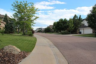
Douglas County is a county located in the U.S. state of Colorado. As of the 2020 census, the population was 357,978. The county seat is Castle Rock.

Oregon City is the county seat of Clackamas County, Oregon, United States, located on the Willamette River near the southern limits of the Portland metropolitan area. Established in 1829 by the Hudson's Bay Company, in 1844 it became the first U.S. city west of the Rocky Mountains to be incorporated.

Weld County is a county located in the U.S. state of Colorado. As of the 2020 census, the population was 328,981. The county seat is Greeley.

The City of Glendale is a home rule municipality located in an exclave of Arapahoe County, Colorado, United States. The city population was 4,613 at the 2020 United States Census. Glendale is an enclave of the City and County of Denver and is the most densely populated municipality in Colorado. The city is a part of the Denver–Aurora–Lakewood, CO Metropolitan Statistical Area and the Front Range Urban Corridor.

The City of Castle Pines is a home rule municipality located in Douglas County, Colorado, United States. The city population was 11,036 at the 2020 United States Census. Castle Pines is a part of the Denver–Aurora–Lakewood, CO Metropolitan Statistical Area and the Front Range Urban Corridor. The city is located north of the Town of Castle Rock and south of the City of Lone Tree, Colorado.

Raton is a city and the county seat of Colfax County in northeastern New Mexico. The city is located just south of Raton Pass. The city is also located about 6.5 miles south of the New Mexico–Colorado border and 85 miles west of Texas.

Park Hill is a neighborhood in Denver, Colorado, U.S. Located in the northeastern quadrant of the city, it is bordered by Colorado Boulevard on the west, East Colfax Avenue on the south, Quebec Street on the east, and East 52nd Avenue on the north. The entire Park Hill neighborhood is located in the area known as East Denver. It is further divided by the City and County of Denver into three administrative neighborhoods, South Park Hill, North Park Hill, and Northeast Park Hill.

Before it was founded, the site of modern-day Colorado Springs, Colorado, was part of the American frontier. Old Colorado City, built in 1858 during the Pike's Peak Gold Rush was the Colorado Territory capital. The town of Colorado Springs, was founded by General William Jackson Palmer as a resort town. Old Colorado City was annexed into Colorado Springs. Railroads brought tourists and visitors to the area from other parts of the United States and abroad. The city was noted for junctions for seven railways: Denver and Rio Grande (1870), Denver and New Orleans Manitou Branch (1882), Colorado Midland (1886-1918), Colorado Springs and Interurban, Atchison, Topeka, and Santa Fe (1889), Rock Island (1889), and Colorado Springs and Cripple Creek Railways. It was also known for mining exchanges and brokers for the Cripple Creek Gold Rush.

Barton Hills is a neighborhood in Austin, Texas. It is located in south Austin, and encompasses part of ZIP code 78704.

Congress Park is a park and a neighborhood in the City and County of Denver, Colorado, United States. In 2010, the neighborhood had 10,235 residents and 5,724 households.

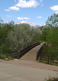
Pikes Peak Greenway is a 16 mile trail in Colorado Springs, Colorado that parallels Monument and Fountain Creeks and winds through and alongside parks, like Monument Valley Park, and sports complexes. It connects with other trails, such as the Midland Trail, Bear Creek Trail and Templeton Gap Trail.

Memorial Park or Memorial Community Park is a community park in Colorado Springs, Colorado. It has a wide range of sports facilities, including an indoor and outdoor pool, a recreation center, trails and Prospect Lake.

The Colorado Springs Labor Day Lift Off is a hot air balloon festival in Colorado Springs. Held each Labor Day weekend since 1977, it takes place near Prospect Lake in Memorial Park. It is the "largest and the longest continuously running hot air balloon festival in the Rocky Mountain region as well as the State of Colorado."

Bear Creek Cañon Park is a high-country park located in Colorado Springs, Colorado with steep trails for hiking, mountain biking and horseback riding.

There are a wide range of recreational areas and facilities in Colorado Springs, Colorado.

The Colorado Springs Pioneers Museum is located at 215 S. Tejon Street in Colorado Springs, Colorado. The granite building with a domed clock tower was the El Paso County Courthouse building from 1903 to 1973. The museum, which moved to this location in 1979, has fine arts, artifacts and archival collections that document the Pikes Peak region. The building is on the National Register of Historic Places, and was the 2nd property to be listed in El Paso County, after Pikes Peak.
Roswell, now annexed into the city of Colorado Springs, Colorado, was a coal mine settlement near the northern bluffs of Colorado Springs and a 19th-century railroad junction. The town was located at roughly the present intersection of Fillmore Street and North Nevada Avenue in Colorado Springs.
Knob Hill, is a neighborhood of Colorado Springs in El Paso County, Colorado, is located northeast of downtown Colorado Springs.

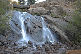
Cheyenne Creek is a stream in Colorado Springs, El Paso County, Colorado at 5,920 feet (1,800 m) in elevation. The stream is fed by the North Cheyenne Creek and South Cheyenne Creek and flows into Fountain Creek near Nevada Avenue, between Interstate 25 and the Pikes Peak Greenway trail. North Cheyenne Creek and South Cheyenne Creek flow through Teller and El Paso Counties. The source of South Cheyenne Creek is Mount Big Chief, near St. Peter's Dome, and it flows to Seven Falls.


