Kotagiri is a Hill town and a taluk in The Nilgiris District in the Indian state of Tamil Nadu. The name ‘Kota-giri’ itself means ‘mountain of the Kotas’. The town has developed around numerous knolls and valleys. It is one of the largest hill station in the Nilgiri Mountains. Located at an average elevation of 1,950 m, Kotagiri is quietly tucked away in the Nilgiris and used to be one of the summer resort of Madras Presidency. The town was discovered in the year 1819 by John Sullivan when he came to a village called Dhimbatty to the North of Kotagiri. Situated at an elevation of about 6,400 feet, Kotagiri enjoys the third coldest climate next to Ooty and Kodaikanal in South India.
Arimalam is a Town Panchayath in the district of Pudukkottai, in the state of Tamil Nadu, India.

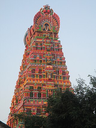
Karamadai is town located near Mettupalayam, in the Indian state of Tamil Nadu. It is located on Coimbatore - Ooty NH 67. Nearby places are Teachers colony, Press Colony, Jodhipuram and Periyanaickenpalayam. The Ranganathaswamy temple and Nanjundeswarar temple are the most prominent landmarks in the town. The place of Karamadai came into limelight due to the presence of ex-steel giant Sri Ramakrishna Steel Industries.
Kariapatti is a town Panchayat city in district of Virudhunagar district, Tamil Nadu. The Kariapatti Town Panchayat has population of 18,984 of which 9,439 are males while 9,545 are females as per report released by Census India 2011. The Kariapatti city is divided into 15 wards for which elections are held every 5 years.
Kilpennathur is a Panchayat Town in Tiruvanamalai district in the Indian state of Tamil Nadu. Kilpennathur is one of the taluks of Tiruvannamalai district and an assembly constituency of Tamil Nadu. The MLA of Kilpennathur assembly constituency is DMK party Mr. K. Pichandi. Vettavalam is the most populous town panchayat in this taluk. Kilpennathur is located a 12.25 degrees latitude and 79.224 degrees longitude. Nearest towns are Avalurpet, Vettavalam, Gingee and Tiruvannamalai, and Chennai is about 177 km away.
Kolathur is a medium-sized town in Salem district in the Indian state of Tamil Nadu. It is located near Mettur and surrounded by Cavery river.

Muthur is a panchayat town in Kangeyam taluk in Tirupur district, Tamil Nadu, India.
Nallur (Nalloor) is a panchayat town in Kanniyakumari district in the Indian state of Tamil Nadu.
Sendarapatti, also known as Senthalai, is a panchayat town in Salem district in the Indian state of Tamil Nadu.
Thevur is a Town Panchayat city in Salem district, Tamil Nadu.
Unnamalaikadai is a panchayat town in Kanya Kumari district in the Indian state of Tamil Nadu.

Vennanthur or Vennandur is a town panchayat in Vennandur block in Rasipuram taluk of Namakkal district in the state of Tamil Nadu, India.
Vettavalam is a first grade panchayat town in Tiruvanamalai district in the Indian state of Tamil Nadu.
Orathanad is a town in Thanjavur district of the Indian state of Tamil Nadu. It is recognised as a Town Panchayat. It is located at a distance of 33 km from Thanjavur and 35 km from Pattukkottai. The town is surrounded by vast agricultural lands.
Kilvelur taluk is a taluk of Nagapattinam district of the Indian state of Tamil Nadu. The headquarters of the taluk is the town of Kilvelur.
Midalam is a village in Killiyur block in Kaniyakumari District of Tamil Nadu, India. It is located 27 km towards west from District headquarters Nagercoil, 741 km from State capital Chennai, 55 km from Thiruvananthapuram, the capital of Kerala. It shares border with Enayam and Thengapattanam at the west, Kurumpanai and Colachel at the east, Karungal at the north and Arabian Sea to the south.
Gerugambakkam is a residential-industrial neighborhood in the South-Western part of Chennai, a metropolitan city in Tamil Nadu, India.It belongs to the Kundrathur taluk of Kanchipuram District, Tamil Nadu, India. It forms a suburb of Chennai city.
Puduvoyal is a village panchayat located in the Thiruvallur district of Indian state of Tamil Nadu.
Alathambadi is a large village located in Thiruthuraipoondi of Thiruvarur district in the Indian state of Tamil Nadu.
Aarani is a municipality city in district of Tiruvannamalai, Tamil Nadu, India. The Aarani city is divided into 33 wards for which elections are held every 5 years. The Aarani Municipality has population of 92375 of which 45,187 are males while 47188 are females as per report released by Census India 2011.


