Port Adelaide Football Club is a professional Australian rules football club based in Alberton, Port Adelaide, South Australia. The club's senior team plays in the Australian Football League (AFL), whilst its reserves team competes in the South Australian National Football League (SANFL). Port Adelaide is the oldest professional sporting club in South Australia and the fifth-oldest club in the AFL. Since the club's founding on 12 May 1870, the club has won 36 South Australian league premierships, including six in a row. The club also won the Champions of Australia competition on a record four occasions. After successfully winning an AFL licence in 1994 the club began competing in the Australian Football League in 1997 as the only pre-existing non-Victorian club—and has subsequently added the 2004 AFL premiership to its achievements.

Rookwood Cemetery is a heritage-listed cemetery in Rookwood, Sydney, New South Wales, Australia. It the largest necropolis in the Southern Hemisphere and is the world's largest remaining operating cemetery from the Victorian era. It is close to Lidcombe railway station about 17 kilometres west of the Sydney central business district. It was added to the New South Wales State Heritage Register on 2 April 1999.

The City of Port Adelaide Enfield, located across inner north and north-western suburbs of Adelaide, is one of the largest metropolitan councils within South Australia. It was established on 26 March 1996 by the amalgamation of the City of Port Adelaide and the City of Enfield.

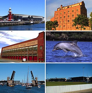
Port Adelaide is a port-side region of Adelaide, approximately 14 kilometres (8.7 mi) northwest of the Adelaide CBD. It is also the namesake of the City of Port Adelaide Enfield council, a suburb, a federal and state electoral division and is the main port for the city of Adelaide. Port Adelaide played an important role in the formative decades of Adelaide and South Australia, with the port being early Adelaide's main supply and information link to the rest of the world.
Bryan Beinke is a former Australian rules footballer in the Australian Football League.

North Adelaide railway station is located on the Gawler line in the inner northern Adelaide suburb of North Adelaide. It is 2.5 kilometres (1.6 mi) from Adelaide station.

Alberton Oval is located in Alberton, a north-western suburb of Adelaide, South Australia. The ground is a public park and exclusively leased to the Port Adelaide Football Club for Australian rules football.
Grand Junction Road is the longest east–west thoroughfare in the Adelaide metropolitan area, and is located approximately 8 kilometres north of the Adelaide city centre. Travelling from the Port Adelaide region, it is mostly a double-lane sealed road running 21 kilometres to the base of the Adelaide Hills. The western end at the intersection of Old Port Road, 300 metres east of a causeway which separates the Port River from West Lakes. The 2.4 kilometre section of road that continues west of Old Port Road to Semaphore South is named Bower Road. The eastern end of Grand Junction Road is in the suburb of Hope Valley, at the intersection of Hancock Road and Lower North East Road, just before the latter proceeds into the Adelaide Hills, past Anstey Hill Recreation Park and on towards the towns of Houghton and Inglewood.

Woodville West is a suburb of Adelaide, situated about 9 kilometres northwest of the Central Business District. It lies within the City of Charles Sturt. The postcode of Woodville West is 5011. Woodville West is bounded by the railway line and Port Road in the north, Findon Road in the east, Trimmer Parade, Todville Street and Minns Street East in the south, and Frank Mitchell Park, Agnes Street and the railway line in the west. As of 2011, Renewal SA and the City of Charles Sturt have been implementing the Woodville West Neighbourhood Renewal Project, which involves an $130m property development.

Robert Berrima Quinn MM was a champion Australian rules footballer with the Port Adelaide Football Club in the South Australian National Football League (SANFL), and a decorated soldier of the Second World War.

East Perth Cemeteries was the first cemetery established for the Swan River Colony in 1829 in East Perth, Western Australia. It is estimated that as many as 10,000 people were buried there between 1829 and 1919 in seven independently administered denominations or sections which is why the place is known as 'East Perth Cemeteries'. Only around 800 gravesites have been identified. A large section of the original site has since been built over, leaving about 5 hectares remaining.

Dudley Park, is a suburb of Adelaide, South Australia, located approximately 3 kilometres north-west of the CBD. The suburb is bordered by Regency Road (north), Simpson Avenue (south), the Adelaide-Gawler railway line (east), and a line directly north-south from the Harrison Road-Simpson Avenue intersection to Regency Road (west).

Queenstown is a north-western suburb of Adelaide about 10.5 km from the CBD, in the state of South Australia, Australia and the city council area of Port Adelaide Enfield.
The Port Adelaide and District Football Association (PADFA) was an Australian rules football competition based in the western and north-western suburbs of Adelaide, South Australia until it folded at the end of the 1952 season.
Parker Thomas "Bo" Morton was an Australian rules footballer, coach and administrator for the Sturt Football Club in the South Australian National Football League (SANFL).
The Portland Football Club is an Australian rules football club based in the western suburbs of Adelaide which was formed in 1997 as a merger between the former Alberton United Football Club, Ethelton Football Club and Riverside Football Club. The club has participated in the South Australian Amateur Football League since being formed.
Robert George Thomas FRIBA was a draftsman and architect in the British colony of South Australia. He drew the original plans for the City of Adelaide and was later responsible for the design and execution of some of its significant buildings, including several churches in a Gothic style.
Rev. Matthew Henry Hodge was a Congregationalist minister who had a substantial career in South Australia, being pastor of the Port Adelaide Congregational Church for 27 years.


