
Aldford is a village and former civil parish, now in the parish of Aldford and Saighton, in the county of Cheshire, England.. The village is approximately 6.5 miles (10.5 km) to the south of Chester, on the east bank of the River Dee. The Aldford Brook joins the Dee just north of the village.

The Stour is a river flowing through the counties of Worcestershire, the West Midlands and Staffordshire in the West Midlands region of England. The Stour is a major tributary of the River Severn, and it is about 25 miles (40 km) in length. It has played a considerable part in the economic history of the region.

The River Dee, in south-west Scotland, flows from its source in Loch Dee amongst the Galloway Hills, firstly to Clatteringshaws Loch, then into Loch Ken, where it joins the Water of Ken. From there, the Dee flows 15 miles (24 km) southwards to Kirkcudbright, and into Kirkcudbright Bay to reach the Solway Firth. The distance is just over 38 miles (61 km) in total. Together with its tributaries, the Dee's total catchment area is over 400 square miles (1,000 km2).

The Walloomsac River from the Native American name, Wal-loom-sac is a 16.8-mile-long (27.0 km) tributary of the Hoosic River in the northeastern United States. It rises in southwestern Vermont, in the Green Mountains east of the town of Bennington in Woodford Hollow at the confluence of Bolles Brook and City Stream where it is labeled Walloomsac Brook on maps but is locally known as "The Roaring Branch". The river then flows west toward Bennington and passes the downtown area to the north. For many years this section was intermittent due to the water having been diverted to power mills in town. This divergence gave the name Walloomsac to a portion of the river flowing through town on the present course of South Stream. The combined Walloomsac / South Stream joins the Roaring Branch northwest of town. From here the river flows westward as the Walloomsac River and joins the Hoosic River below Hoosick Falls, New York.

The River Ribble runs through North Yorkshire and Lancashire in Northern England. It starts close to the Ribblehead Viaduct in North Yorkshire, and is one of the few that start in the Yorkshire Dales and flow westwards towards the sea.

The River Darwen is a river running through the towns of Darwen and Blackburn in Lancashire which eventually joins the River Ribble at Walton le Dale. Here the river runs to the south of Preston on its way to the Ribble Estuary on the west coast of northern England.

The River Hyndburn is a minor river in Lancashire, England. Beginning as Woodnook Water on the slopes of Goodshaw Hill, it passes through Stone Fold, Rising Bridge and Baxenden where it is augmented by streams from Thirteen Stone Hill and continues to the Woodnook area of Accrington. Near St James Church, it collects Broad Oak Water, becoming the River Hyndburn.
The River Hodder is in Lancashire, England. It is a County Biological Heritage Site.

The Meers Brook is a stream in Sheffield, England and one of the main tributaries of the River Sheaf. The Meers Brook originates in Gleadless and flows downhill through Gleadless Valley and Meersbrook then, culverted, continues underneath Heeley to pour into the River Sheaf near Saxon Road and Clyde Road in Lowfield.
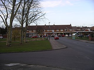
Eastern Green is a mainly residential suburb in the far west of Coventry, England, and was formerly a village in Warwickshire. Its most western area is Upper Eastern Green and the eastern area is Lower Eastern Green, though residents generally do not distinguish between the two.

The River Roddlesworth is a river in Lancashire, England, a tributary of the River Darwen.

Moxie Falls is a waterfall in Somerset County, Maine. At a vertical drop of over 90 feet (30 m) into a pool about 17 feet (5 m) deep, Moxie Falls is one of the highest falls in New England. The falls are part of Moxie Stream which flows from Moxie Pond into the Kennebec River approximately 1 kilometer (0.62 mi) downstream the falls. Moxie Stream drains Moxie Pond approximately 5 miles (8.0 km) upstream of the falls.

Black Brook in Lancashire has its source at Great Hill in the West Pennine Moors. The water is acidic due to a high level of peat in the uplands near to Round Loaf, giving the brook its brown colour. The young river was known as Warth Brook in olden Heapey. A feeder stream also known as Black Brook joins near Kittiwake Road - this short and weak water course commences at Eagle Tower. The jointed brook feeds Anglezarke Reservoir, and joins the River Yarrow in lowland Chorley at Yarrow Bridge. The entire course of Black Brook and the River Yarrow fall within Chorley and its villages.

The Carrabassett River, a tributary of the Kennebec River, is located in Franklin County and Somerset County, Maine, in the United States. It rises near Sugarloaf Mountain, east of Rangeley Lake, and runs for 33.8 miles (54.4 km), flowing southeast past Kingfield and joining the Kennebec River in the town of Anson.
Aldford Castle is a motte and bailey castle in the village of Aldford in Cheshire. The motte is to the north of St John's Church, and the church stands on the site of an infilled bailey ditch.

Skirden Beck is a minor river in Lancashire, England. It is approximately 4.3 miles (6.85 km) long and has a catchment area of 18.87 square miles (48.882 km2).
The Little Southwest Branch Saint John River is a tributary of Southwest Branch Saint John River, flowing on 46.5 kilometres (28.9 mi) in Somerset County, in North Maine Woods, in Maine, in United States.

The Sebec River is a tributary of the Piscataquis River in Piscataquis County, Maine. From the outflow of Sebec Lake in Sebec, the river runs 10.0 miles (16.1 km) east and southeast to its confluence with the Piscataquis in Milo.
The Tannery River is a river in North Attleboro and Attleboro, Massachusetts. It is 4 miles (6 km) long and is a tributary of the Sevenmile River. There is one dam along its length.
