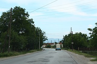
Bierzyn is a village in the administrative district of Gmina Boniewo, within Włocławek County, Kuyavian-Pomeranian Voivodeship, in north-central Poland. It lies approximately 27 kilometres (17 mi) south-west of Włocławek and 68 km (42 mi) south of Toruń.

Pałatki is a village in the administrative district of Gmina Gródek, within Białystok County, Podlaskie Voivodeship, in north-eastern Poland, close to the border with Belarus. It lies approximately 17 kilometres (11 mi) north-west of Gródek and 20 km (12 mi) east of the regional capital Białystok.

Dəlləklər is a village in the Yevlakh Rayon of Azerbaijan. The village forms part of the municipality of Qaramanlı.

Tatar is a village in the Jabrayil Rayon of Azerbaijan.

Grójec Wielki is a village in the administrative district of Gmina Złoczew, within Sieradz County, Łódź Voivodeship, in central Poland. It lies approximately 5 kilometres (3 mi) north-west of Złoczew, 22 km (14 mi) south-west of Sieradz, and 74 km (46 mi) south-west of the regional capital Łódź.

Emilianów is a village in the administrative district of Gmina Radzymin, within Wołomin County, Masovian Voivodeship, in east-central Poland. It lies approximately 7 kilometres (4 mi) north-east of Radzymin, 11 km (7 mi) north of Wołomin, and 31 km (19 mi) north-east of Warsaw.
The 1981 Vienna synagogue attack was a terror attack on the Stadttempel of Vienna, Austria carried out by Abu Nidal Organization.

Modła Księża is a village in the administrative district of Gmina Stare Miasto, within Konin County, Greater Poland Voivodeship, in west-central Poland. It lies approximately 5 kilometres (3 mi) south of Stare Miasto, 9 km (6 mi) south-west of Konin, and 93 km (58 mi) east of the regional capital Poznań.
Helenowo is a village in the administrative district of Gmina Wierzbinek, within Konin County, Greater Poland Voivodeship, in west-central Poland.

Gapowo is a village in the administrative district of Gmina Stężyca, within Kartuzy County, Pomeranian Voivodeship, in northern Poland. It lies approximately 4 kilometres (2 mi) west of Stężyca, 24 km (15 mi) south-west of Kartuzy, and 51 km (32 mi) west of the regional capital Gdańsk.
Dąbie is a village in the administrative district of Gmina Gołdap, within Gołdap County, Warmian-Masurian Voivodeship, in northern Poland, close to the border with the Kaliningrad Oblast of Russia.

Radosze is a village in the administrative district of Gmina Barciany, within Kętrzyn County, Warmian-Masurian Voivodeship, in northern Poland, close to the border with the Kaliningrad Oblast of Russia. It lies approximately 4 kilometres (2 mi) west of Barciany, 16 km (10 mi) north of Kętrzyn, and 71 km (44 mi) north-east of the regional capital Olsztyn.

Donja Zleginja is a village in the municipality of Aleksandrovac, Serbia. According to the 2002 census, the village has a population of 296 people.

Šurić is a village in the municipality of Aleksinac, Serbia. According to the 2002 census, the village has a population of 128 people.

Pranjani is a village in the municipality of Gornji Milanovac, Serbia.
Kugalepa is a village in Saaremaa Parish, Saare County in western Estonia.

Podgorje is a village in the municipality of Višegrad, Bosnia and Herzegovina.

Kawanabe Dam is a dam in Kagoshima Prefecture, Japan, completed in 2002.

Mali Kupci is a village in the municipality of Kruševac, Serbia. According to the 2002 census, the village has a population of 407 people.

Vranishta is a village in Municipality of Struga, Macedonia.


