The Himalayas, or Himalaya, are a mountain range in Asia separating the plains of the Indian subcontinent from the Tibetan Plateau. The range has some of the planet's highest peaks, including the highest, Mount Everest. Over 100 peaks exceeding 7,200 m (23,600 ft) in elevation lie in the Himalayas. By contrast, the highest peak outside Asia is 6,961 m (22,838 ft) tall.

The Alpine region of Switzerland, conventionally referred to as the Swiss Alps, represents a major natural feature of the country and is, along with the Swiss Plateau and the Swiss portion of the Jura Mountains, one of its three main physiographic regions. The Swiss Alps extend over both the Western Alps and the Eastern Alps, encompassing an area sometimes called Central Alps. While the northern ranges from the Bernese Alps to the Appenzell Alps are entirely in Switzerland, the southern ranges from the Mont Blanc massif to the Bernina massif are shared with other countries such as France, Italy, Austria and Liechtenstein.

Pokhara is a metropolitan city in Nepal, which serves as the capital of Gandaki Province. It is the country's largest metropolitan city in terms of area and second-largest in terms of population. The city also serves as the headquarters of Kaski District. Pokhara is located 200 kilometres west of the capital, Kathmandu. The city is on the shore of Phewa Lake, and sits at an elevation of approximately 822m. The Annapurna Range, with three out of the ten highest peaks in the world—Dhaulagiri, Annapurna I and Manaslu—is within 15–35 mi (24–56 km) of the valley.

Ward Creek is a 6.1-mile (9.8 km) eastward-flowing stream in Placer County, California, United States. The creek flows into Lake Tahoe 2.7 miles (4.3 km) south of Tahoe City, California, and has undergone extensive restoration to reduce sediment and surface run-off to maintain the purity of Lake Tahoe.

The Dooars or Duars are the alluvial floodplains in eastern-northeastern India that lie south of the outer foothills of the Himalayas and north of the Brahmaputra River basin. This region is about 30 km (19 mi) wide and stretches over about 350 km (220 mi) from the Teesta River in West Bengal to the Dhansiri River in Assam. The region forms the gateway to Bhutan. It is part of the Terai-Duar savanna and grasslands ecoregion.

Dolpo is a high-altitude culturally Tibetan region in the upper part of the Dolpa District of western Nepal, bordered in the north by China. Part of the region lies in Shey Phoksundo National Park. The sparse, agro-pastoral population, known as Dolpo in standard Tibetan and Dhol-wa in the local dialect, is connected to the rest of Nepal via Jufal airport, which can be reached in three days by horse. There are no precise population numbers for the region, with estimates including less than 5,000 and 18,000

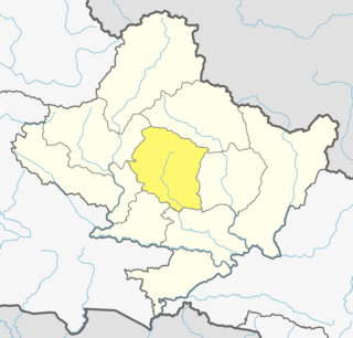
Kaski District (Nepali: कास्की जिल्ला[kaski], a part of Gandaki Province, is one of the seventy-seven districts of Nepal. The name is disambiguated from Kaskikot, the ancient Kaski Kingdom.

Rukum District was a "hill" and "mountain" district some 280 km (170 mi) west of Kathmandu partially belonging to Lumbini Province and partially to Karnali Province before split into two districts Western Rukum and Eastern Rukum after the state's reconstruction of administrative divisions in 2017. Rukum covers an area of 2,877 km2 (1,111 sq mi) with population of 207,290 in 2011 Nepal census. Musikot was the district's administrative center.

Rupandehi District, a part of Lumbini Province, is one of the seventy-seven districts of Nepal and covers an area of 1,360 km2 (530 sq mi). The district headquarter is Bhairahawa. As per the national census 2011, the population of Rupandehi was 880,196.

Dharchula is a town in Pithoragarh district in the northern state of Uttarakhand, India. Dharchula is a major trading centre for the trans-Himalayan trade routes since medieval times. Situated at an elevation of 940 m above sea level, Dharchula is surrounded by Himalayan Peaks. The snow clad Panchachuli peaks located on the west of Dharchula separates it from the Johar valley and Om Parvat in the East which it shares with Nepal. Dharchula is situated on the bank of river Kali which originates from a place called kalapani as it separates and form border between India and Nepal. The hill station gets its name from ‘Darchyo’ and ‘la’; Darchyo is a white coloured traditional holy flag and la is an honorific term in Runglwo. Thus got its name Darchyola later the word changed with time as Dharchula in India and Darchula in Nepal. Hence both of the regions have the same name but different sounds in India and Nepal . It is situated in a valley, on the banks of the Kali River.

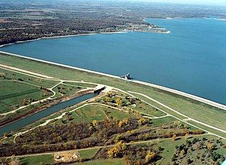
Perry Lake is a US Army Corps of Engineers operated reservoir in northeast Kansas. Its primary purposes are flood control, water reserve for nearby areas and regional recreation. The lake is approximately 11,150 acres (45 km²) in size, with over 160 miles (260 km) of shoreline. Perry Lake's full multi-purpose pool elevation is 891.5 feet (271.7 m) above sea level. Perry Lake is located about 40 miles (64 km) west of Kansas City, just northwest of Lawrence, Kansas. Its close proximity to Kansas City, Lawrence, and the state capitol, Topeka, make it a very popular destination, with the nickname "Paradise on the Plains".

Lipulekh is a Himalayan pass. The pass is near the Chinese trading town of Taklakot (Purang) in Tibet and used since ancient times by traders, mendicants and pilgrims transiting between India and Tibet.

Khaptad National Park is a protected area in the Far-Western Region, Nepal that was established in 1984. Stretching over the four districts of Bajhang, Bajura, Achham and Doti it covers an area of 225 km2 (87 sq mi) and ranges in elevation from 1,400 m (4,600 ft) to 3,300 m (10,800 ft).

Phewa Lake, Phewa Tal or Fewa Lake is a freshwater lake in Nepal formerly called Baidam Tal located in the south of the Pokhara Valley that includes Pokhara city; parts of Sarangkot and Kaskikot. The lake is stream-fed but a dam regulates the water reserves, therefore, the lake is classified as semi-natural freshwater lake. It is the second largest lake in Nepal; the largest in Gandaki Province after the Rara lake in the comparison to Nepal's water bodies. It is the most popular and most visited lake of Nepal. Phewa lake is located at an altitude of 742 m (2,434 ft) and covers an area of about 4.43 km2 (1.7 sq mi). It has an average depth of about 8.6 m (28 ft) and a maximum depth of 24 m (79 ft). Maximum water capacity of the lake is approximately 43,000,000 cubic metres (35,000 acre⋅ft). The Annapurna range on the north is only about 28 km away from the lake. The lake is also famous for the reflection of mount Machhapuchhre and other mountain peaks of the Annapurna and Dhaulagiri ranges on its surface. The Tal Barahi Temple is situated on an island in the lake. It is located 4 km from the city's centre Chipledhunga.

Pokhara Valley is the second-largest valley in the hilly region of Nepal. It lies in the western part of Nepal. The cities of Pokhara and Lekhnath are in the valley. It is located in Gandaki zone, 203 kilometres (126 mi) west of Kathmandu Valley. The city of Pokhara is one of the major cities of Nepal and it, like Kathmandu Valley, is extremely vulnerable to earthquakes due to its clay soil and liquefaction potential.

Melamchi is a municipality in Sindhupalchok District in the Bagmati Province of central Nepal. At the time of the 1991 Nepal census it had a population of 3936 and had 710 houses in the village.

Letang, "लेटाङ " is a Municipality in Morang District in the Province No. 1 of south-eastern Nepal. It was formed by merging the existing Village Development Committees of Letang, Jante, Warrangi and Bhogateni.
Edited by ABHASH

Gleniffer Lake also known as Gleniffer Reservoir or originally Lake Gleniffer is an artificial lake in central Alberta, Canada created in 1983 by the construction of the Dickson Dam which impounded the Red Deer River, a major tributary of the South Saskatchewan River which flows into the Saskatchewan River Basin.

Grays Lake is a 80-acre (32 ha) kettle lake located in the Village of Grayslake in Lake County, Illinois.

Rupa Lake or Rupa Tal is a freshwater lake in Nepal located in the border of Pokhara Metropolitan and Rupa Rural Municipality of Kaski District. It is the third biggest lake in Pokhara valley of Nepal and at an altitude of 600 m (1,969 ft) covering area about 1.35 km2 (0.5 sq mi) with an average water depth 3 m and maximum depth 6 m. The lake is elongated north to south and is fed by perennial streams. Its watershed area is 30 km2, where The main inflow of water is from Talbesi stream, whereas Dhovan khola is the feeder stream with its outlet Tal khola at Sistani ghat. It supports a number of floral and faunal species. A total of 36 species of waterbirds have been recorded in the lake which represents about 19 percent of the total 193 wetland-dependent birds found in Nepal.


