
Lincoln County is a county located in the U.S. state of Montana. As of the 2010 United States Census, the population was 19,687. Its county seat is Libby. The county was founded in 1909 and named for President Abraham Lincoln. The county lies on Montana's north border and thus shares the US-Canadian border with the Canadian province of British Columbia.

Charlo is an unincorporated community and census-designated place (CDP) in Lake County, Montana, United States. The population was 379 at the 2010 census, down from 439 at the 2000 census. The 2018 estimate is 320.

The Flathead Indian Reservation, located in western Montana on the Flathead River, is home to the Bitterroot Salish, Kootenai, and Pend d'Oreilles tribes – also known as the Confederated Salish and Kootenai Tribes of the Flathead Nation. The reservation was created through the July 16, 1855, Treaty of Hellgate.

The Stillwater River rises 15 miles south of the border between Montana and Alberta (Canada), west of Glacier National Park in the Kootenai National Forest. It runs mainly south to Duck Lake, then Upper Stillwater Lake, Lagoni Lake and on to Lower Stillwater Lake. It then flows south to Kalispell where it joins the Whitefish River, very near where that river enters the Flathead River.

Lake Koocanusa is a reservoir in British Columbia (Canada) and Montana formed by the damming of the Kootenay River by the Libby Dam in 1972. The Dam was formally dedicated by President Gerald Ford on August 24, 1975.

The Kootenay is a major river in the Northwest Plateau, within the borders of southeastern British Columbia, Canada, and northern Montana and Idaho in the United States. It is one of the uppermost major tributaries of the Columbia River, the largest North American river that empties into the Pacific Ocean. The Kootenay River runs 781 kilometres (485 mi) from its headwaters in the Kootenay Ranges of the Canadian Rockies, flowing from British Columbia's East Kootenay region into northwestern Montana, then west into the northernmost Idaho Panhandle and returning to British Columbia in the West Kootenay region, where it joins the Columbia at Castlegar.

The Flathead National Forest is a national forest in the western part of the U.S. state of Montana. The forest lies primarily in Flathead County, south of Glacier National Park. The forest covers 2,404,935 acres of which about 1 million acres (4,000 km2) is designated wilderness. It is named after the Flathead Native Americans who live in the area.

Lake Pend Oreille in the northern Idaho Panhandle is the largest lake in the U.S. state of Idaho and the 38th-largest lake by area in the United States, with a surface area of 148 square miles (380 km2). It is 43 miles (69 km) long, and 1,150 feet (350 m) deep in some regions, making it the fifth-deepest in the nation. The lake is fed by the Clark Fork River and the Pack River, and drains into the Pend Oreille River, as well as subsurfacely into the Spokane Valley–Rathdrum Prairie Aquifer. It is surrounded by national forests and a few small towns, with the largest population on the lake at Sandpoint. The majority of the shoreline is non-populated and all but the southern tip of the lake is in Bonner County. The southern tip is in Kootenai County and is home to Farragut State Park, formerly the Farragut Naval Training Station during World War II, of which a small part is still active and conducts U.S. Navy acoustic underwater submarine research.

The Kootenai National Forest is a national forest located in the far northwestern section of Montana and the northeasternmost lands in the Idaho panhandle in the United States, along the Canada–US border. Of the 2.2 million acres (8,900 km2) administered by the forest, less than 3 percent is located in the state of Idaho. Forest headquarters are located in Libby, Montana. There are local ranger district offices in Eureka, Fortine, Libby, Trout Creek, and Troy, Montana. About 53 percent of the 94,272-acre (381.51 km2) Cabinet Mountains Wilderness is located within the forest, with the balance lying in neighboring Kaniksu National Forest.

Libby Dam is a concrete gravity dam in the northwestern United States, on the Kootenai River in northwestern Montana. Dedicated on August 24, 1975, it is west of the continental divide, seventeen miles (27 km) upstream from the town of Libby.
Lost Trail National Wildlife Refuge is a 8,834-acre (3,575 ha) National Wildlife Refuge of the United States located in Montana. Established in 1999, it is one of the newest National Wildlife Refuges in the U.S. and is managed by the U.S. Fish and Wildlife Service, an agency of the U.S. Department of the Interior. The refuge was originally a sprawling horse and cattle ranch dating back to the late 19th century and was known as the Lost Trail Ranch. The refuge consists of prairie and wetlands, and has a wide diversity of plant and animal species, including over 100 species of birds such as canada geese, sandhill crane, wood duck, green-winged teals and herons. Several species of grouse also inhabit the refuge. Predatory bird species such as the great horned owl and red-tailed hawk are also found here.
Montana State Highway 37 is a 67.048-mile-long (107.903 km) state highway in the US state of Montana. It begins in downtown Libby, Montana at US 2 and takes a meandering course northeastwards upstream along the Kootenai River and the eastern shore of Lake Koocanusa before terminating at U.S. Route 93 at the northern end of Eureka, Montana. Previously, MT 37 also followed US 93 from Eureka into Whitefish and turned down what is now MT 40 towards US 2 and Glacier National Park until at least 1942.

The Northern Transcon, a route operated by the BNSF Railway, traverses the most northerly route of any railroad in the western United States. This route was originally part of the Chicago, Burlington and Quincy Railroad, Northern Pacific Railway, Great Northern Railway and Spokane, Portland and Seattle Railway systems, merged into the Burlington Northern Railroad system in 1970.
Eureka station was a station on the Great Northern Railway's Empire Builder in Eureka, Montana. It closed in 1970 when Lake Koocanusa was made, flooding The Kootenai River as well as Rexford, MT, where the lines used to run from Eureka to Libby. Around Stryker, the Flathead Tunnel was constructed to bypass Eureka and go to Libby.

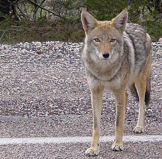
The ecology of the Rocky Mountains is diverse due to the effects of a variety of environmental factors. The Rocky Mountains are the major mountain range in western North America, running from the far north of British Columbia in Canada to New Mexico in the southwestern United States, climbing from the Great Plains at or below 1,800 feet (550 m) to peaks of over 14,000 feet (4,300 m). Temperature and rainfall varies greatly also and thus the Rockies are home to a mixture of habitats including the alpine, subalpine and boreal habitats of the Northern Rocky Mountains in British Columbia and Alberta, the coniferous forests of Montana and Idaho, the wetlands and prairie where the Rockies meet the plains, a different mix of conifers on the Yellowstone Plateau in Wyoming and in the high Rockies of Colorado and New Mexico, and finally the alpine tundra of the highest elevations.

Silene spaldingii is a rare species of flowering plant in the family Caryophyllaceae known by the common names Spalding's silene, Spalding's catchfly and Spalding's campion. It is native to eastern Washington, and eastern Oregon in the United States, as well as northern Idaho and northern Montana, where its distribution extends just into British Columbia, Canada. It is limited to the last remaining stretches of pristine prairie grassland in this region. It is threatened by the degradation and loss of its remaining habitat. It is federally listed as a threatened species in the United States and it is designated endangered by Canada's COSEWIC.
The fauna of the State of California may be the most diverse in the United States of America. Of the Lower 48 conterminous states, California has the greatest diversity in climate, terrain and geology in general. The state's six life zones are the lower Sonoran (desert); upper Sonoran ; transition ; and the Canadian, Hudsonian, and Arctic zones, comprising California's highest elevations. California’s diverse geography gives rise to dozens of different ecosystems, each of which has its own unique native plants and animals. California is a huge state, the 3rd largest in the U.S., and can range broadly in habitat type.

West Kootenai is a census-designated place (CDP) in Lincoln County, Montana, United States. The population was 365 at the 2010 census.
Salix wolfi, or Wolf's willow, is a species of willow native to western United States, from north-central Montana and central Oregon to northern New Mexico.


