Almino Afonso

Last updated
Almino Afonso
Municipality
Bandeira Almino Afonso.jpg
Flag
Brasao Almino Afonso.jpg
Seal
CountryFlag of Brazil.svg  Brazil
Region Nordeste
State Rio Grande do Norte
Mesoregion Oeste Potiguar
Time zone UTC -3

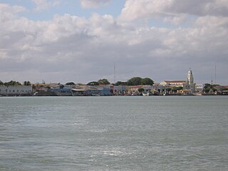
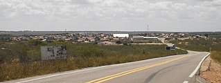
Almino Afonso is a municipality in the state of Rio Grande do Norte in the Northeast region of Brazil. [1] [2] [3] [4]

States of Brazil administrative entity of Brazil

The Federative Republic of Brazil is a union of 27 Federative Units : 26 states and one federal district. The states are generally based on historical, conventional borders which have developed over time. The Federal District cannot be divided into municipalities, according to the Brazilian Constitution, the Federal District assumes the same constitutional and legal powers, attributions and obligations of the states and municipalities, instead, it is divided by administrative regions.

Rio Grande do Norte State of Brazil

Rio Grande do Norte is one of the states of Brazil, located in the northeastern region of the country, occupying the northeasternmost tip of the South American continent. Because of its geographic position, Rio Grande do Norte has a strategic importance. The capital and largest city is Natal. It is the land of the folklorist Luís da Câmara Cascudo and, according to NASA, it has the purest air in the Americas. Its 410 km (254 mi) of sand, much sun, coconut palms and lagoons are responsible for the fame of beaches. Rocas Atoll, the only such feature in the Atlantic Ocean, is part of the state. The main economic activity is tourism, followed by the extraction of petroleum, agriculture, fruit growing and extraction of minerals, including considerable production of seasalt, among other economic activities. The state is famous for having many popular attractions such as the Cashew of Pirangi, the dunes and the dromedaries of Genipabu, the famous beaches of Ponta Negra, Maracajaú and Pipa's paradise, the Carnatal the largest off-season carnival in Brazil, the Forte dos Reis Magos is a sixteenth-century fortress, the hills and mountains of Martins, the Natal Dunes State Park the second largest urban park in the country, and several other attractions. The state is also closest to the archipelago of Fernando de Noronha.
Northeast Region, Brazil Region in Brazil

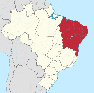
The Northeast Region of Brazil is one of the five official and political regions of the country according to the Brazilian Institute of Geography and Statistics. For the socio-geographic area see Nordeste. Of Brazil's twenty-six states, it comprises nine: Maranhão, Piauí, Ceará, Rio Grande do Norte, Paraíba, Pernambuco, Alagoas, Sergipe and Bahia, along with the Fernando de Noronha archipelago.

See also

Related Research Articles

Ipueira Municipality in Nordeste, Brazil

Ipueira is a municipality in the state of Rio Grande do Norte in the Northeast region of Brazil.

Jardim de Piranhas Municipality in Nordeste, Brazil

Jardim de Piranhas is a municipality in the state of Rio Grande do Norte in the Northeast region of Brazil.

Serra Negra do Norte is a municipality in the state of Rio Grande do Norte in the Northeast region of Brazil.

Timbaúba dos Batistas is a municipality in the state of Rio Grande do Norte in the Northeast region of Brazil.

Jardim do Seridó is a municipality in the state of Rio Grande do Norte in the Northeast region of Brazil.

Apodi, Rio Grande do Norte Municipality in Nordeste, Brazil

Apodi is a municipality in the state of Rio Grande do Norte in the Northeast region of Brazil.

Caraúbas, Rio Grande do Norte Municipality in Nordeste, Brazil

Caraúbas is a municipality in the state of Rio Grande do Norte in the Northeast region of Brazil.

Janduís Municipality in Nordeste, Brazil

Janduís is a municipality in the state of Rio Grande do Norte in the Northeast region of Brazil.

Messias Targino Municipality in Nordeste, Brazil

Messias Targino is a municipality in the state of Rio Grande do Norte in the Northeast region of Brazil.

Paraú is a municipality in the state of Rio Grande do Norte in the Northeast region of Brazil.

Areia Branca, Rio Grande do Norte Municipality in Nordeste, Brazil

Areia Branca is a municipality in the state of Rio Grande do Norte in the Northeast region of Brazil.

Serra do Mel Municipality in Nordeste, Brazil

Serra do Mel is a municipality in the state of Rio Grande do Norte in the Northeast region of Brazil.

Itaú, Rio Grande do Norte Municipality in Nordeste, Brazil

Itaú is a municipality in the state of Rio Grande do Norte in the Northeast region of Brazil.

Riacho da Cruz is a municipality in the state of Rio Grande do Norte in the Northeast region of Brazil.

Severiano Melo Municipality in Nordeste, Brazil

Severiano Melo is a municipality in the state of Rio Grande do Norte in the Northeast region of Brazil.

João Dias is a municipality in the state of Rio Grande do Norte in the Northeast region of Brazil.

Olho-dÁgua do Borges Municipality in Nordeste, Brazil

Olho-d'Água do Borges is a municipality in the state of Rio Grande do Norte in the Northeast region of Brazil.

Serrinha dos Pintos is a municipality in the state of Rio Grande do Norte in the Northeast region of Brazil.

Umarizal Municipality in Nordeste, Brazil

Umarizal is a municipality in the state of Rio Grande do Norte in the Northeast region of Brazil.

Alto do Rodrigues is a municipality in the state of Rio Grande do Norte in the Northeast region of Brazil.

References

  1. "Divisão Territorial do Brasil" (in Portuguese). Divisão Territorial do Brasil e Limites Territoriais, Instituto Brasileiro de Geografia e Estatística (IBGE). July 1, 2008. Retrieved December 17, 2009.
  2. "Estimativas da população para 1º de julho de 2009" (PDF) (in Portuguese). Estimativas de População, Instituto Brasileiro de Geografia e Estatística (IBGE). August 14, 2009. Retrieved December 17, 2009.
  3. "Ranking decrescente do IDH-M dos municípios do Brasil" (in Portuguese). Atlas do Desenvolvimento Humano, Programa das Nações Unidas para o Desenvolvimento (PNUD). 2000. Archived from the original on October 3, 2009. Retrieved December 17, 2009.
  4. "Produto Interno Bruto dos Municípios 2002-2005" (PDF) (in Portuguese). Instituto Brasileiro de Geografia e Estatística (IBGE). December 19, 2007. Archived from the original (PDF) on October 2, 2008. Retrieved December 17, 2009.

Coordinates: 6°09′S37°46′W / 6.150°S 37.767°W / -6.150; -37.767

Geographic coordinate system Coordinate system

A geographic coordinate system is a coordinate system that enables every location on Earth to be specified by a set of numbers, letters or symbols. The coordinates are often chosen such that one of the numbers represents a vertical position and two or three of the numbers represent a horizontal position; alternatively, a geographic position may be expressed in a combined three-dimensional Cartesian vector. A common choice of coordinates is latitude, longitude and elevation. To specify a location on a plane requires a map projection.