Healy is a census-designated place (CDP) in the borough seat of Denali Borough in the U.S. state of Alaska. The population was 1,021 at the 2010 census, up from 1,000 in 2000.

Denali Park, formerly McKinley Park, is a census-designated place (CDP) in Denali Borough, in the U.S. state of Alaska. As of the 2010 census, the population of the CDP was 185, up from 142 at the 2000 census.

Denali National Park and Preserve is an American national park and preserve located in Interior Alaska, centered on Denali, the highest mountain in North America. The park and contiguous preserve encompass 6,045,153 acres which is larger than the state of New Hampshire. On December 2, 1980, 2,146,580-acre Denali Wilderness was established within the park. Denali's landscape is a mix of forest at the lowest elevations, including deciduous taiga, with tundra at middle elevations, and glaciers, snow, and bare rock at the highest elevations. The longest glacier is the Kahiltna Glacier. Wintertime activities include dog sledding, cross-country skiing, and snowmobiling. The park received 594,660 recreational visitors in 2018.
The Stampede Trail is a road and trail located in the Denali Borough in the U.S. state of Alaska. A paved or maintained gravel road for 8 miles (13 km) on its eastern end as far west as Eight Mile Lake, the remainder of the route consists of a primitive, remote, and at times, dangerous hiking or ATV trail following a path where the original road has deteriorated over the years.

The Kantishna River is a 108-mile (174 km) tributary of the Tanana River in the U.S. state of Alaska. Formed by the confluence of the McKinley River with Birch Creek in Denali National Park and Preserve, it drains part of the north slope of the Alaska Range including the Denali massif. The direction of flow is generally north-northeast. The Toklat River is a major tributary.

Doyon, Limited is one of thirteen Alaska Native Regional Corporations created under the Alaska Native Claims Settlement Act of 1971 (ANCSA) in settlement of aboriginal land claims. Doyon, Limited was incorporated in Alaska on June 26, 1972. Headquartered in Fairbanks, Alaska, Doyon, Limited is a for-profit corporation with about 18,000 Alaska Native shareholders primarily of Northern Athabaskan Indian descent.

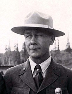
Henry Peter "Harry" Karstens was the first superintendent of Mount McKinley National Park, from 1921 to 1928. He was the guide and climbing leader of the first complete ascent of Denali in 1913, with expedition members Hudson Stuck, Episcopal Archdeacon of the Yukon and Arctic; Walter Harper, and Robert Tatum. John Fredson was one of two young Gwich'in Alaska Natives who supported the party.

Kantishna is an unincorporated community in Denali Borough, Alaska, United States, within Denali National Park and Preserve. Founded as a gold mining camp in 1905, it endured longer than similar communities in the area, having been constructed nearest to the source of the gold. It lies in the Kantishna Hills at the junction of Eureka Creek and Moose Creek, 3 mi (5 km) northwest of Wonder Lake, and near the mouth of the Kantishna River. Although the community was once also called "Eureka", the Board on Geographic Names officially ruled in favor of "Kantishna" in 1944, the name given to the post office that was built at the site in 1905. Its elevation is 1,696 feet (517 m).

Kantishna Airport is an Alaska state owned airstrip located two nautical miles (3.7 km) northwest of the former mining district of Kantishna in Denali National Park and Preserve, Alaska.

The Alaska-St. Elias Range tundra is an ecoregion of northwestern North America.

Stampede Airport is a public use airport located 25 nautical miles northeast of the central business district of Kantishna, a community in the Denali Borough of the U.S. state of Alaska. The airport is located in the Denali National Park and Preserve and owned by the U.S. National Park Service.

The McKinley River is a 58-mile (93 km) tributary of the Kantishna River in central Alaska in the United States. It drains an area on the north slope of the Alaska Range on the south edge of the Tanana Valley southwest of Fairbanks. The river issues from Muldrow Glacier in the northern Alaska Range in Denali National Park and Preserve, northeast of Denali. It flows through the tundra north of the Alaska Range in a generally northwest direction, joining Birch Creek to form the Kantishna River near Chilchukabena Lake.

The Toklat River is an 85-mile (137 km) tributary of the Kantishna River in central Alaska in the United States It drains an area on the north slope of the Alaska Range on the south edge of the Tanana Valley southwest of Fairbanks. It issues from unnamed glaciers in the northern Alaska Range in Denali National Park and Preserve, northeast of Denali. It flows generally northwest through hilly country to the tundra to the north of the Alaska Range.
Kantishna may refer to the following locations in Alaska:

The Denali National Park Improvement Act is a bill that was introduced into the United States Senate during the 113th United States Congress. If enacted, the bill would do four main things. First, it would allow the United States Department of the Interior to "issue permits for microhydroelectric projects in the Kantishna Hills area of the Denali National Park and Preserve in Alaska." Second, the bill would authorize the Department of the Interior and a company called Doyon Tourism, Inc. to exchange some land in the area. Third, the bill would authorize the National Park Service (NPS) to "issue permits to construct a natural gas pipeline in the Denali National Park." Finally, the bill would rename the existing Talkeetna Ranger Station the Walter Harper Talkeetna Ranger Station.

Denali Depot is a passenger railroad station located within Denali National Park. It is adjacent to the visitor center located in McKinley Park, Alaska. The station offers service for the Alaska Railroad's Denali Star route.


