
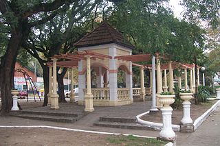
Santa Rosa is a city in the Argentine Pampas (lowlands), and the capital of La Pampa Province, Argentina. It lies on the east of the province, on the shore of the Don Tomás Lagoon, at the intersection of National Routes 5 and 35. The city (94,340) and its surroundings hold 102,610 inhabitants ,Census-ar 2.010 hold 124.101 inhabitants the capital y Toay around a third of the population of the province. Its current mayor is Leandro Altolaguirre. Founded in 1892 by Tomás Mason, Santa Rosa did not develop into a relatively important agricultural centre until the second half of the 20th century. It is still one of the smallest provincial capitals of the country after Patagonian Rawson, Ushuaia and Viedma.
Lanús is the capital of Lanús Partido, Buenos Aires Province in Argentina. It lies just south of the capital city Buenos Aires, in the Greater Buenos Aires metropolitan area. The city has a population of 212,152, and the Partido de Lanús has a total population of 453,500.

Moreno is a city in Buenos Aires Province, Argentina. It is the head town of Moreno Partido. It forms part of the Greater Buenos Aires urban conurbation and is located around 36 km (22 mi) to the west of the autonomous city of Buenos Aires.

Ituzaingó is the capital of the Ituzaingó Partido in the Greater Buenos Aires metropolitan area, Argentina, west of Buenos Aires.
Zárate is a port city in the northeast of the province of Buenos Aires, Argentina. It lies on the western shore of the Paraná River, 90 km (56 mi) from Buenos Aires. Its population as per the 2001 census [INDEC] is 101,271 inhabitants. It is the headquarters for and the only city in the partido of the same name.
Santos Lugares is a town in the southeast of the partido of Tres de Febrero. It is part of the urban agglomeration of Greater Buenos Aires in Buenos Aires Province, northeast of the Buenos Aires city proper. According to the 2001 census [INDEC], Santos Lugares had 17,023 inhabitants.

Rafaela is a city in the province of Santa Fe, Argentina, about 96 km from the provincial capital. It is the head town of the Castellanos Department. It has a population of 99,150 per the 2010 census [INDEC].
Tinogasta is a city in the west of the province of Catamarca, Argentina, on the right-hand shore of the Abaucán River, about 280 km from the provincial capital San Fernando del Valle de Catamarca. It had about 11,500 inhabitants at the 2010 census [INDEC]. It is the head town of the department of the same name. The name of the city comes from the Kakana words tino ("meeting") and gasta ("town").
Presidencia Roque Sáenz Peña is a city in the province of Chaco, Argentina. It is the second largest in the province. It is located 170 kilometres (110 mi) west-northwest of the provincial capital Resistencia, on the main rail and road route across northern Argentina to Salta. The city has a population of 76,377 for the urban area (localidad) and 88,164 for the whole municipality.

Campana is a city in the province of Buenos Aires, Argentina. It is the seat of the Campana Partido. It is located about 75 km (47 mi) from the Autonomous City of Buenos Aires, on the right-hand margin of the Paraná River. Its population is 94,333 inhabitants as per the 2010 census [INDEC].
Ensenada is a city and port in Buenos Aires Province, Argentina, located around the Ensenada de Barragán. It has 31,031 inhabitants as per the 2001 census [INDEC]. It is the capital of Ensenada Partido, and together with Berisso Partido they are the main suburbs of the Gran La Plata conurbation around the provincial capital of La Plata.

Monte Grande is a city which forms part of the urban agglomeration of Greater Buenos Aires. It is the administrative seat of Esteban Echeverría Partido in Buenos Aires Province, Argentina. It was founded on April 3, 1889, by a company named Sociedad Coni, Sansisena y Cía., and currently has an area of 22.57 km² and a population of 109,644 inhabitants.

Junín Partido is a county (partido) in the province of Buenos Aires, Argentina. Its population is 88,664 inhabitants and the population density reaches 39.4 inhabitants/km2. Its administrative seat is the city of Junín.

Olavarría is a city in the province of Buenos Aires, Argentina. It is the administrative seat of the Olavarría Partido and has over 111,320 inhabitants, per the 2010 census [INDEC].

Burzaco is a city in Almirante Brown Partido, Buenos Aires Province, Argentina. It has an area of 22.77 km2, holds a population of 98,859. It is 27 kilometres from Buenos Aires city, to which it is linked by the Ferrocarril General Roca South. Although there were some farms in the area since at least since the end of the 18th century, Burzaco was first established as a town soon after the arrival of the railway in 1865. The current city is the site of the country's first ever National Flag monument, in Burzaco's main square.

Belén is a small town in the province of Catamarca, Argentina. It has about 12,000 inhabitants according to the 2001 census [INDEC], and it is the head town of the department of the same name. Belén is the birthplace of Luis Franco.

Santa María is a city in the province of Catamarca, Argentina. It has about 17,030 inhabitants per the 2010 census [INDEC], and is the head town of the department of the same name.

Glew is a city in southern Almirante Brown Partido, Buenos Aires Province, Argentina. Its municipal area of 17.65 km2 (6.81 sq mi) holds a population of 57,878. It is located 34 km (21 mi) from Buenos Aires city, and connected to it by the Ferrocarril General Roca.
Ciudad Jardín El Libertador is a town in General San Martín Partido of Buenos Aires Province, Argentina. It is located in the Greater Buenos Aires area.
