
Saxony, officially the Free State of Saxony, is a landlocked state of Germany, bordering the states of Brandenburg, Saxony-Anhalt, Thuringia, and Bavaria, as well as the countries of Poland and the Czech Republic. Its capital is Dresden, and its largest city is Leipzig. Saxony is the tenth largest of Germany's sixteen states, with an area of 18,413 square kilometres (7,109 sq mi), and the sixth most populous, with more than 4 million inhabitants.

Wümme is a river in northern Germany, in the states Lower Saxony and Bremen, marking the border between the two states for part of its course. It is the main headstream of the Lesum.
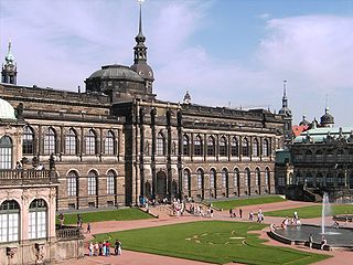
The Gemäldegalerie Alte Meister in Dresden, Germany, displays around 750 paintings from the 15th to the 18th centuries. It includes major Italian Renaissance works as well as Dutch and Flemish paintings. Outstanding works by German, French, and Spanish painters of the period are also among the gallery's attractions.

The Aland is a river in the German states of Lower Saxony and Saxony-Anhalt, left tributary of the Elbe. It is the continuation of the river Biese, which is the continuation of the river Milde. The Aland is 27 kilometres (17 mi) long, whereas the total Milde-Biese-Aland system is 97 kilometres (60 mi) long. The Aland flows into the Elbe in Schnackenburg.
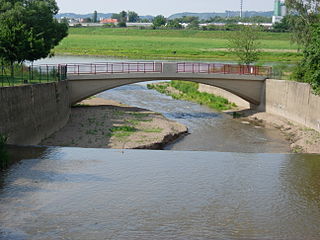
The Weißeritz is a river of Saxony, Germany. It is 13.7 km [8.5 mi] long and a left tributary of the Elbe.
Bauerngraben is a river of Saxony, Germany. It is a left tributary of the Neue Luppe river, which it joins northwest of Leipzig.

Kleine Luppe is a river of Saxony, Germany. It is a tributary of the Nahle near Leutzsch.
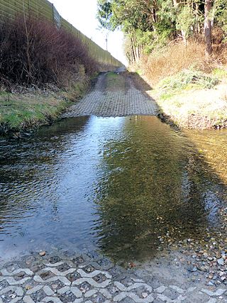
The Nahle is a river of Saxony, Germany. It is a 2.7-kilometre-long (1.7 mi) tributary of the White Elster in Leipzig, Saxony. It is part of the Elster-Luppe system in the northern Leipzig floodplain forest.

Neue Luppe is an artificial river of Saxony and Saxony-Anhalt, Germany.

The Eastern Rietzschke is a river flowing through Leipzig.

The Zschampert is a river of Saxony, Germany. It flows into the Alte Luppe near Leipzig.

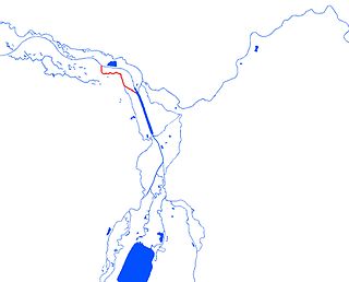
Luppe is a river of Saxony and Saxony-Anhalt, Germany. It lies in the floodplain around the confluence of the rivers Saale and White Elster, near the cities Leipzig and Halle. It flows into the Saale in Schkopau. Until the 1930s, when the Neue Luppe was constructed, the Luppe was a distributary of the White Elster. The Nahle and the Alte Luppe are relicts of the former course of the Luppe. The remaining Luppe flows from near Kleinliebenau to the west, and no longer receives water from its former upper course.
Alte Elbe is the German name for oxbows of the Elbe, i.e. cut-off meanders. With about 20 km (12 mi) the largest one of these is the Dornburger Alte Elbe, a river of Saxony-Anhalt, Germany.
Bauerngraben may refer to:
Alte Hehlenriede is a river of Lower Saxony, Germany.
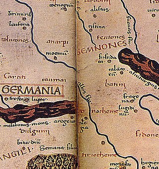
Loupfourdon, also Latin: Lupfurdum and Greek: Λούπφουρδον, is a place name mentioned in the atlas Geography, which was compiled by Ptolemy around 150 AD. Up to now, it has not been possible to locate the place or to determine whether the name component furd refers to a ford. Around 150 AD, Ptolemy, as part of his Geography, was probably the first to map some places in Central Europe in a system of coordinates. For this purpose he relied on the information provided by travelers who had crossed the area then known as Magna Germania. Today only medieval copies of the map series still exist. The resulting inaccuracies led to the fact that the location of individual places was controversial in the 19th and 20th centuries.

Alte Messe Leipzig is the circa 50 hectares site in the southeastern part of Leipzig's district Mitte, where from 1920 until 1991 the technical exhibitions of the Leipzig Trade Fair took place, as well as the buildings that stand on it – but not the trade fair itself, which found a new home at a new site in the northern part of Leipzig. Since 1996 there has been no trade fair activity on the old site.
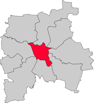
Leipzig-Mitte is one of ten boroughs (Stadtbezirke) of Leipzig, located in the center of the city. It includes numerous architectural monuments. Most of them are located in the subdivision "Zentrum", which is sited inside the Inner City Ring Road and the Promenadenring:

