
Pagosa Springs is a home rule municipality that is the county seat, the most populous community, and the only incorporated municipality in Archuleta County, Colorado, United States. The population was 1,571 at the 2020 census. Approximately 65 percent of the land in Archuleta County is either San Juan National Forest, Weminuche and South San Juan wilderness areas, or Southern Ute Indian reservation land.

The geothermal areas of Yellowstone include several geyser basins in Yellowstone National Park as well as other geothermal features such as hot springs, mud pots, and fumaroles. The number of thermal features in Yellowstone is estimated at 10,000. A study that was completed in 2011 found that a total of 1,283 geysers have erupted in Yellowstone, 465 of which are active during an average year. These are distributed among nine geyser basins, with a few geysers found in smaller thermal areas throughout the Park. The number of geysers in each geyser basin are as follows: Upper Geyser Basin (410), Midway Geyser Basin (59), Lower Geyser Basin (283), Norris Geyser Basin (193), West Thumb Geyser Basin (84), Gibbon Geyser Basin (24), Lone Star Geyser Basin (21), Shoshone Geyser Basin (107), Heart Lake Geyser Basin (69), other areas (33). Although famous large geysers like Old Faithful are part of the total, most of Yellowstone's geysers are small, erupting to only a foot or two. The hydrothermal system that supplies the geysers with hot water sits within an ancient active caldera. Many of the thermal features in Yellowstone build up sinter, geyserite, or travertine deposits around and within them.

The Alvord Desert is a desert located in Harney County, in southeastern Oregon in the Western United States. It is roughly southeast of Steens Mountain. The Alvord Desert is a 12-by-7-mile dry lake bed and averages 7 inches (180 mm) of rain a year. Two mountain ranges separate it from the Pacific Ocean—the Coast Range, and the Cascade Mountains. Along with Steens Mountain, these topographical features create a rain shadow. The Alvord Desert lies at an elevation of approximately 4,000 feet (1,200 m).

Terwilliger Hot Springs, also known as Cougar Hot Springs, are geothermal pools in the Willamette National Forest in the U.S. state of Oregon, 53 miles (85 km) east of Eugene. The springs drain into Rider Creek, which in turn drains into Cougar Reservoir. They are about a quarter mile from Forest Service Road 19, also known as Aufderheide Memorial Drive.

The Umpqua Hot Springs are a group of geothermal springs located along the North Umpqua River in the U.S. state of Oregon at 2,640 feet (800 m) elevation.

Mickey Hot Springs is a small hot spring system in southeastern Oregon, United States. The hot springs are located at the north end of the Alvord Desert just east of Steens Mountain and north of the 2-6 Hot Springs which are much larger but less known. There are several natural bubbling mudpots and steam vents. The system contains at least 60 vents, 11 of which are dry. The hydrothermal system may be in its waning stages of existence.

Bagby Hot Springs are natural hot springs in the Mount Hood National Forest, about 67 miles (108 km) southeast of Portland, Oregon, United States and about 98 miles (158 km) east of Salem, Oregon. The springs are in the Cascade Mountains in a heavily forested area at elevation 2280 ft. They are just outside the boundary of the Bull of the Woods Wilderness area.

Hot Lake Hotel is a historic Colonial Revival hotel originally built in 1864 in Hot Lake, Union County, Oregon, United States. The hotel received its namesake from the thermal spring on the property, and operated as a luxury resort and sanitorium during the turn of the century, advertising the medicinal attributes of the mineral water and drawing visitors worldwide. It is also the first known commercial building in the world to utilize geothermal energy as its primary heat source.
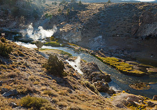
Hot Creek, starting as Mammoth Creek, is a stream in Mono County of eastern California, in the Western United States. It is within the Inyo National Forest.

Castle Rock Springs was a resort Lake County, California built around a group of mineral springs, including one hot spring with relatively high volumes of water.

Borax Lake is a 10-acre (4.0 ha) alkaline lake in the Alvord Desert of southeastern Oregon in the United States. The lake is fed by geothermal springs 100 feet (30 m) below the surface that range in temperature from 104 to 300 °F. Surface water temperatures usually range from 61 to 100 °F but occasionally go higher. The springs lie along the Steens fault zone, which runs north–south through the Alvord Valley east of Steens Mountain.
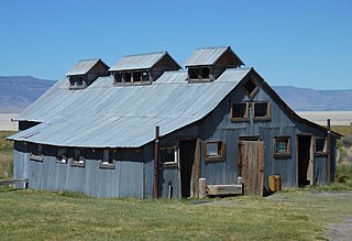
Summer Lake Hot Springs are natural hot springs at the south end of Summer Lake in south-central Oregon. They are artesian mineral springs with four surface sources. The springs have complex water chemistry. The temperature of the main source is approximately 123 °F (51 °C) with a water flow of approximately 20 US gallons (76 L) per minute. Over the years, the site has been developed as a rustic family bathing and relaxation resort. The hot springs are 124 miles (200 km) southeast of Bend, Oregon, near the small town of Paisley, Oregon.

Pagosa hot springs is a hot spring system located in the San Juan Basin of Archuleta County, Colorado. The town of Pagosa Springs claim they are the world's deepest known geothermal hot springs.
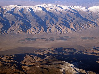
Fish Lake Hot Well, also known as Fish Lake Hot Spring and Fish Lake Valley Hot Well is a geothermal hot spring in Nevada.

Baker Hot Springs are a system of geothermal springs located on Fumarole Butte, northwest of the town of Delta, Utah. The springs were formerly known as Crater Springs and Abraham Hot Springs.

Breitenbush Hot Springs, also known as Breitenbusher Hot Springs, is a thermal mineral spring system along the Breitenbush River near the historic town of Breitenbush, Oregon, United States.
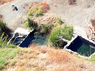
Big Caliente Hot Springs are a grouping of thermal mineral springs located in the Los Padres National Forest of California.
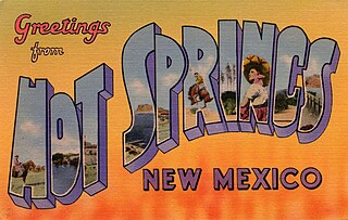
Truth or Consequences Hot Springs is a thermal spring system located in the Hot Springs Artesian Basin area of Truth or Consequences, New Mexico in Sierra County.
Beverly Hot Springs is the only remaining natural geothermal hot spring within the center of the city of Los Angeles. It is located between Beverly Hills and downtown Los Angeles on what is now Oxford Avenue.

Delonegha Hot Springs are located in Kern County, California, United States, northeast of the city of Bakersfield and southeast of Glennville. Delonegha is one of several hot springs adjacent to the Kern River and State Route 178. The springs lie within the boundaries of Sequoia National Forest, "100 yd (91 m) down a steep dirt trail" from the highway. Except for a brief period in the first years of the 20th century when there was a small resort at the site, the Delonegha springs have remained largely undeveloped.


