Alwero Dam

Last updated
Alwero Dam
Alwero Dam.png
Ethiopia relief location map.jpg
Red pog.svg
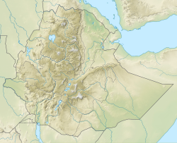
Location of Alwero Dam in Ethiopia
Country Ethiopia
Location Gambela Region
Coordinates 7°50′51″N34°28′57″E / 7.8476356°N 34.4824508°E / 7.8476356; 34.4824508
PurposeIrrigation
StatusOperational
Construction began1984
Dam and spillways
ImpoundsAlwero River

The Alwero Dam, also known as the Abobo Dam, is a reservoir and irrigation system in the Abobo district of Gambela Region, in western Ethiopia. It was built in 1985 with Soviet Union aid, as part of a strategy by the Derg regime led by former Ethiopian President Mengistu Haile Mariam to increase resource spending on irrigation following the 1983–1985 famine in Ethiopia. [1] It is located at a longitude of 34.4824508 and latitude of 7.8476356 on the Alwero river, Abobo, Gambela Region. It was constructed for irrigation, with a water capacity of 74.6 million cubic metres, and a dam height of 22 metres. This offers a conducive environment for water resources development for the population settled in the lowlands area to irrigate agriculture lands in the local region. It drains into the Nile Basin and has the capacity to irrigate over 10,000 hectares (100,000,000 m2) of land. [2] [3]

Related Research Articles

<span class="mw-page-title-main">Oromia</span> Regional state of Ethiopia

Oromia is a regional state in Ethiopia and the homeland of the Oromo people. Under Article 49 of Ethiopian Constitution, the capital of Oromia is Addis Ababa, also called Finfinne. The provision of the article maintains special interest of Oromia by utilizing social services and natural resources of Addis Ababa.

<span class="mw-page-title-main">Gambela Region</span> Regional state in western Ethiopia

The Gambela Region, officially the Gambela Peoples' Region, is a regional state in western Ethiopia, bordering South Sudan. Previously known as Region 12, its capital is Gambela. The Region is situated between the Baro and Akobo Rivers, with its western part including the Baro River.

<span class="mw-page-title-main">Anuak people</span> Luo Nilotic ethnic group in the East Africa

The Anyuak, also known as Anyuaa and Anywaa, are a Luo Nilotic ethnic group inhabiting parts of East Africa. The Anuak belong to the larger Luo family group. Their language is referred to as Dha-Anywaa. They primarily reside in the Gambela Region of western Ethiopia, and South Sudan. Group members number between 200,000 and 300,000 people worldwide. Many of the Anyuak people now follow Christianity. It is one of the first of the Nilotic groups to become almost entirely Christian, following the Shilluk people.

<span class="mw-page-title-main">Illubabor Zone</span> Zone in Oromia Region of Ethiopia

Illubabor is a zone in Oromia Region of Ethiopia. Illubabora is named for the former province Illubabor. It is bordered on the south by the Southern Nations, Nationalities and Peoples Region, on the southwest by the Gambela Region, on the west by Kelem Welega Zone, on the north by West Welega Zone, and Benishangul-Gumuz Region, on the northwest by East Welega Zone, and on the east by Jimma. Towns and cities in Illubabora include Bedele, Gore and Metu.

<span class="mw-page-title-main">Oromia Zone</span> Zone in Amhara Region of Ethiopia

The Oromia Zone is a zone in Amhara Region of Ethiopia. Oromia is named for the Oromo people, who settled along the edge of the Ethiopian Highlands that form this Zone. Oromia Zone is bordered on the southwest by North Shewa Zone, on the northwest by South Wollo and Argobba special woreda, and on the east by the Afar Region. The Zone consists of 7 Woredas which are Artuma Fursi, Bati, Bati Town, Dewa Cheffa, Dewa Harewa, Jilye Tumuga and Kemisie town. Kemise is the administrative center of the Zone.

<span class="mw-page-title-main">Administrative Zone 2 (Gambela)</span>

Administrative Zone 2 was one of the three zones of the Ethiopian Region of Gambela. This zone was bordered by South Sudan and the Southern Nations, Nationalities, and Peoples Region on the south, Administrative Zone 3 on the west, Administrative Zone 1 on the north, and the Godere special woreda on the east. It was added to Anuak Zone. Towns in this zone included Abobo and Fugnido.

<span class="mw-page-title-main">Asosa Zone</span> Zone in Benishangul-Gumuz Region of Ethiopia

Assosa is a zone in Benishangul-Gumuz Region of Ethiopia. This Zone was named after the Assosa Sultanate, which had approximately the same boundaries. Assosa is bordered on the south by the Mao-Komo special woreda, on the west by Sudan, and on the northeast by the Kamashi. The largest town in this zone is Assosa. Its highest point is Mount Bambashi, located in the woreda of the same name. The majority ethnic group in the zone is the Benishangul people[before;Berta]].

Abwobo is a woreda in Gambela Region, Ethiopia. Part of the Anywaa Zone, Abwobo is bordered on the southeast by the Majang Zone, on the south by Gog, on the southwest by Jor, on the northwest by Itang special woreda, on the north by Gambela Zuria, and on the northeast by the Oromia Region; part of its northern boundary is defined by the Alworo River. The major town in Abwobo is Abwobo.

Gog is a woreda in Gambela Region, Ethiopia. Part of the Anuak Zone, Gog is bordered on the south by Dimma, on the southwest by the Akobo River which separates it from South Sudan, on the west by Jor, and on the north by Abobo. The major town in Gog is Fugnido.

Gambela Zuria was a woreda in the Gambela Region of Ethiopia. Part of the Anuak Zone, Gambela Zuria is bordered on the south by Abobo, on the west by Itang special woreda, and on the north and east by the Oromia Region. Gambela, which is the capital of the Region, is surrounded by this woreda.

<span class="mw-page-title-main">Alamata (woreda)</span> District in Tigray Region, Ethiopia

Alamata is a woreda in Tigray Region, Ethiopia. Part of the Debubawi Zone, Alamata is bordered on the south and west by the Amhara Region, on the northwest by Ofla, and on the northeast by Raya Azebo. Towns in Alamata include Waja. The city of Alamata is a separate entity and is surrounded by Alamata woreda.

Adami Tullu and Jido Kombolcha is one of the districts in the Oromia Region of Ethiopia. Part of the East Shewa Zone located in the Great Rift Valley, Adami Tullu and Jido Kombolcha is bordered on the south by West Arsi Zone with which it shares the shores of Lakes Abijatta and Langano, on the west by the Silte Zone of Southern Nations, Nationalities and Peoples Region, on the north by Dugda Bora, on the northeast by Hora-Dambal, and on the east by the Arsi Zone. The main town of district is Adami Tullu; other towns include Abosa, Bulbulla, and Jido.

Alwero River is a river in Abobo woreda of Gambela Region, Ethiopia. It flows through the Gambela National Park and through wetlands into the Openo/Baro River. The potential land for irrigation development in the Gambella region, where the present study was conducted, is estimated to be 500,000 ha [10]. The region has a number of perennial rivers including, Baro, Alwero, Gille, and Akoba, which can be used as potential sources of irrigation water. In fact, this study was initiated to assess the physical land suitability for irrigation in the lower Alwero river area of Abobo, Anywaa Zone of Gambella Region.

<span class="mw-page-title-main">Shihmen Dam</span> Dam in Taoyuan City, Taiwan

Shihmen Dam is a major rock fill dam across the Dahan River in northern Taoyuan City. It forms the Shihmen Reservoir (石門水庫), Taiwan's third largest reservoir or artificial lake. It provides irrigation in Taoyuan, flood control for the Taipei Basin, and hydroelectricity and domestic water supply for more than three million people in northern Taiwan.

The Ikere Gorge Dam is a major earth-fill dam in Iseyin local government area of Oyo State in the south west of Nigeria on the Ogun River. Reservoir capacity is 690 million m3. The dam was initiated by the military regime of General Olusegun Obasanjo and started in 1983 by the administration of Shehu Shagari. The dam was planned to generate 37.5 MW of electricity, to supply water to local communities and to Lagos and to irrigate 12,000 hectares of land. Built in 1982/1983, work on the dam was abandoned by subsequent military governments. A report for the UN in 2004 said that no irrigation had taken place so far, but efforts were being made to implement one of the five planned irrigation projects. The project was based on the sprinkler system which is difficult to manage and requires that the farmers be trained.

<span class="mw-page-title-main">Mezhenger Zone</span> Zone in Gambela Region of Ethiopia

The Mezhenger Zone or Majang Zone is a zone in Gambela Region of Ethiopia. It is named for one of the three largest indigenous groups in Gambela, the Majangir. This zone is bordered on the south and east by the Southern Nations, Nationalities and Peoples Region (SNNPR), on the west by the Anuak Zone, and on the north by the Oromia Region. Towns in this Zone include Meti.

<span class="mw-page-title-main">Gambela People's Liberation Movement</span> Rebel group in Gambela Region of Ethiopia

The Gambela People's Liberation Movement was a rebel group in the Gambela Region in Ethiopia. The GPLM was founded by Anuak dissidents during the Derg and Woyane regime. The organization remained dominated by Anuaks. Agwa Alemu was the chairman of the GPLM.

Anyuak Zone or Anywaa Zone is a zone in Gambela Region of Ethiopia. It was created from former Administrative Zone 1 and Administrative Zone 2 of Gambela. This zone is bordered on the southwest by South Sudan, on the southeast by the Southern Nations, Nationalities, and Peoples Region, on the east by Majang Zone, on the northeast by the Oromia Region, and on the northwest by South Sudan and Nuer Zone. Towns in this zone include Gambela, Abwobo and Pinyudo.

<span class="mw-page-title-main">Romaine-1 Generating Station</span> Dam in Minganie, Quebec

The Romaine-1 Generating Station is a 270 MW hydroelectric generating station on the Romaine River in the Côte-Nord region of the province of Quebec, Canada. It is owned and operated by Hydro-Québec.

References

  1. Cheru, Fantu; Cramer, Christopher; Oqubay, Arkebe (2019-01-10). The Oxford Handbook of the Ethiopian Economy. Oxford University Press. p. 192. ISBN   978-0-19-254644-9.
  2. Tournier, Jean-Pierre; Bennett, Tony; Bibeau, Johanne (2019-08-08). Sustainable and Safe Dams Around the World / Un monde de barrages durables et sécuritaires: Proceedings of the ICOLD 2019 Symposium, (ICOLD 2019), June 9-14, 2019, Ottawa, Canada / Publications du symposium CIGB 2019, juin 9-14, 2019, Ottawa, Canada. CRC Press. p. 1155. ISBN   978-1-000-59682-3.
  3. The Journal of Oromo Studies. Vol. 12–13. Oromo Studies Association. 2005. p. 96. One of the big projects, the Alwero Dam was completed in 1985. The dam has a capacity to irrigate over 10,000 hectares of land.{{cite book}}: CS1 maint: date and year (link)

7°50′51″N34°28′57″E / 7.8476356°N 34.4824508°E / 7.8476356; 34.4824508