Ambil, Looc

Last updated
Ambil
Lubang Group of Islands, 2023 (04).jpg
Aerial view of Ambil Island from the west
Ambil, Looc
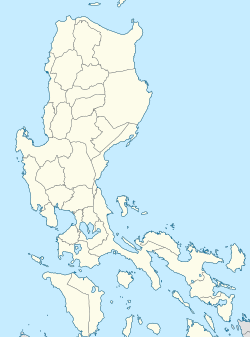
Philippines location map (Luzon mainland).svg
Red pog.svg
Ambil
Philippines location map (square).svg
Red pog.svg
Ambil
Coordinates: 13°47′35″N120°16′30″E / 13.793°N 120.275°E / 13.793; 120.275
Country Philippines
Region Mimaropa
Province Occidental Mindoro
Municipality Looc
Government
  Type Barangay
Highest elevation
(Mount Benagongon)
750 m (2,460 ft)
Lowest elevation
0 m (0 ft)
Population
 (2020) [1]
  Total
1,725
Time zone UTC+8 (PST)

Ambil is an island barangay in the Philippines that covers the island [2] of the same name along with the two other smaller outlying islands of Mandaui and Malavatuan to the northeast. The barangay is administered as part of the municipality of Looc, Occidental Mindoro. The island, which is the 93rd largest island in the Philippines, was formed by a conical mountain that is around 2,461 feet (750 m) in height, Mount Benagongon. [2]
See also

Related Research Articles

<span class="mw-page-title-main">Guimaras</span> Province in Western Visayas, Philippines

Guimaras, officially the Province of Guimaras, is an island province in the Philippines located in the Western Visayas region. The capital is Jordan, while the largest local government unit is the municipality of Buenavista. The province is situated in Panay Gulf, between the islands of Panay and Negros. To the northwest is the city and province of Iloilo and to the southeast is Negros Occidental. The whole island is part of the Metro IloiloGuimaras, one of the twelve metropolitan areas of the Philippines.

<span class="mw-page-title-main">Anda, Pangasinan</span> Municipality in Pangasinan, Philippines

Anda, officially the Municipality of Anda, is a municipality in the province of Pangasinan, Philippines. According to the 2020 census, it has a population of 41,548 people.

<span class="mw-page-title-main">Itbayat</span> Municipality in Batanes, Philippines

Itbayat, officially the Municipality of Itbayat,, is a municipality in the province of Batanes, Philippines. In the 2020 census, it had a population of 3,128 people.

<span class="mw-page-title-main">Maripipi</span> Municipality in Biliran, Philippines

Maripipi, officially the Municipality of Maripipi, is a municipality in the province of Biliran, Philippines. According to the 2020 census, it has a population of 6,373 people, making it the least populated town in the province. The town's populace predominantly speak Waray language.

<span class="mw-page-title-main">Concepcion, Romblon</span> Municipality in Romblon, Philippines

Concepcion, officially the Municipality of Concepcion, is a municipality in the province of Romblon, Philippines. The municipality is coextensive with Maestre de Campo Island, which is also known as Sibale Island. According to the 2020 census, it has a population of 3,561 people, making it the least populated town in the province.

<span class="mw-page-title-main">Santo Niño, Samar</span> Municipality in Samar, Philippines

Santo Niño, officially the Municipality of Santo Niño, is a municipality in the province of Samar, Philippines. According to the 2020 census, it has a population of 12,519 people.

<span class="mw-page-title-main">Lavezares</span> Municipality in Northern Samar, Philippines

Lavezares, officially the Municipality of Lavezares, is a municipality in the province of Northern Samar, Philippines. According to the 2020 census, it has a population of 29,390 people.

<span class="mw-page-title-main">Concepcion, Iloilo</span> Municipality in Iloilo, Philippines

Concepcion, officially the Municipality of Concepcion, is a 1st class municipality in the province of Iloilo, Philippines. According to the 2020 census, it has a population of 44,633 people.

<span class="mw-page-title-main">Quezon, Quezon</span> Municipality in Quezon, Philippines

Quezon, officially the Municipality of Quezon, is a 4th classmunicipality in the province of the same name. According to the 2020 census, it has a population of 15,886 people.

<span class="mw-page-title-main">Agutaya</span> Municipality in Palawan, Philippines

Agutaya, officially the Municipality of Agutaya, is a municipality in the province of Palawan, Philippines. According to the 2020 census, it has a population of 12,867 people.

<span class="mw-page-title-main">Linapacan</span> Municipality in Palawan, Philippines

Linapacan, officially the Municipality of Linapacan, is a municipality in the province of Palawan, Philippines. According to the 2020 census, it has a population of 16,424 people.

<span class="mw-page-title-main">Fuga Island</span> Island and barangay in the Philippines

Fuga Island is an island and barangay located north of Luzon and is part of the Babuyan Islands, which is the second-northernmost island group of the Philippines. Barangay Fuga Island is one of the 42 barangays under the jurisdiction of the municipality of Aparri in the province of Cagayan.

<span class="mw-page-title-main">Jintotolo Channel</span>

The Jintotolo Channel is the body of water that connects the Sibuyan Sea with the Visayan Sea. It is located between the Philippine islands of Panay and Masbate, and is an important shipping route to and from the Central Visayas.

<span class="mw-page-title-main">Cabra, Lubang</span> Barangay in Mimaropa, Philippines

Cabra is a barangay in the Philippines that covers the island of the same name. The island is the north-westernmost of the Lubang Group of Islands in the Verde Island Passage southwest of the country's main island of Luzon and northwest of the island of Mindoro. The barangay is administered as part of the municipality of Lubang, Occidental Mindoro.

<span class="mw-page-title-main">Ilin Island</span>

Ilin Island is a small island in the Philippines. Measuring 47 square kilometres (18 sq mi), it is just south of Mindoro, separated by the Ilin Strait and Mangarin Bay. To the west is the smaller Ambulong Island, across the Ambulong Strait.

<span class="mw-page-title-main">Aliguay</span>

Aliguay is an island in the Philippines, and a barangay of Dapitan. The island is an established marine sanctuary. The island is surrounded by white sand beaches and coral reefs. There are no water sources on the island. A few residents live on Aliguay Island, mostly selling fish to tourists.

Manlot is an island-barangay in northeastern Iloilo, Philippines. It is one of fourteen islands politically administered by the municipality of Carles.

<span class="mw-page-title-main">Selinog</span> Municipality in Zamboanga del Norte, Philippines

Selinog, historically known as Silino and also named Silinog, is an island barangay in Dapitan, Zamboanga del Norte, Philippines. It is coterminous with Silino Island and is located 12.9 kilometres (8.0 mi) off Tagolo Point, the northern entrance point to Dapitan Bay, and some 15 kilometres (9.3 mi) east of the island of Aliguay in the Bohol Sea. The island is a flat coralline island with a land area of 78 hectares. It is surrounded by 70 hectares of coral reefs and sandy areas. According to the 2020 census, the island community has a population of 692 inhabitants.

<span class="mw-page-title-main">Ambulong</span>

Ambulong is a small island in the Philippines located on the western side of the Ambolon Strait, that separates it from Ilin Island. Ambulong is located in Occidental Mindoro province of the Philippines, part of the municipality of San Jose. In 1919 it was described as "hilly and well wooded", and in 1919 its elevation at the northern part of the island was recorded at 567 feet (173 m).

<span class="mw-page-title-main">Jintotolo</span>

Jintotolo is an island within the Jintotolo Channel, part of the Province of Masbate, Philippines. It constitutes two barangays of the Municipality of Balud and has a population of 3,687 persons in the 2020 census.

References

  1. Census of Population (2020). "Mimaropa". Total Population by Province, City, Municipality and Barangay. Philippine Statistics Authority . Retrieved 8 July 2021.
  2. 1 2 Survey, U.S. Coast and Geodetic; Christman, R.J. (1919). United States Coast Pilot, Philippine Islands. Its Serial. U.S. Government Printing Office. p.  160.