A flood is an overflow of water that submerges land that is usually dry. In the sense of "flowing water", the word may also be applied to the inflow of the tide. Floods are an area of study of the discipline hydrology and are of significant concern in agriculture, civil engineering and public health. Human changes to the environment often increase the intensity and frequency of flooding, for example land use changes such as deforestation and removal of wetlands, changes in waterway course or flood controls such as with levees, and larger environmental issues such as climate change and sea level rise. In particular climate change's increased rainfall and extreme weather events increases the severity of other causes for flooding, resulting in more intense floods and increased flood risk.
The Delta Works is a series of construction projects in the southwest of the Netherlands to protect a large area of land around the Rhine–Meuse–Scheldt delta from the sea. Constructed between 1954 and 1997, the works consist of dams, sluices, locks, dykes, levees, and storm surge barriers located in the provinces of South Holland and Zeeland.

The Willamette River is a major tributary of the Columbia River, accounting for 12 to 15 percent of the Columbia's flow. The Willamette's main stem is 187 miles (301 km) long, lying entirely in northwestern Oregon in the United States. Flowing northward between the Oregon Coast Range and the Cascade Range, the river and its tributaries form the Willamette Valley, a basin that contains two-thirds of Oregon's population, including the state capital, Salem, and the state's largest city, Portland, which surrounds the Willamette's mouth at the Columbia.

Medford is a city 6.7 miles (10.8 km) northwest of downtown Boston on the Mystic River in Middlesex County, Massachusetts, United States. At the time of the 2020 U.S. Census, Medford's population was 59,659. It is home to Tufts University, which has its campus along the Medford and Somerville border.

The Mystic River is a 7.0-mile-long (11.3 km) river in Massachusetts. In the Massachusett language, missi-tuk means "large estuary," alluding to the tidal nature of the Mystic River. The resemblance to the English word mystic is a coincidence, which the colonists followed.

The Middlesex Canal was a 27-mile (44-kilometer) barge canal connecting the Merrimack River with the port of Boston. When operational it was 30 feet wide, and 3 feet deep, with 20 locks, each 80 feet long and between 10 and 11 feet wide. It also had eight aqueducts.

The Warren County Canal was a branch of the Miami and Erie Canal in southwestern Ohio about 20 miles (32 km) in length that connected the Warren County seat of Lebanon to the main canal at Middletown in the mid-19th century. Lebanon was at the crossroads of two major roads, the highway from Cincinnati to Columbus and the road from Chillicothe to the College Township (Oxford), but Lebanon businessmen and civic leaders wanted better transportation facilities and successfully lobbied for their own canal, part of the canal fever of the first third of the 19th century. The Warren County Canal was never successful, operating less than a decade before the state abandoned it.

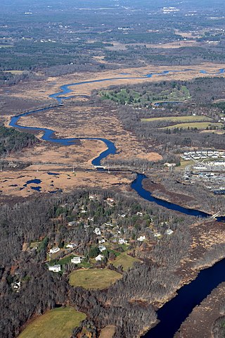
The Assabet River is a small, 34.4-mile (55.4 km) long river located about 20 miles (30 km) west of Boston, Massachusetts, United States. The Assabet rises from a swampy area known as the Assabet Reservoir in Westborough, Massachusetts, and flows northeast before merging with the Sudbury River at Egg Rock in Concord, Massachusetts, to become the Concord River. The Organization for the Assabet, Sudbury and Concord Rivers, headquartered in West Concord, Massachusetts, is a non-profit organization dedicated to the preservation, protection, and enhancement of the natural and recreational features of these three rivers and their watershed. As the Concord River is a tributary of the Merrimack River, it and the Assabet and Sudbury rivers are part of the larger Merrimack River watershed.

South Medford is the southern neighborhood of Medford, Massachusetts.

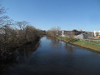
The Malden River is a 2.3-mile-long (3.7 km) river in Malden, Medford, and Everett, Massachusetts. It is roughly 675 feet (206 m) wide at its widest point and is very narrow at its smallest point. Its banks are largely occupied by industrial business, and the river is scarcely used or even mentioned. Its water quality is worse than most local waters, including the Mystic River, into which it flows.

The Sudbury River is a 32.7-mile-long (52.6 km) tributary of the Concord River in Middlesex County, Massachusetts, in the United States.

The Turners Falls Canal, also historically known as the Montague Canal, was a canal along the Connecticut River in Montague, Massachusetts. It was reconstructed in 1869.

The Cascade Locks and Canal was a navigation project on the Columbia River between the U.S. states of Oregon and Washington, completed in 1896. It allowed the steamboats of the Columbia River to bypass the Cascades Rapids, and thereby opened a passage from the lower parts of the river as far as The Dalles. The locks were submerged and rendered obsolete in 1938, when the Bonneville Dam was constructed, along with a new set of locks, a short way downstream.

The Charles River Dam is a flood control structure on the Charles River in Boston, Massachusetts, located just downstream of the Leonard P. Zakim Bunker Hill Memorial Bridge, near Lovejoy Wharf, on the former location of the Warren Bridge.

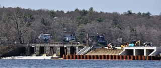
The Mystic Dam are a historic dam and gatehouse between Lower and Upper Mystic Lakes in the suburbs north of Boston, Massachusetts. The dam was built in 1864–65 by the Charlestown Water Commission as part of a water supply system. It was located at a narrow point between the Lower and Upper Mystic Lakes, with its west end in Arlington and its east end in Medford. The water system it was a part of eventually merged into the Metropolitan District Commission (MDC), predecessor to the Massachusetts Water Resources Authority (MWRA) and the Massachusetts Department of Conservation and Recreation (DCR).

Flood control methods are used to reduce or prevent the detrimental effects of flood waters. Flood relief methods are used to reduce the effects of flood waters or high water levels. Flooding can be caused by a mix of both natural processes, such as extreme weather upstream, and human changes to waterbodies and runoff. A distinction is made between structural and non-structural flood control measures. Structural methods physically restrain the flood waters, whereas non-structural methods do not. Building hard infrastructure to prevent flooding, such as flood walls, is effective at managing flooding. However, increased best practice within landscape engineering is to rely more on soft infrastructure and natural systems, such as marshes and flood plains, for handling the increase in water. To prevent or manage coastal flooding, coastal management practices have to handle natural processes like tides but also the human cased sea level rise.

Ten Hills is a neighborhood in the northeastern part of the city of Somerville, Massachusetts. The area is roughly wedge-shaped, about 50 acres (200,000 m2) in size, and is bounded by the Mystic River to the north, McGrath Highway to the east, and is largely separated from the rest of Somerville by Interstate 93 to the southwest. Ten Hills is next to Assembly Square in the east, and Winter Hill in the southwest. The neighborhood landscape is predominated by a single hill, the peak of which is roughly at the intersection of Temple and Putnam Roads. The Ten Hills neighborhood is located in Ward 4, Precinct 1 of the City of Somerville, which is in the 34th district of Middlesex County.

The Mystic River Reservation is a publicly owned nature preserve with recreational features located along the Mystic River in the towns of Winchester, Arlington, Medford, Somerville, Everett, and Chelsea in eastern Massachusetts. The reserve is part of the nearly 76-square-mile (200 km2) Mystic River watershed. It is managed by the Massachusetts Department of Conservation and Recreation.

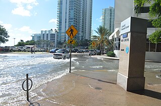
Tidal flooding, also known as sunny day flooding or nuisance flooding, is the temporary inundation of low-lying areas, especially streets, during exceptionally high tide events, such as at full and new moons. The highest tides of the year may be known as the king tide, with the month varying by location. These kinds of floods tend not to be a high risk to property or human safety, but further stress coastal infrastructure in low lying areas.


