
The Appalachian Trail, also called the A.T., is a hiking trail in the Eastern United States, extending almost 2,200 miles (3,540 km) between Springer Mountain in Georgia and Mount Katahdin in Maine, and passing through 14 states. The Appalachian Trail Conservancy claims the Appalachian Trail to be the world's longest hiking-only trail. More than three million people hike segments of it each year.

Scouting in Missouri has a long history, from the 1910s to the present day.

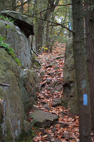
Hiking is a long, vigorous walk, usually on trails or footpaths in the countryside. Walking for pleasure developed in Europe during the eighteenth century. Religious pilgrimages have existed much longer but they involve walking long distances for a spiritual purpose associated with specific religions.

Lady Bird Lake is a river-like reservoir on the Colorado River in Austin, Texas, United States. The City of Austin created the reservoir in 1960 as a cooling pond for a new city power plant. The lake, which has a surface area of 416 acres (168 ha), is now used primarily for recreation and flood control. The reservoir is named in honor of former First Lady of the United States Lady Bird Johnson.

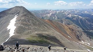
The Continental Divide National Scenic Trail is a United States National Scenic Trail with a length measured by the Continental Divide Trail Coalition of 3,028 miles (4,873 km) between the U.S. border with Chihuahua, Mexico and the border with Alberta, Canada. Frequent route changes and a large number of alternate routes result in an actual hiking distance of 2,700 miles (4,300 km) to 3,150 miles (5,070 km). The CDT follows the Continental Divide of the Americas along the Rocky Mountains and traverses five U.S. states — Montana, Idaho, Wyoming, Colorado, and New Mexico. In Montana near the Canadian border the trail crosses Triple Divide Pass.

The Superior Hiking Trail, also known as the SHT, is a 310-mile (500 km) long hiking trail in northeastern Minnesota that follows the rocky ridges overlooking Lake Superior for most of its length. The trail travels through forests of birch, aspen, pine, fir, and cedar. Hikers enjoy views of boreal forests, the Sawtooth Mountains, babbling brooks, rushing waterfalls, and abundant wildlife. The lowest point in the path is 602 ft (183 m) above sea level and the highest point is 1,829 ft (557 m) above sea level. The footpath is intended for hiking only. Motorized vehicles, mountain bikes, and horses are not allowed on the trail. Many people use the trail for long-distance hiking, and facilitating this purpose are 94 backcountry, fee-free campsites.
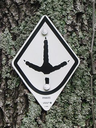
The Pinhoti Trail is a Southern Appalachian Mountains long-distance trail, 335 miles (540 km) in length, located in the United States within the states of Alabama and Georgia. The trail's southern terminus is on Flagg Mountain, near Weogufka, Alabama, the southernmost peak in the state that rises over 1,000 feet (300 m). The trail's northern terminus is where it joins the Benton MacKaye Trail. The trail's highest point is Buddy Cove Gap, with an elevation of 3164 feet near the Cohutta Wilderness. Its lowest point above sea level is close to Weogufka Creek near Weogufka State Forest at 545 feet.
The Metacomet Trail is a 62.7-mile (100.9 km) Blue-Blazed hiking trail that traverses the Metacomet Ridge of central Connecticut and is a part of the newly designated New England National Scenic Trail. Despite being easily accessible and close to large population centers, the trail is considered remarkably rugged and scenic. The route includes many areas of unique ecologic, historic, and geologic interest. Notable features include waterfalls, dramatic cliff faces, woodlands, swamps, lakes, river flood plain, farmland, significant historic sites, and the summits of Talcott Mountain and the Hanging Hills. The Metacomet Trail is maintained largely through the efforts of the Connecticut Forest and Park Association.

The Cardinal Greenway (TCG) is a multi-use recreational network combining a rail trail and an on-street route that together cross 62 miles (100 km) and five counties — in east central Indiana. The greenway, which was designated a National Recreation Trail in June 2003 and in 2018 was named to the Rails-to-Trails Conservancy's "Rail Trail Hall of Fame." uses the former CSX railroad track between Richmond and Marion. It is named after the Cardinal, the last regular passenger train service on the (Chicago-Cincinnati-Washington) route. Currently it is Indiana's longest rail trail project.

Greene Valley Provincial Park is a provincial park east of the Town of Peace River, Alberta, Canada, in Northern Sunrise County. It was designated a provincial park on June 6, 2000, by the Alberta provincial government.

A bridle path, also bridleway, equestrian trail, horse riding path, ride, bridle road, or horse trail, is a trail or a thoroughfare that is used by people riding on horses. Trails originally created for use by horses often now serve a wider range of users, including equestrians, hikers, and cyclists. Such paths are either impassable for motorized vehicles, or vehicles are banned. The laws relating to allowable uses vary from country to country.

The Bridge to Nowhere is an arch bridge that was built in 1936 north of Azusa, California, United States in the San Gabriel Mountains. It spans the East Fork of the San Gabriel River and was meant to be part of a road connecting the San Gabriel Valley with Wrightwood, California.

Gugi-dong is a dong, neighbourhood of Jongno-gu in Seoul, South Korea. It is a legal dong administered under its administrative dong, Pyeongchang-dong.

The Colorado Mountain Club (CMC), formed in 1912, is a nonprofit, 501 (c)(3) outdoor education organization based in Golden, Colorado that gathers and disseminates information regarding Colorado's mountains in the areas of art, science, literature and recreation. The club advocates for the preservation of the alpine regions, and was instrumental in the creation of Rocky Mountain National Park. The CMC has its own press with over 30 published titles, and has continuously published Trail & Timberline magazine since 1918.

Teatown Lake Reservation is a nonprofit nature preserve and environmental education center in Westchester County, New York, U.S., located in the towns of Ossining, Yorktown, Cortlandt, and New Castle. The reservation includes an 1,000-acre (4.0 km2) nature preserve and education center, visited annually by around 25,000 people.

The Bird Alliance of Oregon (formerly Portland Audubon) is a non-profit environmental organization dedicated to bird and habitat protection across Oregon in the United States.
British Columbia Mobility Opportunities Society (BCMOS) is a not-for-profit organization that enables people with disabilities in Vancouver, Canada, to explore the outdoors. Activities include hiking and gliding.
Bates State Park is a 131-acre (53 ha) state park in Grant County, Oregon, USA, near Prairie City. The park includes hiking trails, primitive RV and tent campsites, and a day use area for hikers and bicyclists.
The Continental Divide Trail Coalition (CDTC) is a Colorado-based organization that works to complete, promote, and protect the Continental Divide National Scenic Trail. The CDT is used by hikers, equestrians, and mountain bikers, and runs approximately 3,000-miles along the Continental Divide from Mexico to Canada. The trail crosses five states: New Mexico, Colorado, Wyoming, Idaho, and Montana, and is considered one of the three Triple Crown of Hiking trails in the United States.
