Related Research Articles

Ebute Metta is a neighbourhood of Lagos Mainland, Lagos, in Lagos State, Nigeria.

Nainital district is a district in Kumaon division which is a part of Uttarakhand state in India. The headquarters is at Nainital.

Kaladhungi is a town and a nagar panchayat in Nainital district in the Indian state of Uttarakhand.

Tagab is one of the 29 districts of Badakhshan province in Afghanistan. It was created in 2005 from part of Fayzabad District and has a population of approximately 31,207 residents. The Karaste Canal is located in Tagab District.

Ramnagar I is a community development block that forms an administrative division in Contai subdivision of Purba Medinipur district in the Indian state of West Bengal.

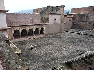
Ramnagar is a town and municipal board in the Nainital district of Kumaon, India. It is located approximately 65 kilometres (40 mi) from Nainital, the headquarters of the district.

Wingett Run is an unincorporated community in western Ludlow Township, Washington County, Ohio, United States. It has a post office with the ZIP code 45789. It is located along State Route 26 and the Little Muskingum River.
Ramnagar is a town and notified area committee in Udhampur District in the Indian union territory of Jammu and Kashmir.
Leming is an unincorporated community and census-designated place in Atascosa County, Texas, United States. As of the 2010 census, it had a population of 946. This was a new CDP for the 2010 census. The community is part of the San Antonio Metropolitan Statistical Area. Leming has a post office, with the ZIP code 78050.

Ramnagar II is a community development block that forms an administrative division in Contai subdivision of Purba Medinipur district in the Indian state of West Bengal.
Kembla Grange is a suburb west of Berkeley, in the City of Wollongong. At the 2016 census, it had a population of 252.
Simalkha is a village in Betalghat Mandal in Nainital district in Uttarakhand State in India. It has 67.63700 hectare land. Simalkha is 23.9 km distance from its District main city Nainital and 153 km distance from its State Main City Dehradun.
Betalghat is a small town and tehsil in Nainital district, Uttarakhand, India. As of 2011, it had a total population of 21,265 spread over 4,357 households.
The Karuma–Olwiyo–Pakwach–Nebbi–Arua Road is a road in the Northern Region of Uganda, connecting the towns of Karuma, Olwiyo, Pakwach, Nebbi and the city of Arua.

Ramnagar is a Township Area, in Ramnagar I CD block in Contai subdivision of Purba Medinipur district in the state of West Bengal, India.
Depal is a village and a gram panchayat in Ramnagar II Block in Contai subdivision of Purba Medinipur district in the Indian state of West Bengal.
Sitabani Wildlife Reserve is a wildlife reserve in Amgarhi, located in the Nainital district of Uttarakhand, India. It is home to variety of flora and fauna, including leopards, tigers, and over 500 species of native and migrating birds throughout the year.
Harindanga is a village and a gram panchayat within the jurisdiction of the Falta police station in the Falta CD block in the Diamond Harbour subdivision of the South 24 Parganas district in the Indian state of West Bengal.
Ramnagar is a village within the jurisdiction of the Diamond Harbour police station in the Diamond Harbour II CD block in the Diamond Harbour subdivision of the South 24 Parganas district in the Indian state of West Bengal.
Dudu is a village and municipality in Udhampur district of the Indian union territory of Jammu and Kashmir. The town is located 100 kilometres from the district headquarters Udhampur.
References
29°28′20″N79°14′35″E / 29.47222°N 79.24306°E
| | This article related to a location in the Indian state of Uttarakhand is a stub. You can help Wikipedia by expanding it. |