Articles related to Cambodia and Cambodian culture include:

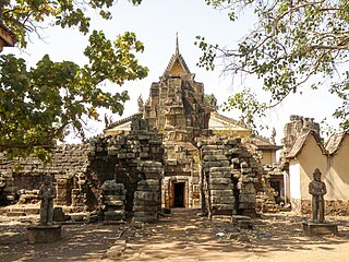
Kampong Cham is a province of Cambodia located on the central lowlands of the Mekong River. It borders the provinces of Kampong Chhnang to the west, Kampong Thom and Kratié to the north, Tboung Khmum to the east, and Prey Veng and Kandal to the south. Kampong Cham was officially divided into two provinces on 31 December 2013 in what was seen by many as a political move by the ruling party. All land west of the Mekong remained Kampong Cham while land east of the river became Tbong Khmum province. Prior to this division, Kampong Cham extended eastward to the international border with Vietnam, was the eleventh largest province in Cambodia, and with a population of 1,680,694, was the most populous province in Cambodia. Its capital and largest city is Kampong Cham.

Kampong Chhnang is one of the central provinces (khaet) of Cambodia. Neighboring provinces are Kampong Thom, Kampong Cham, Kandal, Kampong Speu, and Pursat. The provincial capital is the city of Kampong Chhnang.

Kandal is a province of Cambodia located in the southeast portion of the country. It completely surrounds the Cambodian capital of Phnom Penh and borders the provinces of Kampong Speu and Takéo to the west, Kampong Chhnang and Kampong Cham to the north, Prey Veng to the east, and shares an international border with Vietnam to the south. It is the second most populous province in Cambodia after the capital Phnom Penh. Its capital and largest city is Ta Khmau, which is approximately eight kilometres (5.0 mi) south of central Phnom Penh. Kandal is one of the wealthier provinces in the country.

Cambodia is divided into 25 provinces. The capital Phnom Penh is not a province but an "autonomous municipality", equivalent to a province governmentally and administered at the same level as the other 24 provinces.

Kampong Chhnang is the capital city of Kampong Chhnang Province, in central Cambodia.
Batheay is a district (srok) of Kampong Cham province, Cambodia. The district capital is Ph'av town. The town is located on National Highway 6 around 64 kilometres east of the provincial capital at Kampong Cham city and 60 kilometres north of the Cambodian capital Phnom Penh. The district lies at the junction between two major waterways, the Mekong River and the Tonle Sap.
Phnum Kravanh district is a district in Pursat province, Cambodia. In English the name translates to the Cardamom Mountains.
Baribour is a district (srok) in the north of Kampong Chhnang province, in central Cambodia. The district capital is Baribour town located around 38 kilometres north west of the provincial capital of Kampong Chhnang by road. The district shares a border with Pursat province to the west and with Kampong Thom province to the north. The district borders on the Tonle Sap and the Tonle Sap river forms the northern and eastern borders of the district.
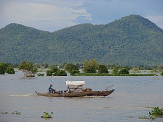
Chol Kiri is a district (srok) in the east of Kampong Chhnang province, in central Cambodia. The district capital is Chol Kiri town located around eight km (5.0 mi) south of the provincial capital of Kampong Chhnang by road. Chol Kiri district is the easternmost district of Kampong Chhnang. The district shares a border with Kampong Thom and Kampong Cham provinces to the east. Most of the district is low lying floodplain and the Tonlé Sap river runs through the district roughly from north to south. This proximity to the river and the lack of high land make Chol Kiri one of the most flood prone districts in the country. The Kampong Chhnang Department of Development has estimated that both Chol Kiri and Kampong Leaeng districts are flooded for six months of the year and that after the floodwaters have receded drinking water sources are left contaminated.
Kampong Leaeng is a district (srok) in the north east of Kampong Chhnang province, in central Cambodia. The district capital is Kampong Leaeng town located around 4 kilometres east of the provincial capital of Kampong Chhnang in a direct line. Kampong Leaeng district is the northernmost district of Kampong Chhnang. The district shares a border with Kampong Thom province to north and east. Much of the district is low-lying floodplain and the Tonle Sap river runs through the district roughly from north to south. In the south of the district are two significant mountains. Phnom Chrak Tunling and Phnom Neang Kangrei both over 1000 metres in elevation.

Kampong Tralach is a district (srok) in the south east of Kampong Chhnang province, in central Cambodia. The district capital is Kampong Tralach town located 37 kilometres south of the provincial capital of Kampong Chhnang by road. The district shares a border with Kandal province to the south and Kampong Cham province to the east. The Tonle Sap river runs through the district crossing roughly from north to south.

Rolea B'ier is a district (srok) in the center of Kampong Chhnang province, in central Cambodia. The district capital is Rolea B'ier, a town located 5 kilometres south of the provincial capital of Kampong Chhnang. The district is surrounded by other Kampong Chhnang districts and in turn surrounds Kampong Chhnang district which includes the provincial capital. The Tonle Sap serves as the border of the district in the north east. The Kampong Chhnang Airport, built during the period of Democratic Kampuchea lies in Krang Leav commune.
Sameakki Mean Chey is a district (srok) in the south of Kampong Chhnang province, in central Cambodia. The district capital is Sameakki Mean Chey town located on the rail line some 52 kilometres south of the provincial capital of Kampong Chhnang by road. The district shares a border with Kandal and Kampong Speu provinces to the south. The National Railway line from Phnom Penh to Sisophon runs through the district crossing roughly from north to south.

Tuek Phos is a district (srok) in the west of Kampong Chhnang province, in central Cambodia. The district capital is Tuek Phos town located on the rail line some 28 kilometres south west of the provincial capital of Kampong Chhnang by road. The district shares a border with Pursat and Kampong Speu provinces to the west. The National Railway line from Phnom Penh to Sisophon runs through the district entering in the south and exiting in the north west.
Kampong Chhnang municipality is a municipality in the centre of Kampong Chhnang province in central Cambodia. This is classed as an urban district and the provincial capital Kampong Chhnang City lies within the municipality. The district is quite small and encompasses the provincial town and nearby communes. Kampong Chhnang is the smallest district in Kampong Chhnang province and is surrounded by other Kampong Chhnang districts. The Tonle Sap river lies on the north and eastern borders of the district.
Kampong Siem is a district (srok) located in Kampong Cham province, Cambodia. The district surrounds the provincial capital Kampong Cham City. The administrative center of the district locates not far from the Provincial capital of Kampong Cham in Ampil Leu Village, Ampil Commune about 3 km west from the center of Kampong Cham city on National Highway 7 and is 120 kilometres by road from Phnom Penh. The district borders on the western bank of the Mekong for most of its length.
Kampong Chhnang Airport is an abandoned airport near Kampong Chhnang, the capital of the Kampong Chhnang Province in Cambodia. It is located near Pratlang village, roughly 60 kilometers northwest of Phnom Penh. The airfield was built and abandoned during the Cambodian Genocide.
Samrong Sen on the east bank of the Stueng Chinit River is a prehistoric archaeological site in the Kampong Chhnang Province, Cambodia. Consisting of a very large fluviatile shell midden, it flourished in particular from 1500 BC to 500 BC.


