Amtala (disambiguation)

Last updated

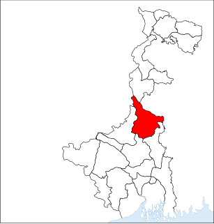
Amtala is a census town in South 24 Parganas district in the Indian state of West Bengal.

Amtala Town in West Bengal, India

Amtala is a town in Bishnupur II CD Block of South 24 Parganas district in the Indian state of West Bengal. The Bishnupur police station serves this town.

A census town is a type of town that satisfies certain characteristics, depending on the country in which it is located.

West Bengal State in Eastern India

West Bengal is an Indian state, located in Eastern India on the Bay of Bengal. With over 91 million inhabitants, it is India's fourth-most populous state. It has an area of 88,752 km2 (34,267 sq mi). A part of the ethno-linguistic Bengal region of the Indian subcontinent, it borders Bangladesh in the east, and Nepal and Bhutan in the north. It also borders the Indian states of Odisha, Jharkhand, Bihar, Sikkim, and Assam. The state capital is Kolkata (Calcutta), the seventh-largest city in India, and center of the third-largest metropolitan area in the country. As for geography, West Bengal includes the Darjeeling Himalayan hill region, the Ganges delta, the Rarh region, and the coastal Sundarbans. The main ethnic group are the Bengalis, with Bengali Hindus forming the demographic majority.

Other places with the same name are:

Amtala (Kamrup) Village in Assam, India

Amtala is a village in Kamrup district, situated in the south bank of the river Brahmaputra.

Kamrup district ; also Kamrup rural district is an administrative district in the state of Assam in India formed by bifurcating old Kamrup district into two in the year 2003; other being Kamrup Metropolitan district, named after region it constitute. The district, along with Nalbari and Barpeta together form the Kamrup region, has Kamrupi culture and language.

Assam State in northeast India

Assam is a state in India, situated south of the eastern Himalayas along the Brahmaputra and Barak River valleys. Assam covers an area of 78,438 km2 (30,285 sq mi). The state is bordered by Bhutan and the state of Arunachal Pradesh to the north; Nagaland and Manipur to the east; Meghalaya, Tripura, Mizoram and Bangladesh to the south; and West Bengal to the west via the Siliguri Corridor, a 22 kilometres (14 mi) strip of land that connects the state to the rest of India.

Related Research Articles

Murshidabad City in West Bengal, India

Murshidabad is a city and a municipality in Murshidabad district in the Indian state of West Bengal. Murshidabad was for a time the Mughal capital of the Bengal region, and is located on the eastern bank of the Hooghly River, a distributary of the Ganges River.

Berhampore, West Bengal City in West Bengal, India

Berhampore is a city and a municipality in the state of West Bengal, India. As of the 2011 census, it had a population of 305,609 and was the seventh largest city in West Bengal. It used to be known as Brahmapur because many of the Brahmin families settled here. Berhampore is the administrative headquarters of the Murshidabad district. It is located about 200 km (124 mi) from Kolkata, the state capital.

Murshidabad district Place in West Bengal, India

Murshidabad district is a district of West Bengal, in eastern India. Situated on the left bank of the river Ganges, the district is very fertile. Covering an area of 5,341 km² and having a population 5.863m, it is a densely populated district and the ninth most populous in India. Baharampur town is the headquarters of the district.

Nabagram may refer to:

Berhampore subdivision Subdivision in West Bengal, India

Barhampur subdivision is an administrative subdivision of Murshidabad district in the state of West Bengal, India.

Bhagawangola I Community development block in West Bengal, India

Bhagawangola I is a community development block that forms an administrative division in Lalbag subdivision of Murshidabad district in the Indian state of West Bengal.

Beldanga I Community development block in West Bengal, India

Beldanga I is a community development block that forms an administrative division in Barhampur subdivision of Murshidabad district in the Indian state of West Bengal.

Naoda (community development block) Community development block in West Bengal, India

Naoda is a community development block that forms an administrative division in Barhampur subdivision of Murshidabad district in the Indian state of West Bengal.

Raninagar I Community development block in West Bengal, India

Raninagar I is a community development block that forms an administrative division in Domkol subdivision of Murshidabad district in the Indian state of West Bengal.

Raghunathganj Town in West Bengal, India

Raghunathganj is a town, not identified in 2011 census, with a police station and post office, in Raghunathganj I CD Block in Jangipur subdivision of Murshidabad district in the state of West Bengal, India.

Raghunathganj II Community development block in West Bengal, India

Raghunathganj II is a community development block that forms an administrative division in Jangipur subdivision of Murshidabad district in the Indian state of West Bengal.

Azimganj is a railway station on the Barharwa-Azimganj-Katwa loop and is located in Murshidabad district lying west of Bhagirathi, a part of the Hooghly river in the Indian state of West Bengal. It serves Jiaganj Azimganj municipality.

New Farakka Junction railway station Railway Station in West Bengal, India

New Farakka Junction is a railway station on the Howrah-New Jalpaiguri line and is located in Murshidabad district in the Indian state of West Bengal. New Farakka Junction railway station lies south of the Farakka Barrage.

Jatindra Rajendra Mahavidyalaya college of West Bengal

Jatindra Rajendra Mahavidyalaya, also known as Amtala College established in 1986, is a general degree college of Amtala in Murshidabad district. It offers undergraduate courses in arts. It is affiliated to University of Kalyani.

Naoda Town in West Bengal, India

Naoda is a town, not identified in 2011 census, with a police station, in Naoda CD Block in Barhampur subdivision of Murshidabad district in the state of West Bengal, India.

Hariharpara Village in West Bengal, India

Hariharpara is a village, with a police station, in Hariharpara CD Block in Barhampur subdivision of Murshidabad district in the state of West Bengal, India.

Raninagar Town in West Bengal, India

Raninagar is a town, with a police station, not identified in 2011 census, in Raninagar II CD Block in Domkol subdivision of Murshidabad district in the state of West Bengal, India.

Amtala, Murshidabad Town in West Bengal, India

Amtala is a town, with a college, not identified in 2011 census, in Naoda CD Block in Barhampur subdivision of Murshidabad district in the state of West Bengal, India.

Amtala Annadamani Balika Vidyalaya is a secondary and higher secondary educational high school located in Amtala, Naoda, Murshidabad, India.