
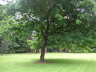
Anderson Park is a park in Invercargill, New Zealand. It consists of a Georgian-style residence set in 24 hectares of landscaped gardens. The house displays Invercargill's extensive collection of New Zealand art.
Anderson Park is a park in Invercargill, New Zealand. It consists of a Georgian-style residence set in 24 hectares of landscaped gardens. The house displays Invercargill's extensive collection of New Zealand art.
Sir Robert Anderson, a notable Invercargill businessman, built the house and it was completed in 1925. [1] The house was designed by Cecil Wood, a Christchurch-based architect. [1] Interior walls were of white plaster to show Sir Robert's paintings and etchings to best advantage. [2] To the rear of the house stands a wharepuni or Māori house known as Te Wharepuni o Anehana, the traditional carving coming from Rotorua. [2]
After the deaths of Sir Robert (1942) and his wife (1951), the house and grounds were given to the city of Invercargill. [2] From 1951 the house has been used to display Invercargill's collection of art. [2] The collection is extensive, with a number of early European works but largely focusing on notable New Zealand and local art. [3] The collection is managed by an incorporated society. [3] Exhibitions from the permanent collection and notable artists were held regularly [3] until it was closed on 30 January 2014 due to earthquake risk. [1] It was re-opened on 12 November 2022 after 1.5 million dollars of renovations. [4]
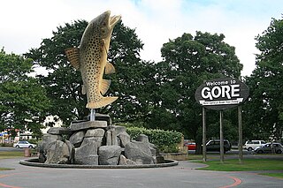
Gore is a town and district in the Southland region of the South Island of New Zealand. It has a resident population of 8,240 as of June 2023. Gore is known for its country music scene and hosts an annual country music festival. The town is also surrounded by farmland and is an important centre for agriculture in the region.

Invercargill is the southernmost and westernmost city in New Zealand, and one of the southernmost cities in the world. It is the commercial centre of the Southland region. The city lies in the heart of the wide expanse of the Southland Plains to the east of the Ōreti or New River some 18 km north of Bluff, which is the southernmost town in the South Island. It sits amid rich farmland that is bordered by large areas of conservation land and marine reserves, including Fiordland National Park covering the south-west corner of the South Island and the Catlins coastal region.

Bluff, previously known as Campbelltown and often referred to as "The Bluff", is a town and seaport in the Southland region, on the southern coast of the South Island of New Zealand. It is the southernmost town in mainland New Zealand and, despite Slope Point and Stewart Island being further south, Bluff is colloquially used to refer to the southern extremity of the country. According to the 2018 census, the resident population was 1,797, a decrease of 6 since 2013.

The Christchurch Botanic Gardens, located in the central city of Christchurch, New Zealand, were founded in 1863 when an English oak was planted to commemorate the solemnisation of the marriage of Prince Albert and Princess Alexandra of Denmark. The gardens sprawl over an area of 21 hectares and lie adjacent to the loop of the Avon River next to Hagley Park. The Christchurch Botanic Gardens have a variety of collections of exotic and local plants of New Zealand, several conservatories, a nursery, playground and Climatological Station.
The Tokanui Branch, also known as the Seaward Bush Branch, was a branch line railway located in Southland, New Zealand. It diverged from the Bluff Branch south of the main railway station in Invercargill and ran for 54 kilometres in a southeasterly direction. Construction began in 1883 and it operated until 1966.
Queens Park is a park in Invercargill, New Zealand, and was part of the original plan when Invercargill was founded in 1856. The park is 200 acres (0.81 km2) in extent. It is just north of the city centre, bounded by Queens Drive to the east, Kelvin Street to the west, Gala Street to the south and Herbert Street to the north. The Gala Street entrance features the Feldwick Gates, built in 1924 and named after John Feldwick, brother of MP Henry Feldwick.

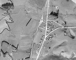
Dacre is a small town in the South Island of New Zealand. It is situated on the Southland Plains between Invercargill and Edendale on State Highway 1. In Dacre, SH 1 is met by State Highway 98, which runs west to Makarewa via Rakahouka. Nearby villages include Mabel Bush to the northwest and Woodlands to the southeast. Dacre is 25 km north east of Invercargill, the closest city. The Main South Line railway passes just to the south of Dacre. It is a dairy farming community, that currently has a community hall and a small engine garage.
Waimahaka is a locality in the Southland region of New Zealand's South Island. It is situated in a rural area, inland from Toetoes Bay. Nearby settlements include Pine Bush and Titiroa to the northwest, Fortification and Te Peka to the east, Pukewao and Tokanui to the southwest, and Fortrose on the coast to the south.
Titiroa is a locality in the Southland region of New Zealand's South Island. It is on the eastern bank of the lower Mataura River, inland from Toetoes Bay. Pine Bush is nearby to the northeast, and Waimahaka is to the southeast.
Gorge Road is a locality in the Southland region of New Zealand's South Island. It is on the Southern Scenic Route and is situated on the western bank of the Mataura River. Nearby settlements include Ashers to the west, and across the Mataura, Pine Bush and Titiroa to the east.
Ashers is a locality in the Southland region of New Zealand's South Island. It is situated east of Invercargill on the Southern Scenic Route as it runs between Kapuka and Gorge Road. Other nearby settlements include Oteramika to the north and Kapuka South to the south. Also south is the Waituna Lagoon and Toetoes Bay.
Mokotua is a locality in the Southland region of New Zealand's South Island. It is situated in a rural area east of Invercargill, between Timpanys and Kapuka on the Southern Scenic Route. To the south are Toetoes Bay and Waituna Lagoon; Rimu is to the north.
The Southland Museum and Art Gallery Niho o te Taniwha is located in Gala Street, Invercargill, New Zealand. It is Southland's largest cultural and heritage institution, and contains a wide variety of the region's art, history and natural history collections. It is notable for its 1990 pyramid-shaped building, constructed over the original 1942 museum. In April 2018 the museum was closed indefinitely due to earthquake risks.
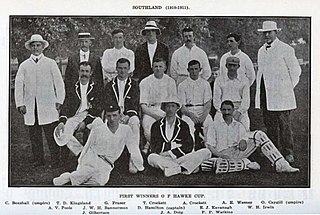
The Southland cricket team represents the Southland Region of New Zealand. They compete in the Hawke Cup.
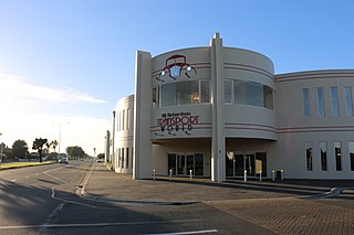
Transport World is an organisation that invests in New Zealand tourism, located in Invercargill. It is sectioned into four production branches: Bill Richardson Transport World, Classic Motorcycle Mecca, Lodges at Transport World, and Dig this Invercargill. Bill Richardson Transport World and Classic Motorcycle Mecca are transport displays, showcasing over 300 vintage vehicles alongside relevant interactive activities. The Lodges At Transport World are boutique apartment accommodations and Dig This Invercargill is an attraction that allows tourists to operate diggers and heavy construction equipment. The Bill Richardson Transport World and Classic Motorcycle Mecca sites both include a restaurant and café; The Grille Café, located at Bill Richardson Transport World, and the Meccaspresso Café, located at the Classic Motorcycle Mecca.
The Karitane Hospitals were six hospitals in New Zealand run by the Plunket Society, located in Auckland, Christchurch, Dunedin, Invercargill, Wanganui and Wellington. They were established as training hospitals for Karitane nurses and cared for babies with malnutrition and other dietetic complaints, and premature babies. They also offered mother care training and assistance. The first hospital opened in 1907 and the hospitals were closed between 1978 and 1980 due to financial difficulties and changes in society and maternity services.

The Civic Theatre is a theatrical venue in the southern New Zealand city of Invercargill.

The Southern District Health Board was a district health board which provided healthcare to an area covering the southern half of the South Island of New Zealand. In July 2022, the Southern DHB was dissolved as part of a nationwide overhaul of the district health board system. Its former functions and responsibilities were taken over by Te Whatu Ora.
The 1930 King's Birthday Honours in New Zealand, celebrating the official birthday of King George V, were appointments made by the King on the recommendation of the New Zealand government to various orders and honours to reward and highlight good works by New Zealanders. They were announced on 3 June 1930.
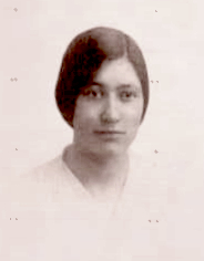
Dorothy Catherine Wentworth Jenkin was a New Zealand watercolorist, botanical illustrator and printmaker. She was a founding member of the Invercargill Art Society and participated in campaigning for a public art gallery in Invercargill. She was involved in ensuring the acquisition of Anderson Park and the establishment of the Invercargill Art Gallery at that location. Many of her works are held at the Rakiura Museum and have been reproduced as prints and postcards.
46°21′42″S168°21′35″E / 46.3618°S 168.3597°E
| | This Southland Region geography article is a stub. You can help Wikipedia by expanding it. |