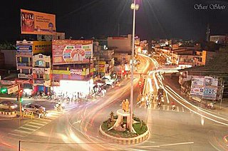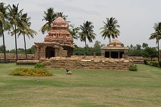
Chamarajanagar is the southernmost district in the state of Karnataka, India. It was carved out of the original larger Mysore District in the year 1998. Chamarajanagar town is the headquarters of this district.

Nagapattinam is a town in the Indian state of Tamil Nadu and the administrative headquarters of Nagapattinam District. The town came to prominence during the period of Medieval Cholas and served as their important port for commerce and east-bound naval expeditions. The Chudamani Vihara in Nagapattinam constructed by the Srivijayan king Sri Mara Vijayattungavarman of the Sailendra dynasty with the help of Rajaraja Chola I was an important Buddhist structure in those times. Nagapattinam was settled by the Portuguese and, later, the Dutch under whom it served as the capital of Dutch Coromandel from 1660 to 1781. In November 1781, the town was conquered by the British East India Company. It served as the capital of Tanjore district from 1799 to 1845 under Madras Presidency of the British. It continued to be a part of Thanjavur district in Independent India. In 1991, it was made the headquarters of the newly created Nagapattinam District. Nagapattinam is administered by a Selection-grade municipality covering an area of 17.92 km2 (6.92 sq mi) and had a population of 102,905 as of 2011.

Dharmapuri is a city in Kongu Nadu region in the western part of Tamil Nadu in South India. The city is located at 126 km from Bangalore, 200 km from Coimbatore, 260 km from Mysore, and 300 km from Chennai. It is located between latitudes N 11 47’ and 12 33’ and longitudes E 77 02’ and 78 40’. The total geographical area of Dharmapuri District is 4497.77 km2, that is, 3.46% of Tamil Nadu. And it is one of top leading Mango cultivator and producer of state.

Kongu Nadu is a region and aspirant state of India comprising the western part of Tamil Nadu. In the ancient Tamilakam, it was the seat of the Chera kings, bounded on the east by Tondai Nadu, on the south-east by Chola Nadu and on the south by Pandya Nadu regions.

Kilakarai, Kilakkarai or Keelakarai is a municipality in Ramanathapuram district in the Indian state of Tamil Nadu. As of 2011, the town had a population of 38,355. Kilakarai is one of the Taluka in Ramanathapuram District. It is also called as Mini Singapore.

The Madurai district is the ninth largest in population of the 32 districts of the state of Tamil Nadu in southeastern India. The city of Madurai serves as the district headquarters. It houses the world-famous Sri Meenakshi Sundareshwarar temple and is situated on the banks of the river Vaigai and the oldest Islamic mosque in Madurai The Kazimar Big Mosque situated in the banks of Kiruthumal river. Thiruparankundram is one of the major tourist place in the district. As of 2011, the district had a population of 3,038,252 with a sex-ratio of 990 females for every 1,000 males. Aside from the city of Madurai, the larger towns are Melur, vadipatti, Peraiyur, Thirumangalam and Usilampatti. It is an important hub for various film shootings.

Tirunelveli district is a district of Tamil Nadu state in South India. It is the largest district in terms of area with Tirunelveli as its headquarters. Tirunelveli District was formed on 1 September 1790 by the British East India Company, and comprised the present Tirunelveli and Thoothukudi districts and parts of Virudhunagar and Ramanathapuram district. As of 2011, the district had a population of 3,077,233.

Thoothukudi District, also known as Tuticorin District is a district in Tamil Nadu state in southern India. The district was formed by dividing Tirunelveli district in 1986 and Thoothukudi is the district headquarters. The district is known for pearl cultivation, with an abundance of pearls being found in the seas offshore. It was formerly ruled by one of the oldest kingdoms in India, the Pandyan Dynasty with the port of Korkai through which trade with Rome happened. The archaeological site at Adichanallur holds the remains of the ancient Tamil civilisation. As of 2011, the district had a population of 1,750,176 with a sex-ratio of 1,023 females for every 1,000 males.

Tindivanam is a town and a municipality in Viluppuram district in the Indian state of Tamil Nadu. Its second largest town in villupuram District after headquarters town Villupuram. Important roads from north to south Tamil Nadu pass through Tindivanam and similarly from west to east.

Thanjavur District is one of the 32 districts of the state of Tamil Nadu, in southeastern India. Its headquarters is Thanjavur. The district is located in the delta of the Cauvery River and is mostly agrarian. As of 2011, Thanjavur district had a population of 2,405,890 with a sex-ratio of 1,035 females for every 1,000 males.

The Government of Tamil Nadu is the governing authority for the Indian state of Tamil Nadu. It is seated at Fort St George, Chennai. The legislature of Tamil Nadu was bicameral until 1986, when it was replaced by a unicameral legislature, like most other states in India.
Pallipattu taluk is a taluk of Tiruvallur district of the Indian state of Tamil Nadu. The headquarters of the taluk is the town of Pallipattu.
Thiruvallur taluk is a taluk of Tiruvallur district of the Indian state of Tamil Nadu. The headquarters of the taluk is the town of Thiruvallur.
Madurantakam taluk is a taluk of Kanchipuram district of the Indian state of Tamil Nadu. The headquarters of the taluk is the town of Madurantakam. Madurantakam taluk is bounded by Chengalpattu taluk in north, Uthiramerur taluk in West, Thirukklaukkundram Taluk in north east and Tindivanam lauk of Villupuram district in south.
Arakkonam Taluk is a taluk in Vellore district of the Indian state of Tamil Nadu. The headquarters of the taluk is the town of Arakkonam.

Vadamadurai is a panchayat village in Thiruvallur district in the Indian state of Tamil Nadu.

Tirukalukundram taluk or Thirukalukundram taluk is a taluk of Kanchipuram district of the Indian state of Tamil Nadu. The headquarters of the taluk is the town of Tambaram.

Elavur is a village in the Tiruvallur district of Tamil Nadu, India. It is located in the Gummidipoondi taluk. It is located in the Andhra Pradesh Border..It is the Gateway of Tamil Nadu.


