
East Godavari is a district in the Coastal Andhra region of Andhra Pradesh, India. Its district headquarters is at Rajamahendravaram.
Annavaram is a temple town on the banks of the Pampa River. It is located in Kakinada district of the Indian state of Andhra Pradesh. The village has the temple of Veera Venkata Satyanarayana, a form of Vishnu on the Ratnagiri Hill. It is 18 km away from Tuni city.

Narsipatnam is a census town in Anakapalle district of the Indian state of Andhra Pradesh. It was upgraded from a gram panchayat into municipality in 2012. The town is spread over an area of 42 km2 (16 sq mi) The resting place of the revolutionary Indian freedom fighter Alluri Sitarama Raju is located in Krishna Devi Peta village of From Narsipatnam to labasingi Village 30 km only.. labasingi most popular winter tourism place..so many Tourists enjoy -2 degree's temparature there.. Narsipatnam town is 43 km away from Tuni. And it is 72 km away from Visakhapatnam.
Kotabommali is a mandal in the Srikakulam district of the Indian state of Andhra Pradesh.

Pathapatnam is a town in Srikakulam district of the Indian state of Andhra Pradesh. It is located in Pathapatnam mandal of Palakonda revenue division. Pathapatnam is located on the border of Srikakulam district of Andhra Pradesh and Gajapati district of Odisha. Parlakhemundi, the headquarters of Gajapati District, can be considered as twin town of Pathapatnam because of its close proximity. It is located around 65 km from srikakulam. It was the old capital of Paralakhemundi Gajapati Maharajah of his erstwhile kingdom.
Rompicherla is a village in Chittoor district of the Indian state of Andhra Pradesh. It is the mandal headquarters of Rompicherla mandal.
Pedanandipadu is a village in the Guntur district of the Indian state of Andhra Pradesh. It is located in Pedanandipadu mandal of Guntur revenue division.

Tadikonda is a village in Guntur district of the Indian state of Andhra Pradesh. It is located in Tadikonda mandal of Guntur revenue division. It forms a part of Andhra Pradesh Capital Region.
Kondapi is a village in Prakasam district of the Indian state of Andhra Pradesh. It is the mandal headquarters of Kondapi mandal in Kandukur revenue division.
Bhimavaram mandal is one of the 19 mandals in West Godavari district of the Indian state of Andhra Pradesh. It has headquarters at Bhimavaram town. The mandal is bounded by Undi mandal, Palacoderu mandal, Veeravasaram mandal, Narasapuram mandal, Mogalthur mandal and Kalla mandal mandals.
Bapatla mandal is one of the 25 mandals in Bapatla district of the state of Andhra Pradesh, India. It is under the administration of Bapatla revenue division and the headquarters are located at Bapatla. The mandal is bounded by Kakumanu, Ponnur, Karlapalem mandals of Guntur district. It also shares borders with Prakasam district and a portion of it lies on the coast of Bay of Bengal.
Amaravathi mandal is one of the 28 mandals in Palnadu district of the Indian state of Andhra Pradesh. It is under the administration of Sattenapalli revenue division and the headquarters are located at Amaravathi. The mandal is located on the banks of Krishna River, at a distance 27 km from the district headquarters. It is bounded by Atchampet, Krosuru, Pedakurapadu, Tadikonda and Thullur mandals.
Kollipara mandal is one of the 18 mandals in Guntur district of the state of Andhra Pradesh, India. It is under the administration of Tenali revenue division and the headquarters are located at Kollipara. The mandal is situated on the banks of the Krishna River, bordered by Duggirala, Tenali, Vemuru and Kollur mandal.

Denduluru is a village in the Eluru district of the Indian state of Andhra Pradesh. It is located on the north-east side of district headquarters Eluru at a distance of 11 km. It is a member of the Eluru revenue division. The Bhimalingadibba or the mounds are one of the centrally protected monuments of national importance.
Arempudi is a census town in Kakinada district of the Indian state of Andhra Pradesh. It is located near Sankhavaram Mandal of Rampachodavaram revenue division.
Sreeparru is a village in Eluru district in the state of Andhra Pradesh in India. It is 22 km from the city of Eluru, the headquarters of Eluru district.
Pinakadimi is a village in Eluru district of the Indian state of Andhra Pradesh. It is located in Pedavegi mandal of Eluru revenue division. It is located at a distance of 7 km from district headquarters Eluru city.
Eduru is a village in West Godavari district in the state of Andhra Pradesh in India. The nearest railway station is at Krishnapatnam (KAPT) located at a distance of 15.83 Km
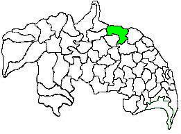
Sankhavaram Mandal is one of the 21 mandals in Kakinada district of Andhra Pradesh. As per census 2011, the mandal comprises one town and 29 villages.
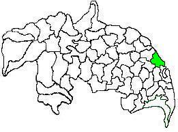
Yeleswaram mandal is one of the 21 mandals in Kakinada District of Andhra Pradesh. As per census 2011, there are 13 villages.


