
A geographic information system (GIS) is a type of database containing geographic data, combined with software tools for managing, analyzing, and visualizing those data. In a broader sense, one may consider such a system to also include human users and support staff, procedures and workflows, body of knowledge of relevant concepts and methods, and institutional organizations.

Esri is an international supplier of geographic information system (GIS) software, web GIS and geodatabase management applications. The company is headquartered in Redlands, California.
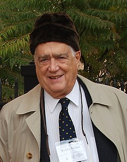
Waldo Rudolph Tobler was an American-Swiss geographer and cartographer. Tobler's idea that "Everything is related to everything else, but near things are more related than distant things" is referred to as the "first law of geography." He has proposed a second law as well: "The phenomenon external to an area of interest affects what goes on inside". Tobler was an active Professor Emeritus at the University of California, Santa Barbara Department of Geography until his death.
A GIS software program is a computer program to support the use of a geographic information system, providing the ability to create, store, manage, query, analyze, and visualize geographic data, that is, data representing phenomena for which location is important. The GIS software industry encompasses a broad range of commercial and open-source products that provide some or all of these capabilities within various information technology architectures.

Torsten Hägerstrand was a Swedish geographer. He is known for his work on migration, cultural diffusion and time geography.

Jack DangermondOON is an American billionaire businessman and environmental scientist, who co-founded, with Laura Dangermond, in 1969 the Environmental Systems Research Institute (Esri), a privately held geographic information systems (GIS) software company. As of October 2021, his net worth was estimated at US$8.6 billion.

ArcGIS is a family of client software, server software, and online geographic information system (GIS) services developed and maintained by Esri. ArcGIS was first released in 1999 and originally was released as ARC/INFO, a command line based GIS system for manipulating data. ARC/INFO was later merged into ArcGIS Desktop, which was eventually superseded by ArcGIS Pro in 2015. ArcGIS Pro works in 2D and 3D for cartography and visualization, and includes Artificial Intelligence (AI).
Time geography or time-space geography is an evolving transdisciplinary perspective on spatial and temporal processes and events such as social interaction, ecological interaction, social and environmental change, and biographies of individuals. Time geography "is not a subject area per se", but rather an integrative ontological framework and visual language in which space and time are basic dimensions of analysis of dynamic processes. Time geography was originally developed by human geographers, but today it is applied in multiple fields related to transportation, regional planning, geography, anthropology, time-use research, ecology, environmental science, and public health. According to Swedish geographer Bo Lenntorp: "It is a basic approach, and every researcher can connect it to theoretical considerations in her or his own way."
A historical geographic information system is a geographic information system that may display, store and analyze data of past geographies and track changes in time. It can be regarded as a tool for historical geography.
The Great Britain Historical GIS, is a spatially enabled database that documents and visualises the changing human geography of the British Isles, although is primarily focussed on the subdivisions of the United Kingdom mainly over the 200 years since the first census in 1801. The project is currently based at the University of Portsmouth, and is the provider of the website A Vision of Britain through Time.

Llanycrwys is a community located in Carmarthenshire, Wales. Situated in the historical Cayo Hundred in the Union of Lampeter, it is situated near the River Cothi, and is separated from the parish of Caio by the Afon Twrch, which flows near the St. Davids church. The church is isolated, and was restored in 1892 by C. H. Purday of Ewan Christian, who had a porch on the western side, with a timbered gable.

Edward Lynn "Ed" Ayers is an American historian, professor, administrator, and university president. In July 2013, he was awarded the National Humanities Medal by President Barack Obama at a White House ceremony for Ayers's commitment “to making our history as widely available and accessible as possible." He served as the president of the Organization of American Historians in 2017–18.
Disease diffusion occurs when a disease is transmitted to a new location. It implies that a disease spreads, or pours out, from a central source. The idea of showing the spread of disease using a diffusion pattern is relatively modern, compared to earlier methods of mapping disease, which are still used today. According to Rytokonen, the goals of disease mapping are: 1) to describe the spatial variation in disease incidence to formulate an etiological hypothesis; 2) to identify areas of high risk in order to increase prevention; and 3) to provide a map of disease risk for a region for better risk preparedness.
Cindi Katz, a geographer, is Professor in Environmental Psychology, Earth and Environmental Sciences, American Studies, and Women's Studies at the CUNY Graduate Center. Her work concerns social reproduction and the production of space, place and nature; children and the environment; the consequences of global economic restructuring for everyday life; the privatization of the public environment, the intertwining of memory and history in the geographical imagination, and the intertwined spatialities of homeland and home-based security. She is known for her work on social reproduction and everyday life, research on children's geographies, her intervention on "minor theory", and the notion of counter-topography, which is a means of recognizing the historical and geographical specificities of particular places while inferring their analytic connections to specific material social practices.

Produced by the Environmental Systems Research Institute, the Esri International User Conference is the world's largest event dedicated to geographic information system (GIS) technology. It is held annually in the United States, usually for one week in July at the San Diego Convention Center in San Diego, California. The Esri UC dates back to 1981. In 2008, conference attendance grew to more than 14,000 attendees.
Geodesign is a set of concepts and methods used to involve all stakeholders and various professions in collaboratively designing and realizing the optimal solution for spatial challenges in the built and natural environments, utilizing all available techniques and data in an integrated process. Originally, geodesign was mainly applied during the design and planning phase. "Geodesign is a design and planning method which tightly couples the creation of design proposals with impact simulations informed by geographic contexts." Now, it is also used during realization and maintenance phases and to facilitate re-use of for example buildings or industrial areas. Geodesign includes project conceptualization, analysis, design specification, stakeholder participation and collaboration, design creation, simulation, and evaluation.

Launched in 2000, Esri's Education User Conference (EdUC), is organized and hosted by Esri's Educational Programs Team the weekend before the annual Esri International User Conference. Held in San Diego, California, during the month of July, the mission of the EdUC is to support and promote the use of geographic information systems (GIS) in educational research, instruction, administration, and policy.

Dawn Jeannine Wright is an American geographer and oceanographer. She is a leading authority in the application of geographic information system (GIS) technology to the field of ocean and coastal science, and played a key role in creating the first GIS data model for the oceans. Wright is Chief Scientist of the Environmental Systems Research Institute. She has also been a professor of geography and oceanography at Oregon State University since 1995 and is a former Oregon Professor of the Year as named by the Council for the Advancement and Support of Education and the Carnegie Foundation for the Advancement of Teaching. Wright was the first African-American female to dive to the ocean floor in the deep submersible ALVIN.
Mary Jean Alexandra Fulbrook, is a British academic and historian. Since 1995, she has been Professor of German History at University College London. She is a noted researcher in a wide range of fields, including religion and society in early modern Europe, the German dictatorships of the twentieth century, Europe after the Holocaust, and historiography and social theory.
Waitman Wade Beorn is a historian who studies the Holocaust in Eastern Europe. He is currently a Senior Lecturer in History at Northumbria University in Newcastle, UK. Previously, he served as the Louis and Frances Blumkin Professor of Holocaust and Genocide Studies at the University of Nebraska-Omaha. From 2015-2016, he was the executive director of the Virginia Holocaust Museum in Richmond, Va.