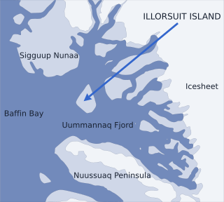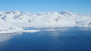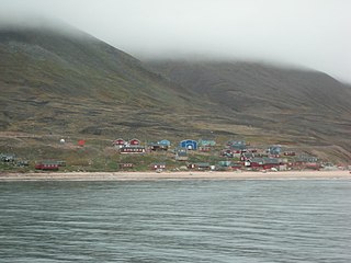
Uummannaq Fjord is a large fjord system in the northern part of western Greenland, the largest after Kangertittivaq fjord in eastern Greenland. It has a roughly south-east to west-north-west orientation, emptying into the Baffin Bay in the northwest.

Sermersooq is a municipality in Greenland, formed on 1 January 2009 from five earlier, smaller municipalities. Its administrative seat is the city of Nuuk, the capital of Greenland, and it is the most populous municipality in the country, with 23,123 inhabitants as of January 2020.

Nunavik Peninsula is a large peninsula in northwestern Greenland. It separates two cultural and geographical regions of northwestern Greenland: Uummannaq Fjord region in the southeast, and Upernavik Archipelago in the north.
Napasorsuaq Fjord or Napasorsuup Kangerlua is a fjord of the King Frederick VI Coast in the Sermersooq municipality, southeastern Greenland.
Lindenow Fjord or Kangerlussuatsiaq, is a fjord in the King Frederick VI Coast, Kujalleq municipality, southern Greenland.

King Frederick VI Coast is a major geographic division of Greenland. It comprises the coastal area of Southeastern Greenland in Sermersooq and Kujalleq municipalities fronting the Irminger Sea of the North Atlantic Ocean. It is bordered by King Christian IX Land on the north and the Greenland Ice Sheet to the west.

Timmiarmiut Fjord ) is a fjord of the King Frederick VI Coast in the Sermersooq municipality, southeastern Greenland.
Thorland is a peninsula in the King Frederick VI Coast, southeastern Greenland. It is a part of the Sermersooq municipality.
Paatusoq, mentioned as 'Patursok' by Wilhelm August Graah, is a fjord in the King Frederick VI Coast, Kujalleq municipality, southeastern Greenland. Its name means "The one with the big mouth" in the Greenlandic language.
Iluileq is a fjord in the King Frederick VI Coast, Kujalleq municipality, southern Greenland.
Kangerluluk, meaning 'the awful fjord', is a fjord in the King Frederick VI Coast, Kujalleq municipality, southern Greenland.
Pyramiden is a mountain in King Frederick VI Coast, Kujalleq municipality, southern Greenland.
Avaqqat Kangerluat, also known as Avarqqat Kangerluat, Avaqqat Kangerlua and Puiagtoq Fjord, is a fjord in the King Frederick VI Coast, Kujalleq municipality, southern Greenland.
Igutsaat Fjord, also known as Igutsait Fjord, is a fjord in the King Frederick VI Coast, Kujalleq municipality, southern Greenland.
Ikersuaq, old spelling Ikerssuak, is a fjord in southwestern Greenland. Administratively it is part of the Kujalleq municipality.
Sikuijivitteq, also known as Kangerdlugsuatsiak, is a fjord of the King Frederick VI Coast in the Kujalleq municipality, southeastern Greenland. The name 'Mogens Heinesen' is based on Magnus Heinason, a 16th-century Faroese naval hero.

Sehested Fjord ) is a fjord of the King Frederick VI Coast in the Sermersooq municipality, southeastern Greenland.
Ingolf Fjord, also known as Ingolf Sound, is a fjord of Greenland's northeastern coast in northern King Frederick VIII Land.

Siorapaluup Kangerlua, also known as Robertson Fjord and Robertson Bay, is a fjord in northern Greenland. To the southwest, the fjord opens into the Murchison Sound of the Baffin Bay. Administratively it belongs to the Avannaata municipality.
The Kangerluluk Range is a mountain range in the King Frederick VI Coast, southeastern Greenland. Administratively this range is part of the Kujalleq municipality.


