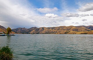
The Huancas, Wancas, or Wankas are a Quechua people living in the Junín Region of central Peru, in and around the Mantaro Valley.

Jauja Province is a Peruvian province. It is one of the nine provinces of the Junín Region. To the north it borders with the Yauli, Tarma and Chanchamayo Provinces. To the east with the Satipo Province, to the south with the Concepción Province and to the west with the Lima Region. The capital of the Jauja Province is the city of Jauja. The city was founded by Francisco Pizarro as the first capital of Peru.
The Huaytapallana mountain range lies in the Junín Region in the Andes of Peru. It extends between 11°47' and 11°56'S and 75°00' and 75°05'W for about 17 km. The surface area of the zone is 378'40 km². The range is located in the provinces of Concepción and Huancayo.
Qiwllaqucha or Qillwaqucha may refer to:
Lake Llacsacocha is a lake in Peru located in the Junín Region, Jauja Province, Canchayllo District. It lies northeast of a lake with the same name, southwest of Chalhuacocha and west of Mancacocha.
Mancacocha is a lake in Peru located in the Junín Region, Jauja Province, Canchayllo District. It lies east of the lake Llacsacocha, southwest of the lake Chalhuacocha and south of the mountain Chalhuacocha (possibly from Quechua Challwaqucha). Mancacocha is connected with the lake Chaquipaque southeast of it, situated at the foot of the mountain Chaquipaque.

Qarwaqucha is a lake in Peru located in the Junín Region, Jauja Province, Canchayllo District. It lies southeast of the peaks of Tunshu and Tukumach'ay and west of a lake named Wayllakancha (Huayllacancha). It belongs to the watershed of the Mantaro River.
Kuntur Sinqa may refer to:
Hatunmarka is an archaeological site in Peru. It is located in the Junín Region, Jauja Province, Marco District. The site was declared a National Cultural Heritage by Resolución Directoral Nacional No. 1346 in November 2000.
Waqlamarka is an archaeological site with walls and round burial towers (chullpa) in Peru. It is situated in the Junín Region, Jauja Province, Parco District.

Putka is a mountain in the Paryaqaqa mountain range in the Andes of Peru, about 5,300 metres (17,388 ft) high. It is located in the Junín Region, Yauli Province, in the districts of Suitucancha and Yauli, north of Qarwachuku.
Putkaqucha is a lake in Peru located in the Junín Region, Yauli Province, Suitucancha District. It lies in the Paryaqaqa or Waruchiri mountain range, south of the mountain Putka.

Putkaqucha is a mountain in Peru, about 4,800 m (15,748 ft) high, at a lake of that name. The mountain and the lake are located in the Junín Region, Concepción Province, Andamarca District, northeast of the Waytapallana mountain range. The peak of Putkaqucha is south of Utkhu Warqu.

Putkaqucha is a 5,236-metre-high (17,178 ft) mountain in the Waytapallana mountain range in Peru. It is located in the Junín Region, Concepción Province, Comas District, and in the Huancayo Province, on the border of the districts of El Tambo and Quilcas. Putkaqucha lies southwest of Puywan and northwest of Waytapallana and Ch'uspi.

Putka is a mountain in the Cordillera Central in the Andes of Peru, about 5,100 metres (16,732 ft) high. It is slocated in the Lima Region, Huarochirí Province, Chicla District.

Mata Mach'ay is a mountain in the Andes of Peru which reaches a height of approximately 4,400 metres (14,436 ft). It is located in the Junín Region, Jauja Province, Pomacancha District.

Waqutuyuq is a mountain in the Andes of Peru which reaches a height of approximately 4,200 metres (13,780 ft). It is located in the Junín Region, Jauja Province, Pomacancha District.

Putka is a mountain in the Andes of Peru which reaches a height of approximately 4,400 m (14,436 ft). It is located in the Huánuco Region, Huamalíes Province, Puños District.


