Al Qaflah District is a district of the 'Amran Governorate, Yemen. As of 2003, the district had a population of 36,722 inhabitants.
Amran District is a district of the 'Amran Governorate, Yemen. As of 2003, the district had a population of 96,375 inhabitants. The capital lies at `Amran.
As Sawd District (Arabic: مديرية السود) is a district of the 'Amran Governorate, Yemen. As of 2003, the district had a population of 25,892 inhabitants.
As Sudah District is a district of the 'Amran Governorate, Yemen. As of 2003, the district had a population of 32,169 inhabitants.
Jabal Iyal Yazid District (Arabic: مديرية جبل عيال يزيد) is a district of the 'Amran Governorate, Yemen. As of 2003, the district had a population of 84,393 inhabitants.
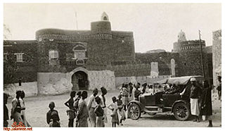
Maswar District (Arabic: مديرية مسور) is a district of the 'Amran Governorate, Yemen. As of 2003, the district had a population of 38,432 inhabitants. In the early 20th century, the mountain village was visited by German explorer and photographer, Hermann Burchardt.
Az Zaydiyah District is a district of the Al Hudaydah Governorate, Yemen. As of 2003, the district had a population of 95,048 inhabitants.
Az Zuhrah District is a district of the Al Hudaydah Governorate, Yemen. As of 2003, the district had a population of 138,045 inhabitants.

Bajil District is a district of the Al Hudaydah Governorate, Yemen. As of 2003, the district had a population of 169,884 inhabitants.
Abs District is a district of the Hajjah Governorate, in north-western Yemen. In 2003, the district had a population of 133,824.
Aflah Al Yaman District is a district of the Hajjah Governorate, Yemen. As of 2003, the district had a population of 38,874 inhabitants.
Ash Shahil District is a district of the Hajjah Governorate, Yemen. As of 2003, the district had a population of 32,548 inhabitants.
Bani Al Awam District is a district of the Hajjah Governorate, Yemen. As of 2003, the district had a population of 52,222 inhabitants.
Bani Qa'is District is a district of the Hajjah Governorate, Yemen. In 2003, the district had a population of 54,272.
Ku'aydinah District is a district of the Hajjah Governorate, Yemen. As of 2003, the district had a population of 69,332 inhabitants.
Midi District is a district of the Hajjah Governorate, Yemen. As of 2003, the district had a population of 16,604 inhabitants.
Qafl Shamer District is a district of the Hajjah Governorate, Yemen. As of 2003, the district had a population of 50,439 inhabitants.
Wadhrah District is a district of the Hajjah Governorate, Yemen. As of 2003, the district had a population of 10,928 inhabitants.

Manakhah District is a district of the Sana'a Governorate, Yemen. As of 2003, the district had a population of 78,932 inhabitants.
Sa'fan District is a district of the Sana'a Governorate, Yemen. As of 2003, the district had a population of 33,722 inhabitants.


