
A townhouse, townhome, town house, or town home, is a type of terraced housing. A modern townhouse is often one with a small footprint on multiple floors. In a different British usage, the term originally referred to any type of city residence of someone whose main or largest residence was a country house.

A terrace, terraced house (UK), or townhouse (US) is a type of medium-density housing which first started in 16th century Europe with a row of joined houses sharing side walls. In the United States and Canada these are sometimes known as row houses or row homes.
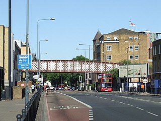
Commercial Road is a street in the London Borough of Tower Hamlets in the East End of London. It is 1.9 miles (3.1 km) long, running from Gardiner's Corner, through Stepney to the junction with Burdett Road in Limehouse at which point the route splits into the East India Dock Road and the West India Dock Road. It is an artery connecting the historic City of London with the more recently developed financial district at Canary Wharf, and part of the A13.
Tower Hill is the area surrounding the Tower of London in the London Borough of Tower Hamlets. It is infamous for the public execution of high status prisoners from the late 14th to the mid 18th century. The execution site on the higher ground north-west of the Tower of London moat is now occupied by Trinity Square Gardens.

Carlton House Terrace is a street in the St James's district of the City of Westminster in London. Its principal architectural feature is a pair of terraces, the Western and Eastern terraces, of white stucco-faced houses on the south side of the street, which overlook The Mall and St. James's Park. These terraces were built on Crown land between 1827 and 1832 to overall designs by John Nash, but with detailed input by other architects including Decimus Burton. Construction was overseen by James Pennethorne. Both terrace blocks are Grade I listed buildings. A separate but linked cul-de-sac at the terrace's western end is named Carlton Gardens.
The New Town is a central area of Edinburgh, the capital of Scotland. It was built in stages between 1767 and around 1850, and retains much of its original neo-classical and Georgian period architecture. Its best known street is Princes Street, facing Edinburgh Castle and the Old Town across the geological depression of the former Nor Loch. Together with the West End, the New Town was designated a UNESCO World Heritage Site alongside the Old Town in 1995. The area is also famed for the New Town Gardens, a heritage designation since March 2001.

Hackney Central is a sub-district of Hackney in the London Borough of Hackney in London, England and is four miles (6.4 km) northeast of Charing Cross.

Shadwell Basin is a housing and leisure complex built around a disused dock in Wapping, London. The old dock was formerly part of the London Docks, a group of docks built by the London Dock Company at Shadwell and Wapping as part of the wider docks of the Port of London.

West Square is a historic square in south London, England, just south from St George's Road. The square is within the London Borough of Southwark, but as it is located in postcode SE11, it is commonly said to be in Lambeth.
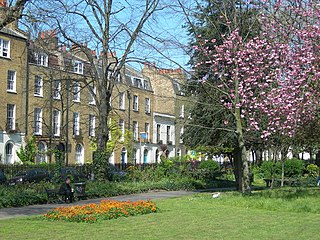
Clapton Square is the second largest garden square in the London Borough of Hackney, located in Lower Clapton, Clapton. It is lined by buildings on three sides. Its Conservation Area designated in 1969 – extended in 1991 and 2000 – takes in a larger green space separated by a stretch of open road: St John's Gardens. Those gardens have the tallest and largest building visible from all parts of the square's garden, the Church of St John-at-Hackney, rebuilt in 1792-97 which contains older monuments. Two sides of the square are lined with tall, partly stone-dressed, classical, Georgian terraced houses.

Carlton Hill is an inner-city area of Brighton, part of the English city and seaside resort of Brighton and Hove. First developed in the early and mid-19th century on steeply sloping farmland east of central Brighton, it grew rapidly as the town became a fashionable, high-class destination. Carlton Hill's population was always poor, though, and by the early 20th century the area was Brighton's worst slum: overcrowding, crime and disease were rife. Extensive slum clearance in the mid-20th century introduced high-density tower blocks, but some old buildings remain: in 2008, Brighton and Hove City Council designated part of Carlton Hill as the city's 34th conservation area. The area now has housing of various styles and ages, large offices and small-scale industry; there are also churches, a school and some open space.

Montpelier is an inner suburban area of Brighton, part of the English city and seaside resort of Brighton and Hove. Developed together with the adjacent Clifton Hill area in the mid-19th century, it forms a high-class, architecturally cohesive residential district with "an exceptionally complete character". Stucco-clad terraced housing and villas predominate, but two of the city's most significant Victorian churches and a landmark hospital building are also in the area, which lies immediately northwest of Brighton city centre and spreads as far as the ancient parish boundary with Hove.

Vernon Terrace is a mid 19th-century residential development in the Montpelier suburb of Brighton, part of the English coastal city of Brighton and Hove. Construction of the first section started in 1856, and the 37-house terrace was complete in the early 1860s. Architecturally, the houses divide into five separate compositions, although all are in a similar late Regency/Italianate style. This was characteristic of houses of that era in Brighton, and especially in the Montpelier area—where the Regency style persisted much later than elsewhere. Standing opposite is the landmark Montpelier Crescent, which had a view of the South Downs until Vernon Terrace blocked it. Three groups of houses in the terrace have been listed at Grade II by English Heritage for their architectural and historical importance.

The Kingston House estate and Ennismore Gardens in Knightsbridge is a green, dual-character area within the western limits of the City of Westminster in London. The first-named is immediately south of Hyde Park, London taking up the park's semi-panorama row of 8 to 13 Princes Gate (demolished) and otherwise, as to more of its wings, set around the east of Princes Gate Garden including a terrace of houses №s 1 to 7 Bolney Gate. The second-named is a garden square of 59 tall creamy-white terraced houses and the approach road to Prince of Wales Gate, Hyde Park as well as the identical-size public, square green of the church that is since 1956 the Russian Orthodox Cathedral of the Dormition of the Mother of God and All Saints facing which green are its anomalous outlier row for a London garden square, №s 61 to 66. The relatively small, broad-fronted house set against the Consulate-used pairing at №s 61 to 62 is № 60 and as with the other 65 numbers of Ennismore Gardens is a listed building.

In British usage, the term townhouse originally referred to the opulent town or city residence of a member of the nobility or gentry, as opposed to their country seat, generally known as a country house or, colloquially, for the larger ones, stately home. The grandest of the London townhouses were stand-alone buildings, but many were terraced buildings.

Cartwright Gardens is a crescent shaped park and street located in Bloomsbury, London.
New City College (NCC) is a large college of further education with campuses in East London and Essex. The college was formed in 2016 with the amalgamation of separate colleges, beginning with the merger between Tower Hamlets College and Hackney Community College, followed by the gradual additions of Redbridge College, Epping Forest College, and both Havering College of Further and Higher Education, Havering Sixth Form College and BSix Sixth Form College. It is the second largest provider of post-16 education in the country since 2019.
Clapton is a district of East London, England, in the London Borough of Hackney.

As of February 2001, there were 1,124 listed buildings with Grade II status in the English city of Brighton and Hove. The total at 2009 was similar. The city, on the English Channel coast approximately 52 miles (84 km) south of London, was formed as a unitary authority in 1997 by the merger of the neighbouring towns of Brighton and Hove. Queen Elizabeth II granted city status in 2000.

St John Street is a street in central Manchester, England. It consists mainly of late Georgian and Regency era terraced houses. Laid out between 1770 and 1830, the street runs roughly east–west between Deansgate and Byrom Street, terminating in an urban park, formerly the site of St John's Church, at its eastern end. Originally built for the prosperous Manchester upper-middle classes, by the 20th century it had become the preserve of the medical and legal professions. In the 21st century, some of the buildings are being reconverted to residential use. The only surviving Georgian terraced street in central Manchester, many of its buildings are listed.

