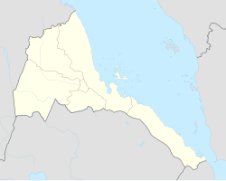
Eritrea, officially the State of Eritrea is a country in the Horn of Africa, with its capital at Asmara. It is bordered by Sudan in the west, Ethiopia in the south, and Djibouti in the southeast. The northeastern and eastern parts of Eritrea have an extensive coastline along the Red Sea. The nation has a total area of approximately 117,600 km2 (45,406 sq mi), and includes the Dahlak Archipelago and several of the Hanish Islands. Its toponym Eritrea is based on the Greek name for the Red Sea, which was first adopted for Italian Eritrea in 1890.
Gash-Barka is one of the six regions of Eritrea. It is situated in the south-west of the country, bordering the Anseba region to the north, and the Maekel (Central) and Debub (Southern) regions to the east; the country of Sudan lies to the west and Ethiopia to the south.
Gash-Setit is a 709 km2 (274 sq mi) designated national wildlife reserve and historical area of western Eritrea. It is located in much of Omhajer District and Haykota District south west of Haykota between the market town of Tesseney in the Gash-Barka region. The name is derived from the two rivers, the Gash and the Setit (Tekezé) River. It is the historical area of the Kunama people and a site of conflict and dispute between the Ethiopians and the Eritreans.
As the name may suggest, the village was founded by the Italians during the occupation.
This page is based on this Wikipedia article Text is available under the CC BY-SA 4.0 license; additional terms may apply. Images, videos and audio are available under their respective licenses.
Related Research Articles
Joanna Gash, an Australian politician, was a member of the House of Representatives representing the Division of Gilmore for the Liberal Party from 1996 to 2013. In 2012, Gash was directly elected as the Mayor of the City of Shoalhaven, a local government area in the south-eastern coastal region of New South Wales. In 2016, Gash lost the direct election for Mayor of the City of Shoalhaven to Amanda Findley. She was elected as a Ward 2 Councillor for the City of Shoalhaven.
Beinn Alligin one of the classic mountains of the Torridon region of Scotland, lying to the north of Loch Torridon, in the Highlands. The name Beinn Alligin is from the Scottish Gaelic, meaning Jewelled Hill. The mountain has two peaks of Munro status: Tom na Gruagaich (922 m) to the south, and Sgùrr Mhòr at 3,235 feet (986 m) to the north.
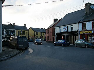
Newmarket-on-Fergus, historically known as Corracatlin, is a town in County Clare, Ireland. It is 13 kilometres from Ennis, 8 kilometres from Shannon Airport, and 24 kilometres from Limerick.
The Division of Gilmore is an Australian electoral division in the state of New South Wales. The division was created in 1984 and is named after Dame Mary Gilmore, the poet and author.
Teseney, also spelled Tessenei or Tesseney, is a market town in western Eritrea. It lies south-east of Kassala in Sudan, on the Gash River. The city was much fought over in the Eritrean War of Independence during which much of it was destroyed. After the war, Tessenei has become a governmental administrative center with customs and agricultural offices and a military base.
Barentu is a town in north-western Eritrea, lying south of Agordat, and is the capital of Gash-Barka Region. The town is integrated with different types of tribes: Kunama, Nara, Tigre and Tigrigna being the dominant.
Akurdet Subregion is a subregion in the western Gash-Barka region of Eritrea. Its capital lies at Akurdet.
Dghe Subregion is a subregion in the western Gash-Barka region of Eritrea. Its capital lies at Dghe.
Haykota Subregion is a subregion in the western Gash-Barka region of Eritrea. Its capital lies at Haykota.
Logo Anseba Subregion is a subregion in the western Gash-Barka Region of Eritrea. Its capital lies at Logo Anseba.
Shambuko Subregion is a subregion in the western Gash-Barka region of Eritrea. Its capital lies at Shambuko.
Molki Subregion is a subregion in the Gash-Barka region of western Eritrea. Its capital lies at Molki.
Teseney Subregion is a subregion in the western Gash-Barka region of Eritrea. Its capital lies at Teseney.
Omhajer Subregion is a subregion in the western Gash-Barka region of Eritrea. Its capital lies at Omhajer. The area has a patented history with the Italians and the struggle between the Eritreans and Ethiopians.
Adendema is a village in western Eritrea. It is located 5.8 miles south-west of the district capital of Haykota in Haykota District in the Gash-Barka region. It lies on the north-east boundary of the Gash-Setit wildlife reserve.
Giamal Biscia is a village in western Eritrea. It is located in the Omhajer Subregion of the Gash-Barka region. It lies inside the Gash-Setit wildlife reserve 6 kilometres north-east of Arcugi.
Gash is a village in Baq Mej Rural District, in the Central District of Chenaran County, Razavi Khorasan Province, Iran. At the 2006 census, its population was 418, in 99 families.
Gash is a village in Isin Rural District, in the Central District of Bandar Abbas County, Hormozgan Province, Iran. At the 2006 census, its population was 27, in 13 families.